TopoQuest Logo
Do you find TopoQuest useful?
Help keep TopoQuest running and adding new maps/features by donating!
Bitcoin:  19c7KJd3qBynnjoSw5npx9KScwjBe4ifkT
Litecoin:  LXs6TkuXGGXo1vDsWCkWVdjQX94eUKd6ui
Home View Maps Find Maps Find Places Resources & Links


Byrne Creek, Montana Topographic Map

USGS Map Title: Byrne Creek, MT
USGS Map MRC: 47110C5
DRG (GeoTIFF) Download: o47110c5.tif


Neighboring USGS Topographic Map Quads:


  Highwood Baldy, MT  
47110D6
 

  Arrow Peak, MT  
47110D5
 

  Palisade Butte, MT  
47110D4
 

  Raynesford, MT  
47110C6
 

  Byrne Creek, MT  
47110C5
 

  Geyser, MT  
47110C4
 

  Limestone Butte, MT  
47110B6
 

  The Arch, MT  
47110B5
 

  Wolf Butte NW, MT  
47110B4


Map MRC Location:

N48°
W111°
N48°
W110°
H8 H7 H6 H5 H4 H3 H2 H1
G8 G7 G6 G5 G4 G3 G2 G1
F8 F7 F6 F5 F4 F3 F2 F1
E8 E7 E6 E5 E4 E3 E2 E1
D8 D7 D6 D5 D4 D3 D2 D1
C8 C7 C6 C5 C4 C3 C2 C1
B8 B7 B6 B5 B4 B3 B2 B1
A8 A7 A6 A5 A4 A3 A2 A1
N47°
W111°
N47°
W110°

Byrne Creek, MT USGS 1:24K Topographic Map Preview:
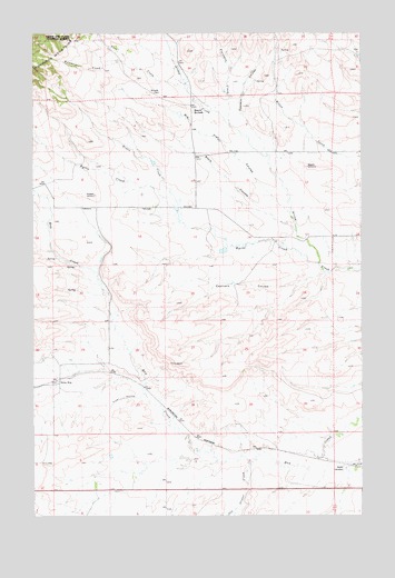
Byrne Creek, MT USGS Topographic Map
Click on map above to begin viewing in our Map Viewer.

This topographic map contains these locations and features:
Feature Name Type Latitude Longitude GNIS ID View Map
17N09E02A___01 WellWellN47.2689°W110.5399°821833View Map
17N09E02AA__01 SpringSpringN47.2705°W110.5374°821844View Map
17N09E03AA__01 WellWellN47.2705°W110.5585°821845View Map
17N09E03AB__01 WellWellN47.2705°W110.5638°821846View Map
17N09E03CD__01 WellWellN47.2597°W110.5691°821766View Map
17N09E03CD__02 WellWellN47.2597°W110.5691°821767View Map
17N09E04AC__01 WellWellN47.2669°W110.5852°821815View Map
17N09E04CB__01 SpringSpringN47.2633°W110.5958°821788View Map
17N09E04CD__01 SpringSpringN47.2597°W110.5905°821770View Map
17N09E04DC__01 SpringSpringN47.2597°W110.5852°821768View Map
17N09E04DC__02 SpringSpringN47.2597°W110.5852°821769View Map
17N09E05AD__01 SpringSpringN47.2669°W110.6010°821816View Map
17N09E05DB__01 SpringSpringN47.2633°W110.6063°821789View Map
17N09E05DC__01 WellWellN47.2597°W110.6063°821772View Map
17N09E05DD__01 WellWellN47.2597°W110.6010°821771View Map
17N09E08AA__01 WellWellN47.2561°W110.6010°821729View Map
17N09E08AA__02 WellWellN47.2561°W110.6010°821730View Map
17N09E08AACA01 WellWellN47.2547°W110.6005°821714View Map
17N09E08ABDA01 WellWellN47.2544°W110.6024°821713View Map
17N09E09BB__01 SpringSpringN47.2561°W110.5958°821728View Map
17N09E10B___01 WellWellN47.2544°W110.5719°821712View Map
17N10E06CC__01 WellWellN47.2597°W110.5094°821765View Map
18N09E02C___01 WellWellN47.3477°W110.5499°822371View Map
18N09E08CD__01 WellWellN47.3316°W110.6099°822265View Map
18N09E09AB__01 SpringSpringN47.3425°W110.5838°822325View Map
18N09E09AC__01 SpringSpringN47.3389°W110.5838°822299View Map
18N09E09CD__01 WellWellN47.3316°W110.5891°822264View Map
18N09E12BB__01 SpringSpringN47.3425°W110.5319°822324View Map
18N09E12CC__01 WellWellN47.3316°W110.5319°822263View Map
18N09E13BB__01 WellWellN47.3280°W110.5319°822237View Map
18N09E14AA__01 SpringSpringN47.3280°W110.5369°822238View Map
18N09E14B___01 WellWellN47.3261°W110.5499°822225View Map
18N09E14DA__01 WellWellN47.3208°W110.5369°822193View Map
18N09E16BA__01 SpringSpringN47.3280°W110.5891°822239View Map
18N09E16BA__02 WellWellN47.3280°W110.5891°822240View Map
18N09E17ADBC01 WellWellN47.3244°W110.5999°822211View Map
18N09E17BB__01 WellWellN47.3280°W110.6152°822241View Map
18N09E20BD__01 SpringSpringN47.3086°W110.6096°822109View Map
18N09E20C___01 WellWellN47.3044°W110.6124°822089View Map
18N09E20DD__01 WellWellN47.3025°W110.5994°822072View Map
18N09E23BC__01 SpringSpringN47.3097°W110.5527°822108View Map
18N09E23CC__01 SpringSpringN47.3025°W110.5527°822071View Map
18N09E27AB__01 SpringSpringN47.2989°W110.5630°822053View Map
18N09E28AC__01 SpringSpringN47.2952°W110.5838°822011View Map
18N09E30DA__01 WellWellN47.2916°W110.6202°821992View Map
18N09E31AA__01 WellWellN47.2844°W110.6202°821943View Map
18N09E32ACAB01 WellWellN47.2819°W110.6044°821926View Map
18N09E35A___01 WellWellN47.2827°W110.5397°821933View Map
18N10E06BB__01 SpringSpringN47.3564°W110.5094°822424View Map
18N10E31CB__01 SpringSpringN47.2766°W110.5094°821888View Map
19N09E35DB__01 SpringSpringN47.3647°W110.5394°822463View Map
19N09E35DC__01 SpringSpringN47.3611°W110.5394°822445View Map
19N09E36AA__01 SpringSpringN47.3719°W110.5130°822513View Map
19N09E36BB__01 SpringSpringN47.3719°W110.5288°822514View Map
19N09E36BD__01 SpringSpringN47.3683°W110.5235°822483View Map
19N09E36CC__01 SpringSpringN47.3611°W110.5288°822444View Map
19N10E31BA__01 SpringSpringN47.3706°W110.5032°822510View Map
Antares DamDamN47.3116°W110.5374°796401View Map
Arrow Post Office (historical)Post OfficeN47.3222°W110.5341°1750627View Map
Black ButtesSummitN47.3558°W110.5652°779982View Map
Black CouleeValleyN47.3236°W110.5258°779995View Map
Byrne CreekStreamN47.3150°W110.5166°780716View Map
Castners CouleeValleyN47.3127°W110.5147°781039View Map
Eastern CouleeValleyN47.3433°W110.5366°782962View Map
Erwin CreekStreamN47.3291°W110.5708°783224View Map
Flanagan CreekStreamN47.3522°W110.5513°778800View Map
Flat CouleeValleyN47.3286°W110.5280°783493View Map
Frost CouleeValleyN47.2811°W110.5830°783770View Map
Geyser CemeteryCemeteryN47.2619°W110.5072°783911View Map
Mad DamDamN47.3533°W110.5658°796400View Map
McLeish CemeteryCemeteryN47.3597°W110.5777°787098View Map
Old Geyser CreekStreamN47.2666°W110.5410°778824View Map
Pine CreekStreamN47.3605°W110.5672°788884View Map
Spion KopPopulated PlaceN47.2850°W110.6172°806978View Map
Spion Kop (historical)LocaleN47.2850°W110.6172°1750733View Map
Spion Kop Post Office (historical)Post OfficeN47.2850°W110.6172°1750600View Map
Spion Kop School (historical)SchoolN47.2850°W110.6172°1750672View Map
Waymeir CreekStreamN47.3655°W110.5849°792893View Map

Note: Coordinates in the location and feature list above are referenced to NAD83 datum.


Copyright (C) 2008-2025 Ryan Niemi / Sunset Dynamics ... All Rights Reserved