TopoQuest Logo
Do you find TopoQuest useful?
Help keep TopoQuest running and adding new maps/features by donating!
Bitcoin:  19c7KJd3qBynnjoSw5npx9KScwjBe4ifkT
Litecoin:  LXs6TkuXGGXo1vDsWCkWVdjQX94eUKd6ui
Home View Maps Find Maps Find Places Resources & Links


Red Butte, Oregon Topographic Map

USGS Map Title: Red Butte, OR
USGS Map MRC: 43122B8
DRG (GeoTIFF) Download: o43122b8.tif


Neighboring USGS Topographic Map Quads:


  Glide, OR  
43123C1
 

  Old Fairview, OR  
43122C8
 

  Mace Mountain, OR  
43122C7
 

  Lane Mountain, OR  
43123B1
 

  Red Butte, OR  
43122B8
 

  Taft Mountain, OR  
43122B7
 

  White Rock, OR  
43123A1
 

  Deadman Mountain, OR  
43122A8
 

  Dumont Creek, OR  
43122A7


Map MRC Location:

N44°
W123°
N44°
W122°
H8 H7 H6 H5 H4 H3 H2 H1
G8 G7 G6 G5 G4 G3 G2 G1
F8 F7 F6 F5 F4 F3 F2 F1
E8 E7 E6 E5 E4 E3 E2 E1
D8 D7 D6 D5 D4 D3 D2 D1
C8 C7 C6 C5 C4 C3 C2 C1
B8 B7 B6 B5 B4 B3 B2 B1
A8 A7 A6 A5 A4 A3 A2 A1
N43°
W123°
N43°
W122°

Red Butte, OR USGS 1:24K Topographic Map Preview:
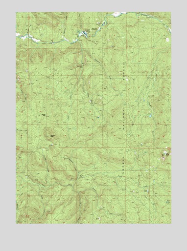
Red Butte, OR USGS Topographic Map
Click on map above to begin viewing in our Map Viewer.

This topographic map contains these locations and features:
Feature Name Type Latitude Longitude GNIS ID View Map
Boundary CreekStreamN43.2368°W122.9920°1138501View Map
Cavitt LakeLakeN43.1442°W122.8953°1163935View Map
Cultus CreekStreamN43.1437°W122.9517°1140536View Map
Egglestron CreekStreamN43.2285°W122.9492°1141696View Map
Emile CreekStreamN43.2482°W122.9042°1141866View Map
Emile Creek Recreation SiteParkN43.2485°W122.8901°1155224View Map
Greenman CreekStreamN43.2332°W122.9623°1143067View Map
Little CreekStreamN43.2379°W122.9501°1145140View Map
Little River Christian CampLocaleN43.2443°W122.9276°1155225View Map
Liveoak CreekStreamN43.1479°W122.9726°1145297View Map
Negro CreekStreamN43.2329°W122.8764°1146759View Map
Negro RidgeRidgeN43.1985°W122.8762°1155223View Map
Plusfour CreekStreamN43.1471°W122.9559°1147810View Map
Red ButteSummitN43.1656°W122.8808°1148276View Map
Red Butte Burn CampLocaleN43.1596°W122.8817°1155230View Map
Red Butte Lookout TowerTowerN43.1665°W122.8817°1163934View Map
Sampson ButteSummitN43.1767°W122.9740°1149013View Map
Shadow FallsFallsN43.1523°W122.9499°1158937View Map
Shadow Falls CampgroundLocaleN43.1554°W122.9442°1156870View Map
Shivigny CreekStreamN43.2485°W122.9234°1155226View Map
Sugar Pine FlatFlatN43.2285°W122.9389°1150539View Map
Tanners PassGapN43.1885°W122.9776°1150897View Map
Tuttle CreekStreamN43.1479°W122.9826°1151541View Map
Watson CabinLocaleN43.1793°W122.9109°1151964View Map
West Fork Wolf CreekStreamN43.2126°W122.9498°1152126View Map
Withrow CreekStreamN43.1515°W122.9523°1152562View Map
Wolf CreekStreamN43.2326°W122.9517°1152574View Map
Wolf Creek FallsFallsN43.2184°W122.9477°1155229View Map
Wolf Creek Falls Recreation SiteLocaleN43.2221°W122.9498°1155228View Map
Wolf Creek Job Corps CenterLocaleN43.2426°W122.9337°1152585View Map
Wolf Creek Recreation SiteLocaleN43.2387°W122.9331°1155227View Map

Note: Coordinates in the location and feature list above are referenced to NAD83 datum.


Copyright (C) 2008-2025 Ryan Niemi / Sunset Dynamics ... All Rights Reserved