TopoQuest Logo
Do you find TopoQuest useful?
Help keep TopoQuest running and adding new maps/features by donating!
Bitcoin:  19c7KJd3qBynnjoSw5npx9KScwjBe4ifkT
Litecoin:  LXs6TkuXGGXo1vDsWCkWVdjQX94eUKd6ui
Home View Maps Find Maps Find Places Resources & Links


White Rock, Oregon Topographic Map

USGS Map Title: White Rock, OR
USGS Map MRC: 43123A1
DRG (GeoTIFF) Download: o43123a1.tif


Neighboring USGS Topographic Map Quads:


  Dixonville, OR  
43123B2
 

  Lane Mountain, OR  
43123B1
 

  Red Butte, OR  
43122B8
 

  Dodson Butte, OR  
43123A2
 

  White Rock, OR  
43123A1
 

  Deadman Mountain, OR  
43122A8
 

  Days Creek, OR  
42123H2
 

  Milo, OR  
42123H1
 

  Tiller, OR  
42122H8


Map MRC Location:

N44°
W124°
N44°
W123°
H8 H7 H6 H5 H4 H3 H2 H1
G8 G7 G6 G5 G4 G3 G2 G1
F8 F7 F6 F5 F4 F3 F2 F1
E8 E7 E6 E5 E4 E3 E2 E1
D8 D7 D6 D5 D4 D3 D2 D1
C8 C7 C6 C5 C4 C3 C2 C1
B8 B7 B6 B5 B4 B3 B2 B1
A8 A7 A6 A5 A4 A3 A2 A1
N43°
W124°
N43°
W123°

White Rock, OR USGS 1:24K Topographic Map Preview:
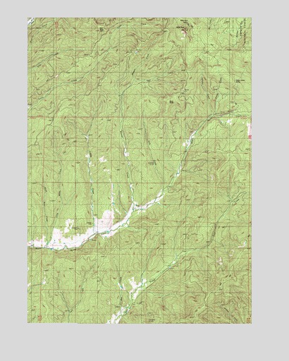
White Rock, OR USGS Topographic Map
Click on map above to begin viewing in our Map Viewer.

This topographic map contains these locations and features:
Feature Name Type Latitude Longitude GNIS ID View Map
Briggs ReservoirReservoirN43.0380°W123.0796°1155243View Map
Buck ButteSummitN43.0900°W123.0481°1138739View Map
Chieftain MineMineN43.0396°W123.0901°1139641View Map
Continental MineMineN43.0398°W123.0981°1140050View Map
Curtin CreekStreamN43.0843°W123.0231°1140569View Map
Isolate Post Office (historical)Post OfficeN43.0040°W123.0773°1164435View Map
Johnson CreekStreamN43.0843°W123.0234°1144325View Map
Lally CreekStreamN43.0546°W123.0506°1144795View Map
Letitia CemeteryCemeteryN43.0401°W123.0831°1155244View Map
Letitia CreekStreamN43.0360°W123.0895°1144956View Map
Long Wiley CreekStreamN43.0326°W123.1148°1145453View Map
May CreekStreamN43.0037°W123.0742°1145893View Map
Nugget (historical)Populated PlaceN43.0415°W123.0762°1155242View Map
Nugget Post Office (historical)Post OfficeN43.0415°W123.0762°1165720View Map
Riser ButteSummitN43.1193°W123.0834°1148482View Map
Short Wiley CreekStreamN43.0307°W123.1164°1149441View Map
Weaver CreekStreamN43.0457°W123.0673°1151982View Map
White RockPillarN43.1202°W123.0383°1152246View Map
White Rock SpringsSpringN43.1228°W123.0365°1155245View Map
White Rock TrailTrailN43.1073°W123.0134°1152252View Map
Wrights CreekStreamN43.1221°W123.1248°1155211View Map
Yellow Jacket SpringSpringN43.0990°W123.0103°1152709View Map

Note: Coordinates in the location and feature list above are referenced to NAD83 datum.


Copyright (C) 2008-2024 Ryan Niemi / Sunset Dynamics ... All Rights Reserved