TopoQuest Logo
Do you find TopoQuest useful?
Help keep TopoQuest running and adding new maps/features by donating!
Bitcoin:  19c7KJd3qBynnjoSw5npx9KScwjBe4ifkT
Litecoin:  LXs6TkuXGGXo1vDsWCkWVdjQX94eUKd6ui
Home View Maps Find Maps Find Places Resources & Links


Lane Mountain, Oregon Topographic Map

USGS Map Title: Lane Mountain, OR
USGS Map MRC: 43123B1
DRG (GeoTIFF) Download: o43123b1.tif


Neighboring USGS Topographic Map Quads:


  Oak Creek Valley, OR  
43123C2
 

  Glide, OR  
43123C1
 

  Old Fairview, OR  
43122C8
 

  Dixonville, OR  
43123B2
 

  Lane Mountain, OR  
43123B1
 

  Red Butte, OR  
43122B8
 

  Dodson Butte, OR  
43123A2
 

  White Rock, OR  
43123A1
 

  Deadman Mountain, OR  
43122A8


Map MRC Location:

N44°
W124°
N44°
W123°
H8 H7 H6 H5 H4 H3 H2 H1
G8 G7 G6 G5 G4 G3 G2 G1
F8 F7 F6 F5 F4 F3 F2 F1
E8 E7 E6 E5 E4 E3 E2 E1
D8 D7 D6 D5 D4 D3 D2 D1
C8 C7 C6 C5 C4 C3 C2 C1
B8 B7 B6 B5 B4 B3 B2 B1
A8 A7 A6 A5 A4 A3 A2 A1
N43°
W124°
N43°
W123°

Lane Mountain, OR USGS 1:24K Topographic Map Preview:
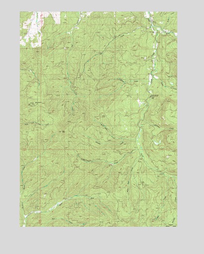
Lane Mountain, OR USGS Topographic Map
Click on map above to begin viewing in our Map Viewer.

This topographic map contains these locations and features:
Feature Name Type Latitude Longitude GNIS ID View Map
Bond CreekStreamN43.2404°W123.0137°1138409View Map
Boulder CreekStreamN43.1751°W123.0345°1138464View Map
Buck ForkStreamN43.1296°W123.1223°1138786View Map
Buck Fork TrailTrailN43.1265°W123.0481°1138787View Map
Buck PeakSummitN43.1802°W123.0929°1138808View Map
Buck Peak CreekStreamN43.1762°W123.0439°1138811View Map
Buckshot CreekStreamN43.1876°W123.0295°1138871View Map
Caritt Falls Recreation SiteLocaleN43.2010°W123.0220°1156357View Map
Cavitt CreekStreamN43.2410°W123.0206°1139479View Map
Cavitt Creek Falls Recreation SiteParkN43.2012°W123.0226°1159294View Map
Cavitt ShelterLocaleN43.1493°W123.0303°1139481View Map
Collins CreekStreamN43.1415°W123.0887°1155247View Map
Copperhead CreekStreamN43.1704°W123.0317°1140110View Map
Evarts CreekStreamN43.2123°W123.0203°1141931View Map
Frank Kinney City ParkParkN43.1648°W123.0762°1122776View Map
Hughes CreekStreamN43.1971°W123.0720°1132890View Map
Jim CreekStreamN43.2418°W123.0212°1144271View Map
Lane MountainSummitN43.1953°W123.1165°1144814View Map
McCaffery PondReservoirN43.2423°W123.0234°1155213View Map
McKay CreekStreamN43.2090°W123.0214°1145989View Map
Mill CreekStreamN43.1535°W123.0078°1146223View Map
Nofog Post Office (historical)Post OfficeN43.1637°W123.0276°1165708View Map
Rockland Post Office (historical)Post OfficeN43.1998°W123.1012°1164639View Map
Sampson LakeLakeN43.1721°W123.0137°1155249View Map
Springer CreekStreamN43.1537°W123.0031°1150199View Map
Stacey Gulch CreekStreamN43.1429°W123.0789°1155246View Map
White Rock CreekStreamN43.1673°W123.0303°1152248View Map

Note: Coordinates in the location and feature list above are referenced to NAD83 datum.


Copyright (C) 2008-2024 Ryan Niemi / Sunset Dynamics ... All Rights Reserved