TopoQuest Logo
Do you find TopoQuest useful?
Help keep TopoQuest running and adding new maps/features by donating!
Bitcoin:  19c7KJd3qBynnjoSw5npx9KScwjBe4ifkT
Litecoin:  LXs6TkuXGGXo1vDsWCkWVdjQX94eUKd6ui
Home View Maps Find Maps Find Places Resources & Links


Red Hill, Montana Topographic Map

USGS Map Title: Red Hill, MT
USGS Map MRC: 46110H2
DRG (GeoTIFF) Download: o46110h2.tif


Neighboring USGS Topographic Map Quads:


  Cayuse Basin, MT  
47110A3
 

  Windham, MT  
47110A2
 

  Benchland, MT  
47110A1
 

  Woodhurst Mountain, MT  
46110H3
 

  Red Hill, MT  
46110H2
 

  Utica, MT  
46110H1
 

  Indian Hill, MT  
46110G3
 

  Browns Canyon, MT  
46110G2
 

  Twin Sisters, MT  
46110G1


Map MRC Location:

N47°
W111°
N47°
W110°
H8 H7 H6 H5 H4 H3 H2 H1
G8 G7 G6 G5 G4 G3 G2 G1
F8 F7 F6 F5 F4 F3 F2 F1
E8 E7 E6 E5 E4 E3 E2 E1
D8 D7 D6 D5 D4 D3 D2 D1
C8 C7 C6 C5 C4 C3 C2 C1
B8 B7 B6 B5 B4 B3 B2 B1
A8 A7 A6 A5 A4 A3 A2 A1
N46°
W111°
N46°
W110°

Red Hill, MT USGS 1:24K Topographic Map Preview:
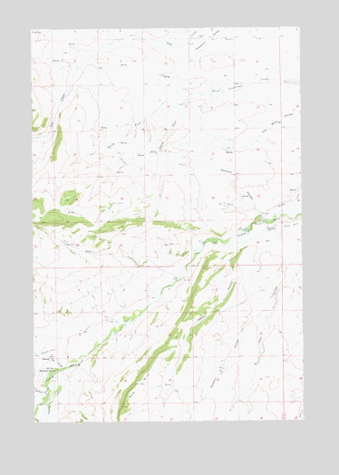
Red Hill, MT USGS Topographic Map
Click on map above to begin viewing in our Map Viewer.

This topographic map contains these locations and features:
Feature Name Type Latitude Longitude GNIS ID View Map
13N12E02DC__01 SpringSpringN46.9105°W110.1619°819329View Map
13N12E03AA__01 SpringSpringN46.9213°W110.1777°819394View Map
13N12E03AA__02 SpringSpringN46.9213°W110.1777°819395View Map
13N12E03AD__01 SpringSpringN46.9177°W110.1777°819368View Map
13N12E04BB__01 SpringSpringN46.9213°W110.2149°819396View Map
13N12E05CD__01 SpringSpringN46.9105°W110.2308°819330View Map
13N12E06AA__01 SpringSpringN46.9213°W110.2413°819397View Map
13N12E07DA__01 SpringSpringN46.8997°W110.2413°819263View Map
13N12E09DD__01 SpringSpringN46.8961°W110.1991°819234View Map
13N12E09DD__02 SpringSpringN46.8961°W110.1991°819235View Map
13N12E12BC__01 WellWellN46.9033°W110.1513°819284View Map
13N12E13BA__01 WellWellN46.8925°W110.1460°819189View Map
13N12E14AB__01 WellWellN46.8925°W110.1619°819190View Map
13N12E15AB__01 SpringSpringN46.8925°W110.1830°819191View Map
13N12E15DB__01 SpringSpringN46.8852°W110.1830°819099View Map
13N12E16AB__01 SpringSpringN46.8925°W110.2044°819192View Map
13N12E17BB__01 WellWellN46.8925°W110.2360°819193View Map
13N12E17BB__02 WellWellN46.8925°W110.2360°819194View Map
13N12E17BC__01 WellWellN46.8888°W110.2360°819144View Map
13N12E17BC__02 SpringSpringN46.8888°W110.2360°819145View Map
13N12E17CA__01 WellWellN46.8852°W110.2308°819100View Map
13N12E18AA__01 SpringSpringN46.8925°W110.2413°819195View Map
13N12E18AA__02 WellWellN46.8925°W110.2413°819196View Map
13N12E18AC__01 SpringSpringN46.8888°W110.2466°819146View Map
13N12E18DA__01 SpringSpringN46.8852°W110.2413°819101View Map
13N12E18DB__01 WellWellN46.8852°W110.2466°819102View Map
13N12E18DB__02 WellWellN46.8852°W110.2466°819103View Map
13N12E18DC__01 WellWellN46.8816°W110.2466°819061View Map
13N12E18DC__02 WellWellN46.8816°W110.2466°819062View Map
13N12E19AB__01 WellWellN46.8777°W110.2466°819019View Map
13N13E06BD__01 WellWellN46.9186°W110.1255°819372View Map
14N12E02CC__01 WellWellN46.9969°W110.1758°820030View Map
14N12E02DC__01 WellWellN46.9969°W110.1652°820028View Map
14N12E02DC__02 WellWellN46.9969°W110.1652°820029View Map
14N12E02DD__01 SpringSpringN46.9969°W110.1599°820026View Map
14N12E02DD__02 WellWellN46.9969°W110.1599°820027View Map
14N12E07AB__01 SpringSpringN46.9933°W110.2499°820001View Map
14N12E07DB__01 SpringSpringN46.9861°W110.2499°819952View Map
14N12E08BC__01 SpringSpringN46.9897°W110.2394°819975View Map
14N12E08CA__01 SpringSpringN46.9861°W110.2341°819951View Map
14N12E08DB__01 WellWellN46.9861°W110.2288°819950View Map
14N12E09DC__01 SpringSpringN46.9825°W110.2077°819928View Map
14N12E10AA__01 WellWellN46.9933°W110.1810°820000View Map
14N12E10CC__01 SpringSpringN46.9825°W110.1969°819927View Map
14N12E10CD__01 SpringSpringN46.9825°W110.1916°819926View Map
14N12E10DC__01 SpringSpringN46.9825°W110.1863°819925View Map
14N12E11BC__01 SpringSpringN46.9897°W110.1758°819974View Map
14N12E11DC__01 WellWellN46.9825°W110.1652°819924View Map
14N12E14AB__01 SpringSpringN46.9797°W110.1671°819894View Map
14N12E14BA__01 SpringSpringN46.9789°W110.1705°819895View Map
14N12E14BC__01 SpringSpringN46.9752°W110.1758°819860View Map
14N12E14BC__02 WellWellN46.9752°W110.1758°819861View Map
14N12E15BC__01 SpringSpringN46.9752°W110.1969°819863View Map
14N12E15BD__01 WellWellN46.9752°W110.1916°819862View Map
14N12E17AD__01 SpringSpringN46.9716°W110.2235°819850View Map
14N12E20CA__01 SpringSpringN46.9569°W110.2341°819683View Map
14N12E21AC__01 SpringSpringN46.9605°W110.2077°819717View Map
14N12E21AD__01 SpringSpringN46.9605°W110.2024°819716View Map
14N12E21DA__01 SpringSpringN46.9569°W110.2024°819682View Map
14N12E22AD__01 WellWellN46.9605°W110.1810°819714View Map
14N12E22BD__01 SpringSpringN46.9605°W110.1916°819715View Map
14N12E23AA__01 WellWellN46.9641°W110.1599°819764View Map
14N12E23AB__01 WellWellN46.9641°W110.1652°819765View Map
14N12E26DA__01 SpringSpringN46.9425°W110.1599°819533View Map
14N12E27BD__01 SpringSpringN46.9461°W110.1916°819559View Map
14N12E29CC__01 SpringSpringN46.9389°W110.2394°819511View Map
14N12E29CD__01 SpringSpringN46.9389°W110.2341°819510View Map
14N12E31AC__01 SpringSpringN46.9316°W110.2499°819460View Map
14N12E31AC__02 SpringSpringN46.9316°W110.2499°819461View Map
14N12E31AD__01 SpringSpringN46.9316°W110.2446°819459View Map
14N12E32DB__01 SpringSpringN46.9280°W110.2288°819442View Map
14N12E34BC__01 SpringSpringN46.9316°W110.1969°819458View Map
14N12E34DA__01 WellWellN46.9280°W110.1810°819441View Map
14N12E35BC__01 SpringSpringN46.9316°W110.1758°819457View Map
14N13E19CC__01 SpringSpringN46.9536°W110.1313°819638View Map
14N13E30BC__01 WellWellN46.9464°W110.1313°819562View Map
14N13E30BCD_01 WellWellN46.9464°W110.1305°819561View Map
Abbott CouleeValleyN46.9361°W110.1363°768032View Map
Alice CouleeValleyN46.8841°W110.1535°778782View Map
Belden DitchCanalN46.9450°W110.1291°768666View Map
Carr CreekStreamN46.9197°W110.1835°780970View Map
Deadman CouleeValleyN46.9408°W110.1444°770519View Map
Dipping Vat CouleeValleyN46.8919°W110.2374°782388View Map
Hobson DivisionCivilN46.8989°W110.1672°1940646View Map
Hopkins CouleeValleyN46.8850°W110.1888°778809View Map
Larson CemeteryCemeteryN46.9969°W110.1735°773233View Map
Missouri CouleeValleyN46.8863°W110.2449°787509View Map
North Fork Courtneys CreekStreamN46.9761°W110.1783°774732View Map
Red HillSummitN46.8797°W110.2091°775642View Map
South Fork Courtneys CreekStreamN46.9761°W110.1783°776813View Map
Spring CreekStreamN46.8925°W110.2344°791257View Map
Waite DitchCanalN46.9366°W110.1299°778076View Map
Windmill CouleeValleyN46.9105°W110.1399°778585View Map

Note: Coordinates in the location and feature list above are referenced to NAD83 datum.


Copyright (C) 2008-2025 Ryan Niemi / Sunset Dynamics ... All Rights Reserved