TopoQuest Logo
Do you find TopoQuest useful?
Help keep TopoQuest running and adding new maps/features by donating!
Bitcoin:  19c7KJd3qBynnjoSw5npx9KScwjBe4ifkT
Litecoin:  LXs6TkuXGGXo1vDsWCkWVdjQX94eUKd6ui
Home View Maps Find Maps Find Places Resources & Links


Red Lion, Pennsylvania Topographic Map

USGS Map Title: Red Lion, PA
USGS Map MRC: 39076H5
DRG (GeoTIFF) Download: o39076h5.tif


Neighboring USGS Topographic Map Quads:


  York Haven, PA  
40076A6
 

  Columbia West, PA  
40076A5
 

  Columbia East, PA  
40076A4
 

  York, PA  
39076H6
 

  Red Lion, PA  
39076H5
 

  Safe Harbor, PA  
39076H4
 

  Glen Rock, PA  
39076G6
 

  Stewartstown, PA  
39076G5
 

  Airville, PA  
39076G4


Map MRC Location:

N40°
W77°
N40°
W76°
H8 H7 H6 H5 H4 H3 H2 H1
G8 G7 G6 G5 G4 G3 G2 G1
F8 F7 F6 F5 F4 F3 F2 F1
E8 E7 E6 E5 E4 E3 E2 E1
D8 D7 D6 D5 D4 D3 D2 D1
C8 C7 C6 C5 C4 C3 C2 C1
B8 B7 B6 B5 B4 B3 B2 B1
A8 A7 A6 A5 A4 A3 A2 A1
N39°
W77°
N39°
W76°

Red Lion, PA USGS 1:24K Topographic Map Preview:
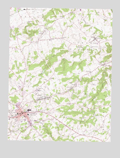
Red Lion, PA USGS Topographic Map
Click on map above to begin viewing in our Map Viewer.

This topographic map contains these locations and features:
Feature Name Type Latitude Longitude GNIS ID View Map
AdamsvillePopulated PlaceN39.8829°W76.6211°1168076View Map
ArborPopulated PlaceN39.8804°W76.6225°1196427View Map
Beaver CreekStreamN39.9343°W76.5097°1168995View Map
Bethlehem ChurchChurchN39.8940°W76.5705°1169428View Map
BittersvillePopulated PlaceN39.9248°W76.5475°1169677View Map
Bittersville SchoolSchoolN39.9287°W76.5425°1169678View Map
Borough of East ProspectCivilN39.9710°W76.5214°1215741View Map
Borough of Red LionCivilN39.8986°W76.6077°1215759View Map
Borough of WindsorCivilN39.9163°W76.5840°1215767View Map
Borough of YorkanaCivilN39.9760°W76.5847°1215772View Map
Brenneman SchoolSchoolN39.9820°W76.5761°1211194View Map
BrigadoonPopulated PlaceN39.9995°W76.6139°1196353View Map
Cabin Creek DamDamN39.9401°W76.5814°1194433View Map
Calvary ChurchChurchN39.9701°W76.5072°1170924View Map
Canadochly ChurchChurchN39.9718°W76.5614°1171147View Map
Canadochly Valley Ambulance ClubBuildingN39.9706°W76.5156°2722151View Map
Cook CreekStreamN39.9520°W76.5130°1212587View Map
CraleyPopulated PlaceN39.9476°W76.5105°1172610View Map
Craley Community Fire Company Station 44BuildingN39.9469°W76.5059°2653128View Map
Craley Post OfficePost OfficeN39.9467°W76.5046°2756667View Map
Crestwood EastPopulated PlaceN39.9862°W76.6214°1196355View Map
D Evans Farm AirportAirportN39.9804°W76.5325°1193795View Map
Dellinger SchoolSchoolN39.9234°W76.5041°1173135View Map
DelroyPopulated PlaceN39.9715°W76.5736°1173143View Map
East End ChurchChurchN39.8968°W76.5347°1173802View Map
East ProspectPopulated PlaceN39.9720°W76.5200°1173858View Map
East Prospect Fire Company Station 42BuildingN39.9704°W76.5212°2653124View Map
East Prospect Post OfficePost OfficeN39.9711°W76.5202°2756683View Map
East Prospect ReservoirReservoirN39.9607°W76.5302°1173859View Map
Edgar C Moore Elementary SchoolSchoolN39.8926°W76.6089°1211259View Map
Emanuel Lutheran ChurchChurchN39.9282°W76.6064°1196307View Map
Emanuel Reformed ChurchChurchN39.9293°W76.6055°1196306View Map
Fairmount ParkParkN39.8934°W76.6061°1196313View Map
Forest HillsPopulated PlaceN39.8870°W76.5997°1196312View Map
FreysvillePopulated PlaceN39.9282°W76.6061°1175237View Map
Greystone FarmsPopulated PlaceN39.9820°W76.6208°1196356View Map
Grimms CrossroadsPopulated PlaceN39.9101°W76.5491°1176241View Map
Hallam StationBuildingN39.9990°W76.6039°1196354View Map
HoltzPopulated PlaceN39.9423°W76.6033°1203831View Map
Kaltreider-Benfer LibraryBuildingN39.8988°W76.6066°2100251View Map
Kendale EastPopulated PlaceN39.9190°W76.6072°1196308View Map
KeysPopulated PlaceN39.8815°W76.5361°1178430View Map
Klein SchoolSchoolN39.9907°W76.5077°1178579View Map
Laurel Fire Company 1 Station 37BuildingN39.9180°W76.5818°2100048View Map
Leiphart MillPopulated PlaceN39.9870°W76.6027°1204009View Map
Leo Independent Fire Engine Company 1 Station 34BuildingN39.8995°W76.6085°2652581View Map
Locust Grove Elementary SchoolSchoolN39.9615°W76.6208°1210968View Map
Locust SpringPopulated PlaceN39.9334°W76.5747°1179796View Map
Lower Windsor Township Police DepartmentBuildingN39.9421°W76.5227°2754584View Map
Magaretta Furnace SchoolSchoolN39.9637°W76.5250°1180189View Map
Margaretta FurnacePopulated PlaceN39.9654°W76.5366°1180401View Map
Margereta Furnace FarmsLocaleN39.9667°W76.5350°2706940View Map
MartinsvillePopulated PlaceN39.9404°W76.5247°1180507View Map
Mazie C Gable Elementary SchoolSchoolN39.9065°W76.6086°1211258View Map
Modern LandfillLocaleN39.9589°W76.5950°2725968View Map
Mount PisgahSummitN39.9965°W76.5489°1193140View Map
Mount Pisgah ChurchChurchN39.9918°W76.5591°1181792View Map
Nebinger SchoolSchoolN39.8993°W76.6083°1182198View Map
Neiam SchoolSchoolN39.9526°W76.5602°1182228View Map
Olewiler CemeteryCemeteryN39.9538°W76.5145°1182964View Map
Orchard HillPopulated PlaceN39.9745°W76.6183°1196357View Map
Panorama HillsPopulated PlaceN39.9607°W76.6169°1196305View Map
PetersburgPopulated PlaceN39.9009°W76.5780°1183634View Map
Pleasant ViewPopulated PlaceN39.9029°W76.5902°1184081View Map
Pleasant View Elementary SchoolSchoolN39.9004°W76.5902°1210962View Map
Red LionPopulated PlaceN39.9009°W76.6058°1184765View Map
Red Lion Ambulance 37BuildingN39.8938°W76.6083°2722150View Map
Red Lion Area Junior High SchoolSchoolN39.8979°W76.6047°1210960View Map
Red Lion Area Senior High SchoolSchoolN39.8943°W76.6039°1210961View Map
Red Lion CemeteryCemeteryN39.9059°W76.6055°1196309View Map
Red Lion Country ClubLocaleN39.8890°W76.6058°1196311View Map
Red Lion Post OfficePost OfficeN39.9083°W76.6173°2756692View Map
Red Lion ReservoirReservoirN39.9407°W76.5824°1184766View Map
Red Lion StadiumParkN39.8957°W76.6058°1196310View Map
RichmondPopulated PlaceN39.9348°W76.5041°1212589View Map
RockeyPopulated PlaceN39.8990°W76.5177°1204528View Map
Saint Paul ChurchChurchN39.8940°W76.5827°1186548View Map
Saint Paul ChurchChurchN39.9490°W76.5125°1186549View Map
Salem ChurchChurchN39.9287°W76.5200°1186812View Map
Samuel S Lewis State ParkParkN39.9973°W76.5414°1198244View Map
Smalls SchoolSchoolN39.9104°W76.5489°1211193View Map
Snavelys SchoolSchoolN39.9679°W76.5894°1187936View Map
Snyder CornerPopulated PlaceN39.9198°W76.5280°1204682View Map
Snyder SchoolSchoolN39.9212°W76.5280°1211237View Map
SpringvalePopulated PlaceN39.8948°W76.5833°1188309View Map
Sylvan HillsPopulated PlaceN39.9726°W76.6122°1196358View Map
Thompson SchoolSchoolN39.8887°W76.5122°1189511View Map
Township of Lower WindsorCivilN39.9620°W76.5362°1217295View Map
Township of WindsorCivilN39.9001°W76.5547°1217312View Map
Trinity ChurchChurchN39.9962°W76.5183°1189779View Map
Valley View ParkLocaleN39.9848°W76.5939°1190327View Map
Warners Airport (historical)AirportN39.8868°W76.6186°1193765View Map
WGCB-AM (Red Lion)TowerN39.9048°W76.5800°1200341View Map
WGCB-FM (Red Lion)TowerN39.9048°W76.5805°1200152View Map
WGCB-TV (Red Lion)TowerN39.9051°W76.5830°1200522View Map
Willis SchoolSchoolN39.9709°W76.5766°1191494View Map
WindsorPopulated PlaceN39.9162°W76.5844°1191581View Map
Windsor ChurchChurchN39.9320°W76.5775°1191583View Map
Windsor Post OfficePost OfficeN39.9127°W76.5900°2756695View Map
Windsor Township Elementary School (historical)SchoolN39.9226°W76.5883°1214109View Map
Winters SchoolSchoolN39.9295°W76.5494°1191613View Map
YorkanaPopulated PlaceN39.9765°W76.5841°1191908View Map
Yorkana Community Fire Company Station 38BuildingN39.9761°W76.5849°2652891View Map
Zion ChurchChurchN39.8807°W76.5847°1191970View Map

Note: Coordinates in the location and feature list above are referenced to NAD83 datum.


Copyright (C) 2008-2025 Ryan Niemi / Sunset Dynamics ... All Rights Reserved