TopoQuest Logo
Do you find TopoQuest useful?
Help keep TopoQuest running and adding new maps/features by donating!
Bitcoin:  19c7KJd3qBynnjoSw5npx9KScwjBe4ifkT
Litecoin:  LXs6TkuXGGXo1vDsWCkWVdjQX94eUKd6ui
Home View Maps Find Maps Find Places Resources & Links


Stewartstown, Pennsylvania Topographic Map

USGS Map Title: Stewartstown, PA
USGS Map MRC: 39076G5
DRG (GeoTIFF) Download: o39076g5.tif


Neighboring USGS Topographic Map Quads:


  York, PA  
39076H6
 

  Red Lion, PA  
39076H5
 

  Safe Harbor, PA  
39076H4
 

  Glen Rock, PA  
39076G6
 

  Stewartstown, PA  
39076G5
 

  Airville, PA  
39076G4
 

  New Freedom, PA  
39076F6
 

  Norrisville, MD  
39076F5
 

  Fawn Grove, PA  
39076F4


Map MRC Location:

N40°
W77°
N40°
W76°
H8 H7 H6 H5 H4 H3 H2 H1
G8 G7 G6 G5 G4 G3 G2 G1
F8 F7 F6 F5 F4 F3 F2 F1
E8 E7 E6 E5 E4 E3 E2 E1
D8 D7 D6 D5 D4 D3 D2 D1
C8 C7 C6 C5 C4 C3 C2 C1
B8 B7 B6 B5 B4 B3 B2 B1
A8 A7 A6 A5 A4 A3 A2 A1
N39°
W77°
N39°
W76°

Stewartstown, PA USGS 1:24K Topographic Map Preview:
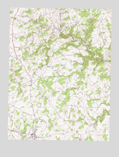
Stewartstown, PA USGS Topographic Map
Click on map above to begin viewing in our Map Viewer.

This topographic map contains these locations and features:
Feature Name Type Latitude Longitude GNIS ID View Map
Bacon MillPopulated PlaceN39.8176°W76.5361°1203007View Map
Base CrossroadsLocaleN39.7829°W76.5411°1211230View Map
Bear BranchStreamN39.8254°W76.5097°1168849View Map
Borough of Cross RoadsCivilN39.8200°W76.5728°1215736View Map
Borough of FeltonCivilN39.8571°W76.5611°1215743View Map
Borough of StewartstownCivilN39.7528°W76.5925°1215763View Map
Borough of WinterstownCivilN39.8408°W76.6174°1215768View Map
BroguevillePopulated PlaceN39.8432°W76.5316°1203158View Map
BrowntonPopulated PlaceN39.8698°W76.5619°1203172View Map
Carter CreekStreamN39.8412°W76.5316°1171284View Map
Center School (historical)SchoolN39.7829°W76.6169°1211233View Map
Cross MillPopulated PlaceN39.7990°W76.5408°1203368View Map
Cross RoadsPopulated PlaceN39.8195°W76.5766°1172746View Map
DolfPopulated PlaceN39.7832°W76.5455°1203430View Map
DracoPopulated PlaceN39.7512°W76.5355°1203442View Map
Draco AirportAirportN39.7527°W76.5361°2770604View Map
Eureka Volunteer Fire and Ambulance Company Station 54BuildingN39.7628°W76.5909°2100032View Map
FeltonPopulated PlaceN39.8548°W76.5644°1174674View Map
Felton Post OfficePost OfficeN39.8553°W76.5710°2756686View Map
Felton Volunteer Fire Company Station 43BuildingN39.8547°W76.5657°2100034View Map
FenmorePopulated PlaceN39.8376°W76.5266°1203560View Map
Fulton SchoolSchoolN39.8437°W76.5669°1211222View Map
Glassick SchoolSchoolN39.8301°W76.5575°1211226View Map
Grove MillPopulated PlaceN39.7645°W76.5189°1203727View Map
Grove Mill (historical)LocaleN39.8501°W76.5980°1211225View Map
Hopewell CemeteryCemeteryN39.8088°W76.5487°1177392View Map
Hopewell CenterPopulated PlaceN39.7976°W76.5075°1203837View Map
Hopewell ChurchChurchN39.8162°W76.5639°1177395View Map
Hyson HillPopulated PlaceN39.7954°W76.5686°1203866View Map
Hyson SchoolSchoolN39.7898°W76.5750°1211223View Map
Kurtz SchoolSchoolN39.7695°W76.5858°1211232View Map
LaurelPopulated PlaceN39.8254°W76.5097°1203989View Map
Lebanon ChurchChurchN39.8515°W76.5847°1179099View Map
Leibs CreekStreamN39.7595°W76.5252°1179170View Map
Manifold SchoolSchoolN39.7934°W76.5033°1211229View Map
Mason Dixon Public LibraryBuildingN39.7556°W76.5986°2100257View Map
MeadetownPopulated PlaceN39.8165°W76.5200°1204142View Map
North Hopewell - Winterstown Volunteer Fire Company Station 45BuildingN39.8380°W76.6196°2652835View Map
North Hopewell Township Police DepartmentBuildingN39.8263°W76.6005°2754605View Map
Old Roundhill CemeteryCemeteryN39.8365°W76.5739°1182933View Map
Pine RunStreamN39.8534°W76.5630°1183888View Map
Pleasant Hill ChurchChurchN39.8651°W76.6197°1184036View Map
Pleasant Valley Golf CourseLocaleN39.7784°W76.5422°1205798View Map
Rambo RunStreamN39.8282°W76.5211°1184621View Map
ReimoldPopulated PlaceN39.7582°W76.6189°1204483View Map
RinelyPopulated PlaceN39.8018°W76.5972°1204512View Map
Roundhill CemeteryCemeteryN39.8154°W76.5633°1185559View Map
Saint James SchoolSchoolN39.8529°W76.5111°1186030View Map
Saint Pauls ChurchChurchN39.8059°W76.5966°1186568View Map
Sechrist MillPopulated PlaceN39.8629°W76.5905°1204600View Map
Sechrist SchoolSchoolN39.7829°W76.5152°1211231View Map
Shaffer CemeteryCemeteryN39.8615°W76.6241°1187323View Map
Stewarstown Post OfficePost OfficeN39.7553°W76.5919°2756706View Map
StewartstownPopulated PlaceN39.7537°W76.5914°1188654View Map
Stewartstown Borough Police DepartmentBuildingN39.7542°W76.5918°2099983View Map
Stewartstown SchoolSchoolN39.7623°W76.5894°1188655View Map
Strayer SchoolSchoolN39.8640°W76.6183°1188869View Map
Township of East HopewellCivilN39.8020°W76.5335°1217285View Map
Township of North HopewellCivilN39.8156°W76.6042°1217301View Map
Trinity CemeteryCemeteryN39.8626°W76.5408°1189768View Map
Trinity Church (historical)ChurchN39.8620°W76.5400°1217452View Map
Trinity SchoolSchoolN39.8620°W76.5400°1214736View Map
Trout SchoolSchoolN39.8115°W76.5283°1211228View Map
Union ChurchChurchN39.8090°W76.5483°1211227View Map
Wallace School (historical)SchoolN39.8032°W76.5480°1211224View Map
WinterstownPopulated PlaceN39.8354°W76.6180°1193679View Map
ZeiglerPopulated PlaceN39.7557°W76.6077°1205010View Map
Zion ChurchChurchN39.7579°W76.5394°1191968View Map

Note: Coordinates in the location and feature list above are referenced to NAD83 datum.


Copyright (C) 2008-2024 Ryan Niemi / Sunset Dynamics ... All Rights Reserved