TopoQuest Logo
Do you find TopoQuest useful?
Help keep TopoQuest running and adding new maps/features by donating!
Bitcoin:  19c7KJd3qBynnjoSw5npx9KScwjBe4ifkT
Litecoin:  LXs6TkuXGGXo1vDsWCkWVdjQX94eUKd6ui
Home View Maps Find Maps Find Places Resources & Links


Big Island, Virginia Topographic Map

USGS Map Title: Big Island, VA
USGS Map MRC: 37079E3
DRG (GeoTIFF) Download: o37079e3.tif


Neighboring USGS Topographic Map Quads:


  Glasgow, VA  
37079F4
 

  Buena Vista, VA  
37079F3
 

  Forks of Buffalo, VA  
37079F2
 

  Snowden, VA  
37079E4
 

  Big Island, VA  
37079E3
 

  Tobacco Row Mountain, VA  
37079E2
 

  Sedalia, VA  
37079D4
 

  Boonsboro, VA  
37079D3
 

  Lynchburg, VA  
37079D2


Map MRC Location:

N38°
W80°
N38°
W79°
H8 H7 H6 H5 H4 H3 H2 H1
G8 G7 G6 G5 G4 G3 G2 G1
F8 F7 F6 F5 F4 F3 F2 F1
E8 E7 E6 E5 E4 E3 E2 E1
D8 D7 D6 D5 D4 D3 D2 D1
C8 C7 C6 C5 C4 C3 C2 C1
B8 B7 B6 B5 B4 B3 B2 B1
A8 A7 A6 A5 A4 A3 A2 A1
N37°
W80°
N37°
W79°

Big Island, VA USGS 1:24K Topographic Map Preview:
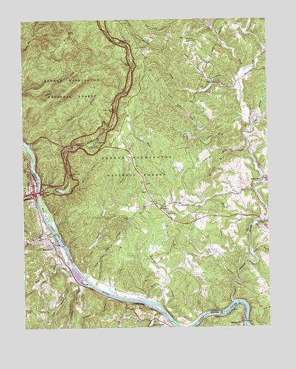
Big Island, VA USGS Topographic Map
Click on map above to begin viewing in our Map Viewer.

This topographic map contains these locations and features:
Feature Name Type Latitude Longitude GNIS ID View Map
Battery CreekStreamN37.5543°W79.3678°1481493View Map
Big IslandPopulated PlaceN37.5337°W79.3598°1492572View Map
Big IslandIslandN37.5471°W79.3642°1481741View Map
Big Island Census Designated PlaceCensusN37.5351°W79.3615°2629017View Map
Big Island DamDamN37.5365°W79.3568°1489137View Map
Big Island Emergency CrewBuildingN37.5370°W79.3620°2075580View Map
Big Island Post OfficePost OfficeN37.5352°W79.3611°2766156View Map
Big Island ReservoirReservoirN37.5368°W79.3581°1489138View Map
Big Island Volunteer Fire DepartmentBuildingN37.5346°W79.3606°2075579View Map
Buck BranchStreamN37.5190°W79.2678°1482106View Map
Burruss DamDamN37.5768°W79.2898°1489158View Map
Cabin CreekStreamN37.5193°W79.3442°1482210View Map
Cashaw Creek TrailTrailN37.5976°W79.3648°1482365View Map
Cedar CreekStreamN37.5768°W79.2623°1482395View Map
Centenary ChurchChurchN37.5462°W79.3020°1482421View Map
Clark CreekStreamN37.5288°W79.2578°1482545View Map
Coleman FallsPopulated PlaceN37.5015°W79.3036°1492790View Map
Coleman Falls Post OfficePost OfficeN37.5012°W79.3026°2766181View Map
Colemans Fall DamDamN37.5018°W79.2998°1489139View Map
Colemans Fall ReservoirReservoirN37.5018°W79.2998°1489140View Map
Corner Stone Baptist ChurchChurchN37.5485°W79.3053°1482716View Map
Dancing CreekStreamN37.5954°W79.2631°1482908View Map
District 3CivilN37.5946°W79.2508°1927219View Map
Grants HollowValleyN37.6230°W79.3696°1483746View Map
Hamilton KnobSummitN37.5854°W79.3586°1488807View Map
Harris HollowValleyN37.5192°W79.3372°1488541View Map
Holcomb RockLocaleN37.5021°W79.2634°1484155View Map
Holcomb Rock DamDamN37.5101°W79.2659°1489163View Map
Horsley CreekStreamN37.5593°W79.2523°1484232View Map
Hunting CreekStreamN37.5382°W79.3598°1484288View Map
Indian RunStreamN37.5060°W79.3059°1484338View Map
Ivy Hill CemeteryCemeteryN37.5465°W79.3167°1484372View Map
Ivy Hill ChurchChurchN37.5440°W79.3214°1484373View Map
Jacks BranchStreamN37.5812°W79.2664°1484381View Map
KnollLocaleN37.5993°W79.2778°1484628View Map
Little Cedar CreekStreamN37.5779°W79.2759°1484881View Map
Little Dancing CreekStreamN37.5974°W79.2667°1484894View Map
Little Maple CreekStreamN37.5721°W79.2592°1484925View Map
Little Otter CreekStreamN37.5554°W79.3536°1484948View Map
Long BranchStreamN37.5207°W79.3459°1485049View Map
Love Lady CreekStreamN37.6051°W79.2623°1485096View Map
Lower Otter Creek OverlookLocaleN37.5612°W79.3520°1485119View Map
Lyn Dan Heights Volunteer Fire DepartmentSchoolN37.5242°W79.3314°2086338View Map
MajorPopulated PlaceN37.5579°W79.3700°1485162View Map
Maple CreekStreamN37.5235°W79.2656°1485167View Map
Middle Otter Creek OverlookLocaleN37.5882°W79.3273°1485382View Map
Miners MountainSummitN37.5604°W79.2795°1485490View Map
NaolaPopulated PlaceN37.5551°W79.3117°1493336View Map
Otter CreekStreamN37.5540°W79.3664°1486008View Map
Otter Creek Flats OverlookLocaleN37.6068°W79.3186°1486009View Map
Otter Creek Recreation AreaParkN37.5746°W79.3386°1486010View Map
Otter LakeReservoirN37.5559°W79.3556°1502090View Map
Otter Lake DamDamN37.5565°W79.3575°1489164View Map
PearchPopulated PlaceN37.5046°W79.2786°1493407View Map
Peavine GapGapN37.6199°W79.3514°1486115View Map
Peavine MountainRidgeN37.6126°W79.3567°1493408View Map
PedlarPopulated PlaceN37.5099°W79.2692°1707613View Map
Pedlar MillsPopulated PlaceN37.5599°W79.2514°1486121View Map
Pedlar RiverStreamN37.5099°W79.2681°1486122View Map
PeraPopulated PlaceN37.6176°W79.2914°1493416View Map
Peters CreekStreamN37.5643°W79.3703°1486163View Map
Reed CreekStreamN37.5246°W79.3498°1486556View Map
Shewey RidgeRidgeN37.5976°W79.3492°1488806View Map
Skimmer CreekStreamN37.5129°W79.3317°1487289View Map
Terrapin CreekStreamN37.5732°W79.3528°1487810View Map
Terrapin Hill OverlookLocaleN37.5737°W79.3478°1487811View Map
The Riffles OverlookLocaleN37.5807°W79.3323°1487851View Map
Thomas Mill CreekStreamN37.5204°W79.3431°1487867View Map
Thornton ChurchChurchN37.6171°W79.2909°1487893View Map
Upper Otter Creek OverlookLocaleN37.6157°W79.3236°1488075View Map
WaughPopulated PlaceN37.5171°W79.3445°1493763View Map
Wilderness CreekStreamN37.5013°W79.2889°1488380View Map

Note: Coordinates in the location and feature list above are referenced to NAD83 datum.


Copyright (C) 2008-2024 Ryan Niemi / Sunset Dynamics ... All Rights Reserved