TopoQuest Logo
Do you find TopoQuest useful?
Help keep TopoQuest running and adding new maps/features by donating!
Bitcoin:  19c7KJd3qBynnjoSw5npx9KScwjBe4ifkT
Litecoin:  LXs6TkuXGGXo1vDsWCkWVdjQX94eUKd6ui
Home View Maps Find Maps Find Places Resources & Links


Redfield, New York Topographic Map

USGS Map Title: Redfield, NY
USGS Map MRC: 43075E7
DRG (GeoTIFF) Download: o43075e7.tif


Neighboring USGS Topographic Map Quads:


  Boylston Center, NY  
43075F8
 

  Worth Center, NY  
43075F7
 

  Sears Pond, NY  
43075F6
 

  Orwell, NY  
43075E8
 

  Redfield, NY  
43075E7
 

  North Osceola, NY  
43075E6
 

  Williamstown, NY  
43075D8
 

  Westdale, NY  
43075D7
 

  Florence, NY  
43075D6


Map MRC Location:

N44°
W76°
N44°
W75°
H8 H7 H6 H5 H4 H3 H2 H1
G8 G7 G6 G5 G4 G3 G2 G1
F8 F7 F6 F5 F4 F3 F2 F1
E8 E7 E6 E5 E4 E3 E2 E1
D8 D7 D6 D5 D4 D3 D2 D1
C8 C7 C6 C5 C4 C3 C2 C1
B8 B7 B6 B5 B4 B3 B2 B1
A8 A7 A6 A5 A4 A3 A2 A1
N43°
W76°
N43°
W75°

Redfield, NY USGS 1:24K Topographic Map Preview:
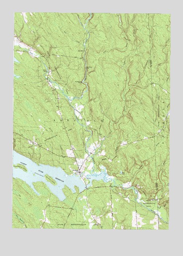
Redfield, NY USGS Topographic Map
Click on map above to begin viewing in our Map Viewer.

This topographic map contains these locations and features:
Feature Name Type Latitude Longitude GNIS ID View Map
Beaver CreekStreamN43.6176°W75.8196°943379View Map
Burdick IslandIslandN43.5278°W75.8444°945203View Map
Castor BrookStreamN43.5806°W75.7855°946002View Map
Castor PondLakeN43.5931°W75.8488°946005View Map
Coey CreekStreamN43.5453°W75.8744°946998View Map
Cold BrookStreamN43.6045°W75.8185°947039View Map
Deer PondLakeN43.5323°W75.7884°948215View Map
Fox BrookStreamN43.5212°W75.8735°950552View Map
Grindstone BrookStreamN43.5834°W75.7782°951830View Map
Horseshoe BendBendN43.5851°W75.8205°953234View Map
Huckleberry IslandIslandN43.5359°W75.8688°953369View Map
Kenny BrookStreamN43.5342°W75.8357°954515View Map
Line BrookStreamN43.5515°W75.7569°955415View Map
Little Baker BrookStreamN43.5415°W75.8744°970291View Map
Mad RiverStreamN43.5745°W75.8307°956245View Map
Mad River FallsFallsN43.5934°W75.8180°956246View Map
Mill StreamStreamN43.5415°W75.8121°957285View Map
Muddy BrookStreamN43.5326°W75.8035°958120View Map
Myrtle CemeteryCemeteryN43.5319°W75.8222°958237View Map
North Branch Salmon RiverStreamN43.5292°W75.8121°958718View Map
Otto MillsPopulated PlaceN43.6026°W75.8194°972902View Map
Prince BrookStreamN43.5117°W75.7641°961140View Map
Rat CreekStreamN43.6042°W75.8196°962201View Map
RedfieldPopulated PlaceN43.5331°W75.8216°962327View Map
Redfield Volunteer Fire DepartmentBuildingN43.5325°W75.8215°2701335View Map
Salmon RiverStreamN43.5240°W75.8166°964320View Map
School Number 1 (historical)SchoolN43.5333°W75.8222°2369704View Map
School Number 5 (historical)SchoolN43.6097°W75.8714°2369705View Map
School Number 9 (historical)SchoolN43.5803°W75.8425°2369706View Map
Stony BrookStreamN43.5237°W75.7841°966536View Map
Town of RedfieldCivilN43.5891°W75.8286°979410View Map

Note: Coordinates in the location and feature list above are referenced to NAD83 datum.


Copyright (C) 2008-2024 Ryan Niemi / Sunset Dynamics ... All Rights Reserved