TopoQuest Logo
Do you find TopoQuest useful?
Help keep TopoQuest running and adding new maps/features by donating!
Bitcoin:  19c7KJd3qBynnjoSw5npx9KScwjBe4ifkT
Litecoin:  LXs6TkuXGGXo1vDsWCkWVdjQX94eUKd6ui
Home View Maps Find Maps Find Places Resources & Links


Florence, New York Topographic Map

USGS Map Title: Florence, NY
USGS Map MRC: 43075D6
DRG (GeoTIFF) Download: o43075d6.tif


Neighboring USGS Topographic Map Quads:


  Redfield, NY  
43075E7
 

  North Osceola, NY  
43075E6
 

  High Market, NY  
43075E5
 

  Westdale, NY  
43075D7
 

  Florence, NY  
43075D6
 

  Point Rock, NY  
43075D5
 

  Camden West, NY  
43075C7
 

  Camden East, NY  
43075C6
 

  Lee Center, NY  
43075C5


Map MRC Location:

N44°
W76°
N44°
W75°
H8 H7 H6 H5 H4 H3 H2 H1
G8 G7 G6 G5 G4 G3 G2 G1
F8 F7 F6 F5 F4 F3 F2 F1
E8 E7 E6 E5 E4 E3 E2 E1
D8 D7 D6 D5 D4 D3 D2 D1
C8 C7 C6 C5 C4 C3 C2 C1
B8 B7 B6 B5 B4 B3 B2 B1
A8 A7 A6 A5 A4 A3 A2 A1
N43°
W76°
N43°
W75°

Florence, NY USGS 1:24K Topographic Map Preview:
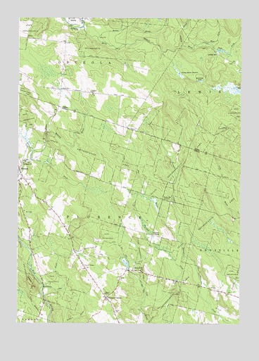
Florence, NY USGS Topographic Map
Click on map above to begin viewing in our Map Viewer.

This topographic map contains these locations and features:
Feature Name Type Latitude Longitude GNIS ID View Map
Big BrookStreamN43.4090°W75.6596°943847View Map
Cowles CreekStreamN43.4951°W75.6930°947601View Map
Davis CemeteryCemeteryN43.4335°W75.7463°948056View Map
East Fork Salmon RiverStreamN43.4903°W75.6468°949071View Map
EmpeyvillePopulated PlaceN43.3967°W75.6849°949652View Map
Fall BrookStreamN43.4967°W75.7144°949873View Map
Finnegan BrookStreamN43.4967°W75.6871°942092View Map
Finnegan BrookStreamN43.3878°W75.7371°950077View Map
FlorencePopulated PlaceN43.4384°W75.7494°950299View Map
Florence Volunteer Fire DepartmentBuildingN43.4381°W75.7489°2734839View Map
Forty Six CornersLocaleN43.4256°W75.6685°950510View Map
Greely CemeteryCemeteryN43.3799°W75.6949°951661View Map
Hanifin CornersLocaleN43.4112°W75.6744°952163View Map
Hickey Beaver MeadowFlatN43.4784°W75.6549°952679View Map
Leisher MillPopulated PlaceN43.4853°W75.6382°972717View Map
Malloy BrookStreamN43.4920°W75.7060°942097View Map
Maloney BrookStreamN43.4534°W75.7341°956318View Map
McCarthys LakeLakeN43.4745°W75.6484°956732View Map
Mount Pleasant CemeteryCemeteryN43.4697°W75.7095°951794View Map
Pickens BrookStreamN43.4890°W75.6585°942102View Map
Powlish PondLakeN43.4703°W75.6259°961083View Map
Saint Marys ChurchChurchN43.4409°W75.7474°963944View Map
Saint Marys Church CemeteryCemeteryN43.4410°W75.7474°2106140View Map
Salmon River CemeteryCemeteryN43.4966°W75.7223°964323View Map
School Number 1 (historical)SchoolN43.4709°W75.7257°974925View Map
School Number 11 (historical)SchoolN43.4325°W75.7011°2106144View Map
School Number 14 (historical)SchoolN43.4114°W75.7214°2106145View Map
School Number 15 (historical)SchoolN43.3911°W75.7358°2106146View Map
School Number 5 (historical)SchoolN43.4678°W75.6922°2106090View Map
School Number 5 (historical)SchoolN43.3867°W75.7010°975449View Map
School Number 5 (historical)SchoolN43.3792°W75.6367°2106141View Map
School Number 8 (historical)SchoolN43.3964°W75.6833°2106142View Map
School Number 9 (historical)SchoolN43.4114°W75.6744°2106143View Map
Smith BrookStreamN43.4417°W75.7427°965456View Map
Smith BrookStreamN43.4970°W75.6880°965458View Map
Stanford CemeteryCemeteryN43.3892°W75.6404°966216View Map
Swancott Lookout TowerTowerN43.4551°W75.6321°974291View Map
Thompson CornersLocaleN43.3853°W75.6996°967406View Map
Town of FlorenceCivilN43.4228°W75.7431°978960View Map
West Fork Salmon RiverStreamN43.4903°W75.6468°969225View Map
Wickwire HillSummitN43.3920°W75.7432°971219View Map

Note: Coordinates in the location and feature list above are referenced to NAD83 datum.


Copyright (C) 2008-2025 Ryan Niemi / Sunset Dynamics ... All Rights Reserved