TopoQuest Logo
Do you find TopoQuest useful?
Help keep TopoQuest running and adding new maps/features by donating!
Bitcoin:  19c7KJd3qBynnjoSw5npx9KScwjBe4ifkT
Litecoin:  LXs6TkuXGGXo1vDsWCkWVdjQX94eUKd6ui
Home View Maps Find Maps Find Places Resources & Links


Westdale, New York Topographic Map

USGS Map Title: Westdale, NY
USGS Map MRC: 43075D7
DRG (GeoTIFF) Download: o43075d7.tif


Neighboring USGS Topographic Map Quads:


  Orwell, NY  
43075E8
 

  Redfield, NY  
43075E7
 

  North Osceola, NY  
43075E6
 

  Williamstown, NY  
43075D8
 

  Westdale, NY  
43075D7
 

  Florence, NY  
43075D6
 

  Panther Lake, NY  
43075C8
 

  Camden West, NY  
43075C7
 

  Camden East, NY  
43075C6


Map MRC Location:

N44°
W76°
N44°
W75°
H8 H7 H6 H5 H4 H3 H2 H1
G8 G7 G6 G5 G4 G3 G2 G1
F8 F7 F6 F5 F4 F3 F2 F1
E8 E7 E6 E5 E4 E3 E2 E1
D8 D7 D6 D5 D4 D3 D2 D1
C8 C7 C6 C5 C4 C3 C2 C1
B8 B7 B6 B5 B4 B3 B2 B1
A8 A7 A6 A5 A4 A3 A2 A1
N43°
W76°
N43°
W75°

Westdale, NY USGS 1:24K Topographic Map Preview:
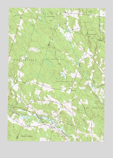
Westdale, NY USGS Topographic Map
Click on map above to begin viewing in our Map Viewer.

This topographic map contains these locations and features:
Feature Name Type Latitude Longitude GNIS ID View Map
Camden WoodsWoodsN43.3773°W75.8502°945517View Map
Finnerty Hill Tree FarmLocaleN43.4800°W75.8614°2542318View Map
Florence HillPopulated PlaceN43.4231°W75.7930°972485View Map
Gifford LakeLakeN43.3974°W75.8316°951083View Map
Graves CemeteryCemeteryN43.4330°W75.7505°951593View Map
Hyatt BranchStreamN43.3965°W75.8505°953553View Map
Johnson CemeteryCemeteryN43.4556°W75.7696°954108View Map
Little RiverStreamN43.4251°W75.7621°955658View Map
Maple HillPopulated PlaceN43.4528°W75.8535°972758View Map
Perry BrookStreamN43.4523°W75.7841°960203View Map
School Number 1 (historical)SchoolN43.4222°W75.7922°2357058View Map
School Number 12 (historical)SchoolN43.4194°W75.7589°2357062View Map
School Number 2 (historical)SchoolN43.4819°W75.8628°2369726View Map
School Number 2 (historical)SchoolN43.4853°W75.7572°2369727View Map
School Number 3 (historical)SchoolN43.4128°W75.8269°2357059View Map
School Number 4 (historical)SchoolN43.4592°W75.7758°2357067View Map
School Number 5 (historical)SchoolN43.4528°W75.8544°2369728View Map
School Number 8 (historical)SchoolN43.3778°W75.7647°2357060View Map
School Number 9 (historical)SchoolN43.3869°W75.8164°2357061View Map
Spellicy BrookStreamN43.4442°W75.7810°965978View Map
Union Church (historical)ChurchN43.4794°W75.7964°2357066View Map
WestdalePopulated PlaceN43.3878°W75.8152°970908View Map
Westdale Federated ChurchChurchN43.3894°W75.8217°2617084View Map

Note: Coordinates in the location and feature list above are referenced to NAD83 datum.


Copyright (C) 2008-2025 Ryan Niemi / Sunset Dynamics ... All Rights Reserved