TopoQuest Logo
Do you find TopoQuest useful?
Help keep TopoQuest running and adding new maps/features by donating!
Bitcoin:  19c7KJd3qBynnjoSw5npx9KScwjBe4ifkT
Litecoin:  LXs6TkuXGGXo1vDsWCkWVdjQX94eUKd6ui
Home View Maps Find Maps Find Places Resources & Links


Reedy, West Virginia Topographic Map

USGS Map Title: Reedy, WV
USGS Map MRC: 38081H4
DRG (GeoTIFF) Download: o38081h4.tif


Neighboring USGS Topographic Map Quads:


  Rockport, WV  
39081A5
 

  Elizabeth, WV  
39081A4
 

  Girta, WV  
39081A3
 

  Liverpool, WV  
38081H5
 

  Reedy, WV  
38081H4
 

  Burning Springs, WV  
38081H3
 

  Gay, WV  
38081G5
 

  Peniel, WV  
38081G4
 

  Spencer, WV  
38081G3


Map MRC Location:

N39°
W82°
N39°
W81°
H8 H7 H6 H5 H4 H3 H2 H1
G8 G7 G6 G5 G4 G3 G2 G1
F8 F7 F6 F5 F4 F3 F2 F1
E8 E7 E6 E5 E4 E3 E2 E1
D8 D7 D6 D5 D4 D3 D2 D1
C8 C7 C6 C5 C4 C3 C2 C1
B8 B7 B6 B5 B4 B3 B2 B1
A8 A7 A6 A5 A4 A3 A2 A1
N38°
W82°
N38°
W81°

Reedy, WV USGS 1:24K Topographic Map Preview:
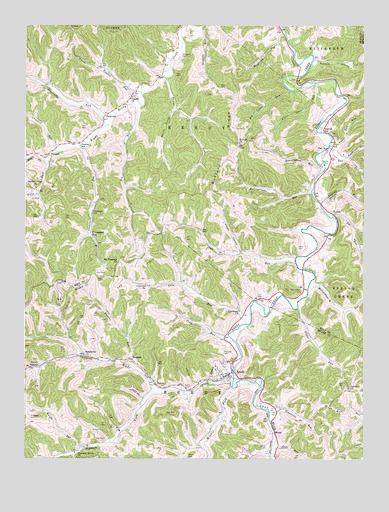
Reedy, WV USGS Topographic Map
Click on map above to begin viewing in our Map Viewer.

This topographic map contains these locations and features:
Feature Name Type Latitude Longitude GNIS ID View Map
Anderson CemeteryCemeteryN38.8867°W81.4979°1534939View Map
Baker CemeteryCemeteryN38.9362°W81.3993°1535143View Map
Big Laurel RunStreamN38.9815°W81.4023°1535880View Map
Big RunStreamN38.9823°W81.4918°1678800View Map
Big RunStreamN38.9767°W81.4571°1535923View Map
Board CemeteryCemeteryN38.8951°W81.4396°1536160View Map
Buffalo CemeteryCemeteryN38.9656°W81.4207°1678804View Map
Buffalo Church (historical)ChurchN38.9662°W81.4212°1536619View Map
Buffalo HollowValleyN38.9901°W81.3921°1536643View Map
Buffalo RidgeRidgeN38.9637°W81.4243°1536649View Map
Buffalo School (historical)SchoolN38.9662°W81.4212°2750016View Map
Cain RunStreamN38.9140°W81.4185°1536849View Map
Cain Run School (historical)SchoolN38.9201°W81.4287°1740862View Map
Callow CemeteryCemeteryN38.8781°W81.4107°1536866View Map
Center Valley CemeteryCemeteryN38.9529°W81.4968°1678810View Map
Center Valley United Methodist ChurchChurchN38.9531°W81.4960°1537158View Map
Conrad RunStreamN38.9318°W81.4004°1537587View Map
Cranenest RunStreamN38.8884°W81.4096°1537797View Map
Cranesnest CemeteryCemeteryN38.9459°W81.4754°1537801View Map
Cranesnest RunLocaleN38.9404°W81.4760°1537802View Map
Cranesnest RunStreamN38.9642°W81.4787°1537804View Map
Crooked RunStreamN38.9634°W81.4885°1537858View Map
Daniell School (historical)SchoolN38.9698°W81.3904°1537987View Map
Daniels RunStreamN38.9487°W81.3912°1537994View Map
DukesPopulated PlaceN38.8965°W81.4518°1549661View Map
Enoch ForkStreamN38.9606°W81.4915°1538719View Map
Fairview ChurchChurchN38.8954°W81.3801°1538813View Map
Fallingtimber RunStreamN38.9523°W81.3946°1538868View Map
Fodderpen RunStreamN38.9620°W81.3807°1539109View Map
Folly RunStreamN38.9093°W81.4235°1539113View Map
Fulls ForkStreamN38.9606°W81.4915°1539297View Map
Good Hope CemeteryCemeteryN38.9178°W81.4199°2574025View Map
Goodhope ChurchChurchN38.9176°W81.4210°1539509View Map
Happy HollowValleyN38.9345°W81.4204°1539933View Map
Knight RunStreamN38.8779°W81.4785°1541268View Map
Lee RunStreamN38.9448°W81.3862°1541608View Map
Left Fork Reedy CreekStreamN38.8995°W81.4232°1541706View Map
Little Laurel RunStreamN38.9831°W81.3929°1542153View Map
Lone Star School (historical)SchoolN38.9342°W81.4143°1678831View Map
Long Bottom School (historical)SchoolN38.8795°W81.4712°1740937View Map
Lower Two RunStreamN38.9659°W81.3862°1542589View Map
LucilePopulated PlaceN38.9454°W81.3860°1555009View Map
Lucile School (historical)SchoolN38.9462°W81.3868°1678833View Map
Masters RunStreamN38.9015°W81.4610°1542858View Map
Mayberry RunStreamN38.9981°W81.4043°1542896View Map
Mayberry School (historical)SchoolN38.9934°W81.4107°1678834View Map
McClung CemeteryCemeteryN38.9056°W81.4268°1542940View Map
McCutcheon CemeteryCemeteryN38.9237°W81.3979°1542979View Map
McCutcheon RunStreamN38.9268°W81.3935°1542981View Map
McCutcheon School (historical)SchoolN38.9256°W81.3901°1678836View Map
Middle Fork Reedy CreekStreamN38.8954°W81.4237°1543193View Map
MoorePopulated PlaceN38.8826°W81.4076°1555159View Map
Moore School (historical)SchoolN38.8859°W81.4085°1740948View Map
Morris HollowValleyN38.9756°W81.4454°1543577View Map
Mount Pleasant ChurchChurchN38.9315°W81.4657°1543744View Map
Mount Vernon School (historical)SchoolN38.9204°W81.4560°1740954View Map
Ott CemeteryCemeteryN38.9970°W81.4396°1544456View Map
PeeweePopulated PlaceN38.9626°W81.4915°1549870View Map
Peewee School (historical)SchoolN38.9651°W81.4801°1544693View Map
Pisgah CemeteryCemeteryN38.9795°W81.4604°1678852View Map
Pisgah United Methodist ChurchChurchN38.9795°W81.4607°1544957View Map
Pleasant Grove CemeteryCemeteryN38.8755°W81.4792°2586154View Map
Pleasant Grove ChurchChurchN38.8754°W81.4807°1544986View Map
Pleasantdale School (historical)SchoolN38.9456°W81.4551°1678853View Map
ReedyPopulated PlaceN38.8995°W81.4248°1545488View Map
Reedy Baptist ChurchChurchN38.8995°W81.4273°1740977View Map
Reedy Elementary SchoolSchoolN38.9019°W81.4299°1740978View Map
Reedy Post OfficePost OfficeN38.9001°W81.4237°1740979View Map
Reedy United Methodist ChurchChurchN38.8979°W81.4290°1740980View Map
Reedy Volunteer Fire DepartmentBuildingN38.8998°W81.4245°2577854View Map
Right Fork Reedy CreekStreamN38.8998°W81.4232°1545687View Map
Roach CemeteryCemeteryN38.8756°W81.4398°1545788View Map
Rock Valley School (historical)SchoolN38.9395°W81.4760°1678858View Map
Roundbottom RunStreamN38.9581°W81.3904°1546114View Map
SeamanPopulated PlaceN38.9034°W81.4604°1549919View Map
Seaman ForkStreamN38.8940°W81.4523°1546535View Map
Sheppard CemeteryCemeteryN38.9909°W81.4423°1546674View Map
Slate RunStreamN38.8781°W81.4073°1546913View Map
Somerville ForkStreamN38.9712°W81.4690°1547056View Map
Southwest DistrictCivilN38.9876°W81.4182°1928368View Map
Stutler RunStreamN38.9184°W81.3990°1547616View Map
Sugarcamp RunStreamN38.9098°W81.4840°1741013View Map
SunflowerPopulated PlaceN38.9051°W81.4782°1549946View Map
Sunflower School (historical)SchoolN38.9051°W81.4776°1741014View Map
Thorns RunStreamN38.9848°W81.4482°1548054View Map
Thorns Run School (historical)SchoolN38.9842°W81.4479°1678866View Map
Town of ReedyCivilN38.8997°W81.4263°2391383View Map
Two RunStreamN38.9648°W81.3876°1548416View Map
Two RunPopulated PlaceN38.9645°W81.3873°1678868View Map
Two Run CemeteryCemeteryN38.9640°W81.3887°1852327View Map
Two Runs ChurchChurchN38.9634°W81.3885°1548418View Map
Two Runs School (historical)SchoolN38.9629°W81.3826°1678870View Map
Twolick RunStreamN38.9809°W81.4573°1548420View Map
Twolick School (historical)SchoolN38.9829°W81.4635°1678871View Map
ZackvillePopulated PlaceN38.9742°W81.4701°1549999View Map

Note: Coordinates in the location and feature list above are referenced to NAD83 datum.


Copyright (C) 2008-2024 Ryan Niemi / Sunset Dynamics ... All Rights Reserved