TopoQuest Logo
Do you find TopoQuest useful?
Help keep TopoQuest running and adding new maps/features by donating!
Bitcoin:  19c7KJd3qBynnjoSw5npx9KScwjBe4ifkT
Litecoin:  LXs6TkuXGGXo1vDsWCkWVdjQX94eUKd6ui
Home View Maps Find Maps Find Places Resources & Links


Reese, Michigan Topographic Map

USGS Map Title: Reese, MI
USGS Map MRC: 43083D6
DRG (GeoTIFF) Download: o43083d6.tif


Neighboring USGS Topographic Map Quads:


  Essexville, MI  
43083E7
 

  Quanicassee, MI  
43083E6
 

  Fairgrove, MI  
43083E5
 

  Saginaw NE, MI  
43083D7
 

  Reese, MI  
43083D6
 

  Gilford, MI  
43083D5
 

  Birch Run North, MI  
43083C7
 

  Frankenmuth, MI  
43083C6
 

  Vassar, MI  
43083C5


Map MRC Location:

N44°
W84°
N44°
W83°
H8 H7 H6 H5 H4 H3 H2 H1
G8 G7 G6 G5 G4 G3 G2 G1
F8 F7 F6 F5 F4 F3 F2 F1
E8 E7 E6 E5 E4 E3 E2 E1
D8 D7 D6 D5 D4 D3 D2 D1
C8 C7 C6 C5 C4 C3 C2 C1
B8 B7 B6 B5 B4 B3 B2 B1
A8 A7 A6 A5 A4 A3 A2 A1
N43°
W84°
N43°
W83°

Reese, MI USGS 1:24K Topographic Map Preview:
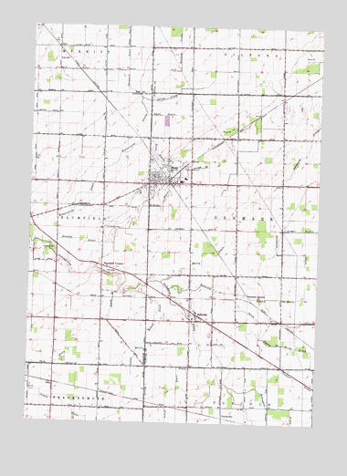
Reese, MI USGS Topographic Map
Click on map above to begin viewing in our Map Viewer.

This topographic map contains these locations and features:
Feature Name Type Latitude Longitude GNIS ID View Map
ArnPopulated PlaceN43.4936°W83.7389°2547459View Map
Arn Post Office (historical)Post OfficeN43.4936°W83.7389°2548195View Map
Arn SchoolSchoolN43.4895°W83.7383°620234View Map
Arn StationLocaleN43.4936°W83.7392°2547457View Map
Bauer DrainCanalN43.3922°W83.6844°620765View Map
Blumfield CemeteryCemeteryN43.4300°W83.7386°621657View Map
Blumfield CornersPopulated PlaceN43.4242°W83.7183°621658View Map
Christ Lutheran ChurchChurchN43.4519°W83.6986°2554339View Map
Country Club of ReeseLocaleN43.4403°W83.7033°2559053View Map
Crossway Assembly of God ChurchChurchN43.4444°W83.6981°2554338View Map
Denmark JunctionPopulated PlaceN43.4159°W83.6550°1617522View Map
Denmark Township CemeteryCemeteryN43.4567°W83.6922°2554516View Map
Denmark Township Police DepartmentBuildingN43.4089°W83.6753°2737597View Map
Durussell DrainCanalN43.4878°W83.7089°625027View Map
Ekund DrainCanalN43.4147°W83.6430°625418View Map
Fink DrainCanalN43.3928°W83.7466°625958View Map
Frankenhilf Historical MarkerParkN43.4081°W83.6792°2554531View Map
GeraPopulated PlaceN43.3872°W83.7386°626746View Map
Gera Post Office (historical)Post OfficeN43.3872°W83.7386°2558492View Map
Gera StationLocaleN43.3875°W83.7392°2558440View Map
Hawkins DrainCanalN43.4936°W83.6866°627957View Map
Hecht DrainCanalN43.3956°W83.6266°628045View Map
Heindel DrainCanalN43.4322°W83.7280°628054View Map
Jenney Post Office (historical)Post OfficeN43.4153°W83.6594°2553973View Map
Lotter DrainCanalN43.3964°W83.7030°631116View Map
Meadows Mobile Home ParkPopulated PlaceN43.4600°W83.6978°2554350View Map
Murry DrainCanalN43.4289°W83.6733°633157View Map
Pebble Creek Mobile Home CommunityPopulated PlaceN43.4761°W83.6403°2554349View Map
ReesePopulated PlaceN43.4506°W83.6964°635770View Map
Reese DrainCanalN43.4542°W83.6889°635772View Map
Reese Elementary SchoolSchoolN43.4522°W83.6828°2554347View Map
Reese Fire RescueBuildingN43.4513°W83.6913°2554340View Map
Reese High SchoolSchoolN43.4606°W83.6811°2554346View Map
Reese Middle SchoolSchoolN43.4514°W83.6844°2554348View Map
Reese Police DepartmentBuildingN43.4489°W83.6960°2554342View Map
Reese Post OfficePost OfficeN43.4489°W83.6967°2554343View Map
Reese StationLocaleN43.4517°W83.6908°2554336View Map
RichvillePopulated PlaceN43.4092°W83.6772°635895View Map
Richville DrainCanalN43.4139°W83.6605°635896View Map
Richville Fire DepartmentBuildingN43.4091°W83.6775°2626932View Map
Richville Post OfficePost OfficeN43.4092°W83.6767°2554351View Map
Richville StationLocaleN43.4142°W83.6800°2554352View Map
Rousch DrainCanalN43.3914°W83.6980°636335View Map
Ryan DrainCanalN43.4722°W83.6930°636432View Map
Saint Elizabeth CemeteryCemeteryN43.4367°W83.7175°636627View Map
Saint Elizabeth's ChurchChurchN43.4514°W83.7019°2559054View Map
Saint Michael's German Lutheran CemeteryCemeteryN43.4089°W83.6786°2554515View Map
Saint Michael's Lutheran ChurchChurchN43.4081°W83.6783°2554354View Map
Saint Michael's Lutheran SchoolSchoolN43.4100°W83.6772°2554353View Map
Schemn DrainCanalN43.4556°W83.6766°637332View Map
Sheboygan DrainCanalN43.4114°W83.6827°637704View Map
Squaw CreekCanalN43.4775°W83.6922°638664View Map
Tinglan DrainCanalN43.3936°W83.6394°1614876View Map
Township of DenmarkCivilN43.4362°W83.6398°1626176View Map
Trinity Lutheran CemeteryCemeteryN43.4478°W83.7028°2558983View Map
Trinity Lutheran ChurchChurchN43.4517°W83.6933°2554344View Map
Trinity Lutheran SchoolSchoolN43.4517°W83.6928°2554345View Map
Tuscola StationLocaleN43.3767°W83.6647°1615212View Map
United Methodist ChurchChurchN43.4514°W83.6931°2554337View Map
Unity District LibraryBuildingN43.4494°W83.6967°2554341View Map
Village of ReeseCivilN43.4528°W83.6894°2399055View Map
Watercourse DrainCanalN43.4553°W83.7186°1615841View Map
Zewerk DrainCanalN43.4134°W83.7133°1616923View Map

Note: Coordinates in the location and feature list above are referenced to NAD83 datum.


Copyright (C) 2008-2024 Ryan Niemi / Sunset Dynamics ... All Rights Reserved