TopoQuest Logo
Do you find TopoQuest useful?
Help keep TopoQuest running and adding new maps/features by donating!
Bitcoin:  19c7KJd3qBynnjoSw5npx9KScwjBe4ifkT
Litecoin:  LXs6TkuXGGXo1vDsWCkWVdjQX94eUKd6ui
Home View Maps Find Maps Find Places Resources & Links


Gilford, Michigan Topographic Map

USGS Map Title: Gilford, MI
USGS Map MRC: 43083D5
DRG (GeoTIFF) Download: o43083d5.tif


Neighboring USGS Topographic Map Quads:


  Quanicassee, MI  
43083E6
 

  Fairgrove, MI  
43083E5
 

  Colling, MI  
43083E4
 

  Reese, MI  
43083D6
 

  Gilford, MI  
43083D5
 

  Caro, MI  
43083D4
 

  Frankenmuth, MI  
43083C6
 

  Vassar, MI  
43083C5
 

  Juniata, MI  
43083C4


Map MRC Location:

N44°
W84°
N44°
W83°
H8 H7 H6 H5 H4 H3 H2 H1
G8 G7 G6 G5 G4 G3 G2 G1
F8 F7 F6 F5 F4 F3 F2 F1
E8 E7 E6 E5 E4 E3 E2 E1
D8 D7 D6 D5 D4 D3 D2 D1
C8 C7 C6 C5 C4 C3 C2 C1
B8 B7 B6 B5 B4 B3 B2 B1
A8 A7 A6 A5 A4 A3 A2 A1
N43°
W84°
N43°
W83°

Gilford, MI USGS 1:24K Topographic Map Preview:
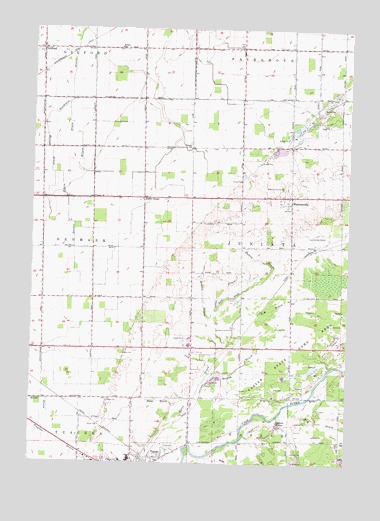
Gilford, MI USGS Topographic Map
Click on map above to begin viewing in our Map Viewer.

This topographic map contains these locations and features:
Feature Name Type Latitude Longitude GNIS ID View Map
Brewer DrainCanalN43.4028°W83.5425°621940View Map
Crossman Post Office (historical)Post OfficeN43.4381°W83.5031°2553980View Map
Denmark Post Office (historical)Post OfficeN43.4506°W83.5828°2553979View Map
E-M DrainCanalN43.4197°W83.5300°625068View Map
Enos DrainCanalN43.4228°W83.5466°625610View Map
Foess DrainCanalN43.3928°W83.5741°626206View Map
Garner DrainCanalN43.4470°W83.6111°626670View Map
GilfordPopulated PlaceN43.4942°W83.6219°626820View Map
Gilford Post OfficePost OfficeN43.4942°W83.6219°2554612View Map
Gilford StationLocaleN43.4875°W83.6219°2554611View Map
Gilford Township CemeteryCemeteryN43.4953°W83.6211°2554511View Map
Gilford United Methodist Church Historical MarkerParkN43.4950°W83.6219°2554530View Map
H-M DrainStreamN43.3920°W83.5222°627567View Map
Haines DrainCanalN43.4647°W83.6180°627606View Map
Hobart SchoolSchoolN43.4947°W83.5913°628361View Map
Humes DrainCanalN43.4342°W83.5350°628805View Map
Juniata Township HallBuildingN43.4533°W83.5228°2553869View Map
Karrs CornerPopulated PlaceN43.4514°W83.5813°1617651View Map
Martin DrainCanalN43.4228°W83.5572°631653View Map
Northwest DrainCanalN43.4870°W83.6100°633711View Map
Odessa LakesLakeN43.3859°W83.5268°633942View Map
Saint Frances X Cabrini ChurchChurchN43.3769°W83.5831°2553942View Map
Saint Lukes Lutheran SchoolSchoolN43.3769°W83.5964°2553934View Map
Saint Marys Vassar Health ClinicHospitalN43.3769°W83.6014°2553935View Map
Tappan SchoolSchoolN43.4664°W83.5622°1614597View Map
Township of JuniataCivilN43.4372°W83.5221°1626546View Map
Trombka DrainCanalN43.4242°W83.5500°1615099View Map
Vassar ChurchChurchN43.4514°W83.6008°1615525View Map
Vassar Golf and Country ClubLocaleN43.4078°W83.5606°2553951View Map
Vassar High SchoolSchoolN43.3761°W83.5853°2553952View Map
Vassar State Game AreaParkN43.4097°W83.5011°1615527View Map
Watrous General Store Historical MarkerParkN43.4519°W83.5258°2554528View Map
WatrousvillePopulated PlaceN43.4522°W83.5230°1615868View Map
Watrousville CemeteryCemeteryN43.4550°W83.5263°1615869View Map
Watrousville Post Office (historical)Post OfficeN43.4522°W83.5231°2553964View Map
Watrousville United Methodist ChurchChurchN43.4522°W83.5208°2553882View Map
Watrousville United Methodist Church Historical MarkerParkN43.4519°W83.5206°2554529View Map
Wilson DrainCanalN43.4681°W83.6066°1616566View Map

Note: Coordinates in the location and feature list above are referenced to NAD83 datum.


Copyright (C) 2008-2024 Ryan Niemi / Sunset Dynamics ... All Rights Reserved