TopoQuest Logo
Do you find TopoQuest useful?
Help keep TopoQuest running and adding new maps/features by donating!
Bitcoin:  19c7KJd3qBynnjoSw5npx9KScwjBe4ifkT
Litecoin:  LXs6TkuXGGXo1vDsWCkWVdjQX94eUKd6ui
Home View Maps Find Maps Find Places Resources & Links


Reeseville, Wisconsin Topographic Map

USGS Map Title: Reeseville, WI
USGS Map MRC: 43088C7
DRG (GeoTIFF) Download: o43088c7.tif


Neighboring USGS Topographic Map Quads:


  Lost Lake, WI  
43088D8
 

  Beaver Dam, WI  
43088D7
 

  Horicon, WI  
43088D6
 

  Astico, WI  
43088C8
 

  Reeseville, WI  
43088C7
 

  Clyman, WI  
43088C6
 

  Waterloo, WI  
43088B8
 

  Richwood, WI  
43088B7
 

  Watertown, WI  
43088B6


Map MRC Location:

N44°
W89°
N44°
W88°
H8 H7 H6 H5 H4 H3 H2 H1
G8 G7 G6 G5 G4 G3 G2 G1
F8 F7 F6 F5 F4 F3 F2 F1
E8 E7 E6 E5 E4 E3 E2 E1
D8 D7 D6 D5 D4 D3 D2 D1
C8 C7 C6 C5 C4 C3 C2 C1
B8 B7 B6 B5 B4 B3 B2 B1
A8 A7 A6 A5 A4 A3 A2 A1
N43°
W89°
N43°
W88°

Reeseville, WI USGS 1:24K Topographic Map Preview:
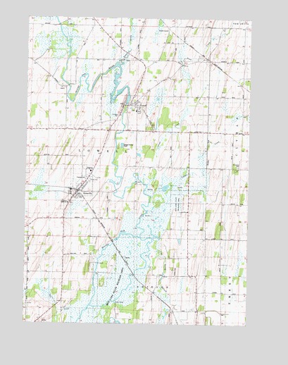
Reeseville, WI USGS Topographic Map
Click on map above to begin viewing in our Map Viewer.

This topographic map contains these locations and features:
Feature Name Type Latitude Longitude GNIS ID View Map
Brookside FarmsLocaleN43.3603°W88.7794°2724040View Map
Casper CreekStreamN43.2958°W88.8068°1562775View Map
Cold Spring CreekStreamN43.2839°W88.7995°1563238View Map
Dodgeland Junior High SchoolSchoolN43.3122°W88.8384°1850673View Map
Dodgeland Middle SchoolSchoolN43.2992°W88.8512°1850674View Map
East Lowell School (historical)SchoolN43.3286°W88.7848°1564352View Map
F and D FarmsLocaleN43.2869°W88.8706°2724057View Map
Firemens ParkParkN43.3094°W88.8409°1850705View Map
Gahlman School (historical)SchoolN43.3436°W88.7723°1565379View Map
Kohn Century FarmsLocaleN43.2733°W88.8511°2724056View Map
Lau CreekStreamN43.2525°W88.8434°1578599View Map
LowellPopulated PlaceN43.3403°W88.8170°1568711View Map
Lowell DamDamN43.3400°W88.8184°1791896View Map
Lowell Elementary SchoolSchoolN43.3369°W88.8137°1850767View Map
Lowell Fire DepartmentBuildingN43.3399°W88.8206°2698137View Map
Lowell MillpondReservoirN43.3404°W88.8189°1791897View Map
Lowell Police DepartmentBuildingN43.3398°W88.8207°2759958View Map
Lowell Post OfficePost OfficeN43.3397°W88.8208°2723993View Map
North LowellPopulated PlaceN43.3703°W88.7962°1577753View Map
North Star School (historical)SchoolN43.2714°W88.7823°1570507View Map
Pleasant Hill School (historical)SchoolN43.3633°W88.8237°1571605View Map
Pratt CreekStreamN43.3064°W88.8059°1571906View Map
ReesevillePopulated PlaceN43.3050°W88.8448°1572180View Map
Reeseville Fire DepartmentBuildingN43.3036°W88.8474°2697698View Map
Reeseville Police DepartmentBuildingN43.3036°W88.8474°2759957View Map
Reeseville Post OfficePost OfficeN43.3036°W88.8464°2723992View Map
Reeseville Public LibraryBuildingN43.3031°W88.8472°2724001View Map
Saint Isidore CemeteryCemeteryN43.3144°W88.7559°1572968View Map
Saint Johns CemeteryCemeteryN43.3353°W88.8237°1850820View Map
Shaw BrookStreamN43.3558°W88.8240°1573972View Map
Town of LowellCivilN43.3256°W88.8369°1583601View Map
United CemeteryCemeteryN43.3289°W88.7768°1850887View Map
Village of LowellCivilN43.3362°W88.8184°1583600View Map
Village of ReesevilleCivilN43.3062°W88.8445°1584008View Map

Note: Coordinates in the location and feature list above are referenced to NAD83 datum.


Copyright (C) 2008-2025 Ryan Niemi / Sunset Dynamics ... All Rights Reserved