TopoQuest Logo
Do you find TopoQuest useful?
Help keep TopoQuest running and adding new maps/features by donating!
Bitcoin:  19c7KJd3qBynnjoSw5npx9KScwjBe4ifkT
Litecoin:  LXs6TkuXGGXo1vDsWCkWVdjQX94eUKd6ui
Home View Maps Find Maps Find Places Resources & Links


Lost Lake, Wisconsin Topographic Map

USGS Map Title: Lost Lake, WI
USGS Map MRC: 43088D8
DRG (GeoTIFF) Download: o43088d8.tif


Neighboring USGS Topographic Map Quads:


  Randolph, WI  
43089E1
 

  Fox Lake, WI  
43088E8
 

  Buckhorn Corner, WI  
43088E7
 

  Fall River, WI  
43089D1
 

  Lost Lake, WI  
43088D8
 

  Beaver Dam, WI  
43088D7
 

  Columbus, WI  
43089C1
 

  Astico, WI  
43088C8
 

  Reeseville, WI  
43088C7


Map MRC Location:

N44°
W89°
N44°
W88°
H8 H7 H6 H5 H4 H3 H2 H1
G8 G7 G6 G5 G4 G3 G2 G1
F8 F7 F6 F5 F4 F3 F2 F1
E8 E7 E6 E5 E4 E3 E2 E1
D8 D7 D6 D5 D4 D3 D2 D1
C8 C7 C6 C5 C4 C3 C2 C1
B8 B7 B6 B5 B4 B3 B2 B1
A8 A7 A6 A5 A4 A3 A2 A1
N43°
W89°
N43°
W88°

Lost Lake, WI USGS 1:24K Topographic Map Preview:
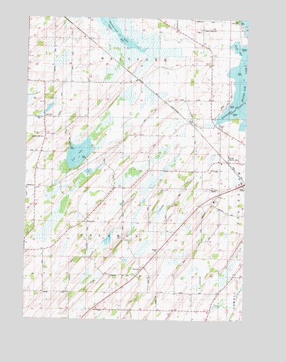
Lost Lake, WI USGS Topographic Map
Click on map above to begin viewing in our Map Viewer.

This topographic map contains these locations and features:
Feature Name Type Latitude Longitude GNIS ID View Map
Bethany CemeteryCemeteryN43.4153°W88.9654°1561613View Map
Calamus CemeteryCemeteryN43.4369°W88.8918°1850645View Map
Derge County ParkParkN43.4989°W88.8804°1850665View Map
Elm Grove School (historical)SchoolN43.4739°W88.8965°1564566View Map
English Prairie CemeteryCemeteryN43.4955°W88.9004°1850682View Map
English Prairie School (historical)SchoolN43.4950°W88.9004°1564664View Map
Harrison SchoolSchoolN43.4297°W88.9948°1566098View Map
High IslandIslandN43.4778°W88.8812°1850733View Map
Jackson School (historical)SchoolN43.4155°W88.9090°1567074View Map
Lost LakeLakeN43.4436°W88.9700°1568655View Map
Lost LakePopulated PlaceN43.4589°W88.9890°1577709View Map
Lost Lake School (historical)SchoolN43.4517°W88.9884°1568687View Map
Middle IslandIslandN43.4869°W88.8776°1850783View Map
Millers IslandIslandN43.4608°W88.8834°1850784View Map
Mount Pleasant School (historical)SchoolN43.4186°W88.9612°1569843View Map
Oak Hill School (historical)SchoolN43.4919°W88.9793°1570652View Map
Pleasant View School (historical)SchoolN43.4511°W88.9440°1571672View Map
Poplar IslandIslandN43.4633°W88.8837°1850800View Map
Saint Marys CemeteryCemeteryN43.4583°W88.9920°1850834View Map
Salem CemeteryCemeteryN43.3964°W88.9332°1573614View Map
South Beaver DamPopulated PlaceN43.4408°W88.8862°1574391View Map
South Beaver Dam Elementary SchoolSchoolN43.4404°W88.8888°2716621View Map
Starkweather BayBayN43.4605°W88.8859°1850864View Map
Sunlit School (historical)SchoolN43.4725°W88.9801°1575081View Map
Town of CalamusCivilN43.4153°W88.9448°1582902View Map
Town of WestfordCivilN43.4968°W88.9430°1584406View Map
Van Buren School (historical)SchoolN43.3889°W88.9440°1576030View Map
Wanderers Rest CemeteryCemeteryN43.4503°W88.9901°1850889View Map
WBEV-AM (Beaver Dam)TowerN43.4286°W88.8926°1582290View Map
WBEV-AM (Beaver Dam)TowerN43.4278°W88.9098°1582291View Map
Weiss BayBayN43.4883°W88.8809°1850903View Map

Note: Coordinates in the location and feature list above are referenced to NAD83 datum.


Copyright (C) 2008-2025 Ryan Niemi / Sunset Dynamics ... All Rights Reserved