TopoQuest Logo
Do you find TopoQuest useful?
Help keep TopoQuest running and adding new maps/features by donating!
Bitcoin:  19c7KJd3qBynnjoSw5npx9KScwjBe4ifkT
Litecoin:  LXs6TkuXGGXo1vDsWCkWVdjQX94eUKd6ui
Home View Maps Find Maps Find Places Resources & Links


Clyman, Wisconsin Topographic Map

USGS Map Title: Clyman, WI
USGS Map MRC: 43088C6
DRG (GeoTIFF) Download: o43088c6.tif


Neighboring USGS Topographic Map Quads:


  Beaver Dam, WI  
43088D7
 

  Horicon, WI  
43088D6
 

  Mayville South, WI  
43088D5
 

  Reeseville, WI  
43088C7
 

  Clyman, WI  
43088C6
 

  Hustisford, WI  
43088C5
 

  Richwood, WI  
43088B7
 

  Watertown, WI  
43088B6
 

  Ixonia, WI  
43088B5


Map MRC Location:

N44°
W89°
N44°
W88°
H8 H7 H6 H5 H4 H3 H2 H1
G8 G7 G6 G5 G4 G3 G2 G1
F8 F7 F6 F5 F4 F3 F2 F1
E8 E7 E6 E5 E4 E3 E2 E1
D8 D7 D6 D5 D4 D3 D2 D1
C8 C7 C6 C5 C4 C3 C2 C1
B8 B7 B6 B5 B4 B3 B2 B1
A8 A7 A6 A5 A4 A3 A2 A1
N43°
W89°
N43°
W88°

Clyman, WI USGS 1:24K Topographic Map Preview:
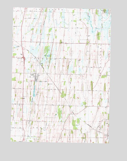
Clyman, WI USGS Topographic Map
Click on map above to begin viewing in our Map Viewer.

This topographic map contains these locations and features:
Feature Name Type Latitude Longitude GNIS ID View Map
American Eagle School (historical)SchoolN43.3567°W88.6854°1560821View Map
ClymanPopulated PlaceN43.3114°W88.7201°1563215View Map
Clyman Center CemeteryCemeteryN43.3280°W88.7379°1850655View Map
Clyman CreekStreamN43.2544°W88.7265°1563216View Map
Clyman Fire DepartmentBuildingN43.3122°W88.7199°2698173View Map
Clyman JunctionPopulated PlaceN43.3253°W88.7179°1577552View Map
Clyman Police DepartmentBuildingN43.3135°W88.7168°2759782View Map
Dead CreekStreamN43.3556°W88.6301°1563764View Map
Emmet CemeteryCemeteryN43.2501°W88.7348°1564638View Map
Fairview FarmsLocaleN43.3039°W88.6533°2724036View Map
Fehling CemeteryCemeteryN43.3428°W88.6887°1850686View Map
Firemans ParkParkN43.3125°W88.7182°1850701View Map
Firemans ParkParkN43.2686°W88.6257°1850702View Map
Holy Assumption CemeteryCemeteryN43.3039°W88.7043°1566583View Map
Kennedy School (historical)SchoolN43.3431°W88.7045°1567413View Map
LebanonPopulated PlaceN43.2553°W88.6268°1567918View Map
Lebanon Census Designated PlaceCensusN43.2587°W88.6292°2586524View Map
Lebanon Post OfficePost OfficeN43.2589°W88.6260°2723988View Map
Lebanon Volunteer Fire DepartmentBuildingN43.2567°W88.6259°2697875View Map
Mengel CemeteryCemeteryN43.3314°W88.7370°1850782View Map
Peterman Game FarmLocaleN43.3658°W88.7156°2724039View Map
Tabor CemeteryCemeteryN43.3567°W88.6840°1575216View Map
Town of ClymanCivilN43.3283°W88.7143°1582992View Map
Townline CemeteryCemeteryN43.3497°W88.6551°1575542View Map
Village of ClymanCivilN43.3116°W88.7231°1582991View Map
Wilson School (historical)SchoolN43.2994°W88.7382°1576837View Map
Zion CemeteryCemeteryN43.3067°W88.7093°1577132View Map

Note: Coordinates in the location and feature list above are referenced to NAD83 datum.


Copyright (C) 2008-2024 Ryan Niemi / Sunset Dynamics ... All Rights Reserved