TopoQuest Logo
Do you find TopoQuest useful?
Help keep TopoQuest running and adding new maps/features by donating!
Bitcoin:  19c7KJd3qBynnjoSw5npx9KScwjBe4ifkT
Litecoin:  LXs6TkuXGGXo1vDsWCkWVdjQX94eUKd6ui
Home View Maps Find Maps Find Places Resources & Links


Rhododendron, Oregon Topographic Map

USGS Map Title: Rhododendron, OR
USGS Map MRC: 45121C8
DRG (GeoTIFF) Download: o45121c8.tif


Neighboring USGS Topographic Map Quads:


  Brightwood, OR  
45122D1
 

  Hickman Butte, OR  
45121D8
 

  Bull Run Lake, OR  
45121D7
 

  Wildcat Mountain, OR  
45122C1
 

  Rhododendron, OR  
45121C8
 

  Government Camp, OR  
45121C7
 

  Three Lynx, OR  
45122B1
 

  High Rock, OR  
45121B8
 

  Wolf Peak, OR  
45121B7


Map MRC Location:

N46°
W122°
N46°
W121°
H8 H7 H6 H5 H4 H3 H2 H1
G8 G7 G6 G5 G4 G3 G2 G1
F8 F7 F6 F5 F4 F3 F2 F1
E8 E7 E6 E5 E4 E3 E2 E1
D8 D7 D6 D5 D4 D3 D2 D1
C8 C7 C6 C5 C4 C3 C2 C1
B8 B7 B6 B5 B4 B3 B2 B1
A8 A7 A6 A5 A4 A3 A2 A1
N45°
W122°
N45°
W121°

Rhododendron, OR USGS 1:24K Topographic Map Preview:
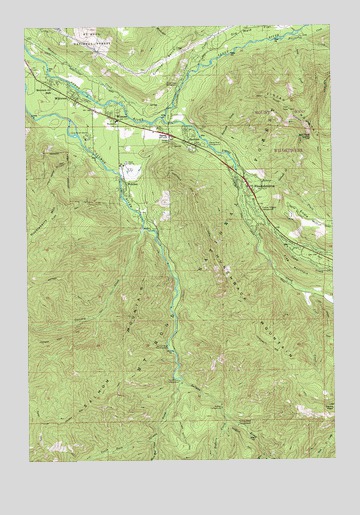
Rhododendron, OR USGS Topographic Map
Click on map above to begin viewing in our Map Viewer.

This topographic map contains these locations and features:
Feature Name Type Latitude Longitude GNIS ID View Map
AJ Dwyer Roadside Reservation Memorial AreaAreaN45.3560°W121.9934°1155888View Map
Arrah Wanna TrailTrailN45.3348°W121.9892°1137302View Map
Bear CreekStreamN45.3465°W121.9495°1137666View Map
Bighorn CampgroundLocaleN45.2648°W121.9226°1138105View Map
Bighorn CreekStreamN45.2623°W121.9209°1138106View Map
Bonanza TrailTrailN45.2996°W121.9854°1138408View Map
Caldwell CreekStreamN45.3296°W121.8992°1139151View Map
Camp Arrah WannaLocaleN45.3423°W121.9765°1139198View Map
Camp CreekStreamN45.3118°W121.8965°1139233View Map
Cheeney CreekStreamN45.3168°W121.9540°1167852View Map
Clackamas County Hoodland Wastewater TreatmentLocaleN45.3469°W121.9692°2697043View Map
Clear CreekStreamN45.3562°W121.9392°1139792View Map
Clear Creek Campground (historical)ParkN45.3576°W121.9384°1139794View Map
Coffman Camp TrailTrailN45.2885°W121.9798°1139903View Map
Cool CreekStreamN45.2987°W121.8876°1140062View Map
Copper CreekStreamN45.2518°W121.9045°1140104View Map
Crutcher BenchBenchN45.3654°W121.9440°1140502View Map
Devils PeakSummitN45.2643°W121.8756°1140968View Map
Enola HillRidgeN45.3187°W121.8859°1141884View Map
FaubionPopulated PlaceN45.3432°W121.9351°1142031View Map
Faubion Post Office (historical)Post OfficeN45.3432°W121.9351°1165245View Map
Fern CreekStreamN45.3110°W121.8851°1157101View Map
Flag MountainSummitN45.3043°W121.8923°1142213View Map
Flag Mountain TrailTrailN45.3021°W121.8842°1142214View Map
Green Canyon Recreation SiteLocaleN45.2837°W121.9445°1159334View Map
Henry CreekStreamN45.3335°W121.9140°1143499View Map
Henry Creek ReservoirReservoirN45.3304°W121.9081°1157100View Map
Hoodland Branch LibraryBuildingN45.3467°W121.9626°2699463View Map
Hoodland County ParkParkN45.3418°W121.9484°1155887View Map
Hoodland Fire District 74 Main StationBuildingN45.3444°W121.9481°2576559View Map
Hoodland Plaza Shopping CenterLocaleN45.3467°W121.9622°2474845View Map
Horseshoe CreekStreamN45.3676°W121.8762°1143806View Map
Hunchback MountainRidgeN45.2932°W121.9090°1143915View Map
Hunchback Mountain TrailTrailN45.2804°W121.8987°1143916View Map
Katy CreekStreamN45.3707°W121.9970°1153308View Map
Kloshe Chuck ReservoirReservoirN45.3521°W121.9430°1157099View Map
Little Cheney CreekStreamN45.3165°W121.9526°1153305View Map
Long CreekStreamN45.3707°W121.8901°1145394View Map
Lost CreekStreamN45.3721°W121.8909°1145525View Map
Lymp CreekStreamN45.3401°W121.9776°1153309View Map
Lymp ReservoirReservoirN45.3360°W121.9720°1157098View Map
Mack Hall CreekStreamN45.2562°W121.9495°1145709View Map
Minikahda CreekStreamN45.3668°W121.9320°1146326View Map
Mount Hood DivisionCivilN45.3516°W121.9662°1938067View Map
Mount Hood Information CenterBuildingN45.3594°W121.9975°2754372View Map
Mount Hood National Forest Zigzag Ranger District Zigzag Ranger StationBuildingN45.3431°W121.9415°1167422View Map
Mount Hood VillagePopulated PlaceN45.3554°W121.9806°1867474View Map
Mount Hood Village Census Designated PlaceCensusN45.3433°W121.9833°2408877View Map
Mountain Air ParkPopulated PlaceN45.3590°W121.9906°1146536View Map
Pioneer Tollgate CampgroundLocaleN45.3218°W121.9065°1147762View Map
RhododendronPopulated PlaceN45.3296°W121.9112°1148408View Map
Rhododendron Post OfficePost OfficeN45.3291°W121.9102°1165850View Map
Rockwood CreekStreamN45.3421°W121.9270°1148650View Map
Rolling Riffle Campground (historical)ParkN45.2598°W121.9156°1148707View Map
Salmon MountainRidgeN45.2832°W121.9631°1148981View Map
Salmon Mountain TrailTrailN45.2757°W121.9609°1148983View Map
Salmon River Guard StationLocaleN45.2829°W121.9437°1148986View Map
Salmon-Huckleberry WildernessReserveN45.2672°W121.9424°1156239View Map
South Fork Campground (historical)ParkN45.2729°W121.9392°1149945View Map
South Fork Salmon RiverStreamN45.2721°W121.9384°1150008View Map
Still CreekStreamN45.3321°W121.9154°1150428View Map
Tawney (historical)LocaleN45.3221°W121.9567°1153307View Map
The CoursesLocaleN45.3351°W121.9610°1163744View Map
Tollgate Recreation SiteLocaleN45.3221°W121.9067°1926234View Map
WelchesPopulated PlaceN45.3282°W121.9609°1152002View Map
Welches CreekStreamN45.3235°W121.9595°1153306View Map
Welches Elementary SchoolSchoolN45.3436°W121.9470°2391949View Map
Welches Middle SchoolSchoolN45.3434°W121.9487°1152003View Map
Welches Post OfficePost OfficeN45.3467°W121.9639°1166141View Map
WemmePopulated PlaceN45.3487°W121.9659°1152014View Map
Wemme Post Office (historical)Post OfficeN45.3487°W121.9659°1166144View Map
West Zigzag LookoutSummitN45.3423°W121.8848°1152148View Map
West Zigzag Mountain TrailTrailN45.3521°W121.8951°1152149View Map
WildwoodPopulated PlaceN45.3543°W121.9812°1152368View Map
Wildwood Recreation Site and Picnic AreaLocaleN45.3526°W121.9967°1155889View Map
ZigzagPopulated PlaceN45.3440°W121.9431°1152771View Map
Zigzag Post OfficePost OfficeN45.3440°W121.9431°1166229View Map
Zigzag RiverStreamN45.3485°W121.9456°1152778View Map
Zigzag River Campground (historical)ParkN45.3404°W121.9270°1152779View Map

Note: Coordinates in the location and feature list above are referenced to NAD83 datum.


Copyright (C) 2008-2024 Ryan Niemi / Sunset Dynamics ... All Rights Reserved