TopoQuest Logo
Do you find TopoQuest useful?
Help keep TopoQuest running and adding new maps/features by donating!
Bitcoin:  19c7KJd3qBynnjoSw5npx9KScwjBe4ifkT
Litecoin:  LXs6TkuXGGXo1vDsWCkWVdjQX94eUKd6ui
Home View Maps Find Maps Find Places Resources & Links


Three Lynx, Oregon Topographic Map

USGS Map Title: Three Lynx, OR
USGS Map MRC: 45122B1
DRG (GeoTIFF) Download: o45122b1.tif


Neighboring USGS Topographic Map Quads:


  Cherryville, OR  
45122C2
 

  Wildcat Mountain, OR  
45122C1
 

  Rhododendron, OR  
45121C8
 

  Bedford Point, OR  
45122B2
 

  Three Lynx, OR  
45122B1
 

  High Rock, OR  
45121B8
 

  Wanderers Peak, OR  
45122A2
 

  Fish Creek Mountain, OR  
45122A1
 

  Mount Mitchell, OR  
45121A8


Map MRC Location:

N46°
W123°
N46°
W122°
H8 H7 H6 H5 H4 H3 H2 H1
G8 G7 G6 G5 G4 G3 G2 G1
F8 F7 F6 F5 F4 F3 F2 F1
E8 E7 E6 E5 E4 E3 E2 E1
D8 D7 D6 D5 D4 D3 D2 D1
C8 C7 C6 C5 C4 C3 C2 C1
B8 B7 B6 B5 B4 B3 B2 B1
A8 A7 A6 A5 A4 A3 A2 A1
N45°
W123°
N45°
W122°

Three Lynx, OR USGS 1:24K Topographic Map Preview:
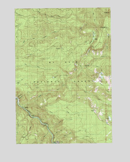
Three Lynx, OR USGS Topographic Map
Click on map above to begin viewing in our Map Viewer.

This topographic map contains these locations and features:
Feature Name Type Latitude Longitude GNIS ID View Map
Cat CreekStreamN45.1360°W122.0826°1135211View Map
Corral Springs TrailTrailN45.1746°W122.0365°1140156View Map
Deer CreekStreamN45.1332°W122.0790°1154905View Map
Dinner CreekStreamN45.1379°W122.0834°1141040View Map
Dry Ridge TrailTrailN45.1618°W122.0756°1141353View Map
Fanton Plaza TrailTrailN45.2357°W122.0809°1142012View Map
Grouse CreekStreamN45.1646°W122.1020°1135212View Map
Grouse PointSummitN45.1548°W122.0254°1143134View Map
Huxley LakeLakeN45.1860°W122.0767°1143972View Map
Lookout Springs CampgroundLocaleN45.2126°W122.0676°1135210View Map
Lookout Springs Guard StationLocaleN45.2121°W122.0642°1145484View Map
Monty CreekStreamN45.1665°W122.1234°1154902View Map
North Fork QuarryMineN45.2068°W122.1094°2754388View Map
Plaza CreekStreamN45.2054°W122.0095°1154906View Map
Plaza Guard Station (historical)LocaleN45.2407°W122.0051°1851729View Map
Pup CreekStreamN45.1487°W122.1026°1148051View Map
Roaring RiverStreamN45.1582°W122.1173°1148520View Map
Roaring River Recreation SiteLocaleN45.1582°W122.1142°1148521View Map
Roaring River WildernessReserveN45.1634°W122.0050°2767380View Map
Serene LakeLakeN45.1474°W122.0038°1149241View Map
Sheepshead RockSummitN45.2451°W122.0048°1135215View Map
Shining CreekStreamN45.1979°W122.0279°1135214View Map
Shining LakeLakeN45.1856°W122.0136°1149403View Map
Shining Lake CampgroundLocaleN45.1821°W122.0181°1135213View Map
South Fork Roaring RiverStreamN45.1837°W122.0523°1150002View Map
Sunstrip Recreation SiteLocaleN45.1526°W122.1095°1162448View Map
The NarrowsGapN45.1423°W122.0859°1151028View Map
Three LynxPopulated PlaceN45.1262°W122.0715°1151169View Map
Three Lynx CreekStreamN45.1257°W122.0745°1151170View Map
Three Lynx School (historical)SchoolN45.1276°W122.0734°1162450View Map
Tumala CreekStreamN45.2011°W122.0225°1150242View Map
Tumala LakesLakeN45.2248°W122.0229°1150281View Map
Tumala MeadowFlatN45.2226°W122.0226°1150284View Map
Tumala MountainSummitN45.2303°W122.0411°1150290View Map
Twin Springs Forest CampLocaleN45.2310°W122.0106°1151594View Map
Whitewater (historical)LocaleN45.1296°W122.0779°1152270View Map
Whitewater Forest CampLocaleN45.1290°W122.0804°1162449View Map
Winslow Spur Gravel PitMineN45.1800°W122.1126°2754381View Map

Note: Coordinates in the location and feature list above are referenced to NAD83 datum.


Copyright (C) 2008-2025 Ryan Niemi / Sunset Dynamics ... All Rights Reserved