TopoQuest Logo
Do you find TopoQuest useful?
Help keep TopoQuest running and adding new maps/features by donating!
Bitcoin:  19c7KJd3qBynnjoSw5npx9KScwjBe4ifkT
Litecoin:  LXs6TkuXGGXo1vDsWCkWVdjQX94eUKd6ui
Home View Maps Find Maps Find Places Resources & Links


Wolf Peak, Oregon Topographic Map

USGS Map Title: Wolf Peak, OR
USGS Map MRC: 45121B7
DRG (GeoTIFF) Download: o45121b7.tif


Neighboring USGS Topographic Map Quads:


  Rhododendron, OR  
45121C8
 

  Government Camp, OR  
45121C7
 

  Mount Hood South, OR  
45121C6
 

  High Rock, OR  
45121B8
 

  Wolf Peak, OR  
45121B7
 

  Wapinitia Pass, OR  
45121B6
 

  Mount Mitchell, OR  
45121A8
 

  Timothy Lake, OR  
45121A7
 

  Mount Wilson, OR  
45121A6


Map MRC Location:

N46°
W122°
N46°
W121°
H8 H7 H6 H5 H4 H3 H2 H1
G8 G7 G6 G5 G4 G3 G2 G1
F8 F7 F6 F5 F4 F3 F2 F1
E8 E7 E6 E5 E4 E3 E2 E1
D8 D7 D6 D5 D4 D3 D2 D1
C8 C7 C6 C5 C4 C3 C2 C1
B8 B7 B6 B5 B4 B3 B2 B1
A8 A7 A6 A5 A4 A3 A2 A1
N45°
W122°
N45°
W121°

Wolf Peak, OR USGS 1:24K Topographic Map Preview:
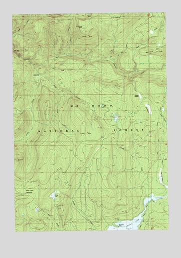
Wolf Peak, OR USGS Topographic Map
Click on map above to begin viewing in our Map Viewer.

This topographic map contains these locations and features:
Feature Name Type Latitude Longitude GNIS ID View Map
Abbott BurnAreaN45.1804°W121.8179°1135332View Map
Anvil LakeLakeN45.1372°W121.8573°1135333View Map
Basin PointSummitN45.1812°W121.7670°1137565View Map
Basin Point QuarryMineN45.1790°W121.7660°2754393View Map
Black Wolf MeadowsFlatN45.1487°W121.8690°1138224View Map
Buck Creek TrailTrailN45.1426°W121.8745°1138783View Map
Buck Lake Gravel PitMineN45.1295°W121.8667°2754394View Map
Cooper CreekStreamN45.1487°W121.7662°1140080View Map
Crater CreekStreamN45.1660°W121.7512°1140394View Map
Dinger Creek TrailTrailN45.1782°W121.8198°1141036View Map
Dinger LakeLakeN45.1460°W121.8440°1141037View Map
Draw CreekStreamN45.2204°W121.8626°1141232View Map
Dry MeadowSwampN45.1944°W121.7658°1141347View Map
Fir Tree CreekStreamN45.2232°W121.7979°1142117View Map
Fir Tree Forest CampLocaleN45.2473°W121.7881°1142118View Map
Frying Pan LakeLakeN45.1886°W121.7932°1142520View Map
Frying Pan QuarryMineN45.1970°W121.8043°2754392View Map
Inch CreekStreamN45.2146°W121.8534°1144012View Map
Jackpot MeadowSwampN45.2021°W121.7731°1144189View Map
Linney CreekStreamN45.2168°W121.8592°1145053View Map
Linney Creek Recreation SiteLocaleN45.2193°W121.8595°1156856View Map
Little Crater LakeLakeN45.1482°W121.7509°1154254View Map
Little Crater Lake Geological AreaReserveN45.1485°W121.7523°1159336View Map
Meditation PointCapeN45.1276°W121.7956°1135334View Map
Meditation Point Recreation SiteLocaleN45.1273°W121.7945°1158367View Map
Mud CreekStreamN45.2160°W121.7767°1146564View Map
Mud Creek RidgeRidgeN45.2282°W121.7601°1158386View Map
North Arm Recreation SiteLocaleN45.1323°W121.7784°1926232View Map
Sherar BurnAreaN45.2451°W121.8198°1149382View Map
Split FallsFallsN45.2287°W121.8744°1158934View Map
Stein FallsFallsN45.2264°W121.8702°1158936View Map
String CreekStreamN45.2060°W121.8423°1150494View Map
Wolf Camp ButteSummitN45.2412°W121.8184°1152573View Map
Wolf CreekStreamN45.2262°W121.8323°1152577View Map

Note: Coordinates in the location and feature list above are referenced to NAD83 datum.


Copyright (C) 2008-2024 Ryan Niemi / Sunset Dynamics ... All Rights Reserved