TopoQuest Logo
Do you find TopoQuest useful?
Help keep TopoQuest running and adding new maps/features by donating!
Bitcoin:  19c7KJd3qBynnjoSw5npx9KScwjBe4ifkT
Litecoin:  LXs6TkuXGGXo1vDsWCkWVdjQX94eUKd6ui
Home View Maps Find Maps Find Places Resources & Links


Rib Lake, Wisconsin Topographic Map

USGS Map Title: Rib Lake, WI
USGS Map MRC: 45090C2
DRG (GeoTIFF) Download: o45090c2.tif


Neighboring USGS Topographic Map Quads:


  Ogema, WI  
45090D3
 

  Timms Hill, WI  
45090D2
 

  Spirit, WI  
45090D1
 

  Westboro, WI  
45090C3
 

  Rib Lake, WI  
45090C2
 

  Wood Lake, WI  
45090C1
 

  Medford, WI  
45090B3
 

  Rib River Lookout Tower, WI  
45090B2
 

  Goodrich, WI  
45090B1


Map MRC Location:

N46°
W91°
N46°
W90°
H8 H7 H6 H5 H4 H3 H2 H1
G8 G7 G6 G5 G4 G3 G2 G1
F8 F7 F6 F5 F4 F3 F2 F1
E8 E7 E6 E5 E4 E3 E2 E1
D8 D7 D6 D5 D4 D3 D2 D1
C8 C7 C6 C5 C4 C3 C2 C1
B8 B7 B6 B5 B4 B3 B2 B1
A8 A7 A6 A5 A4 A3 A2 A1
N45°
W91°
N45°
W90°

Rib Lake, WI USGS 1:24K Topographic Map Preview:
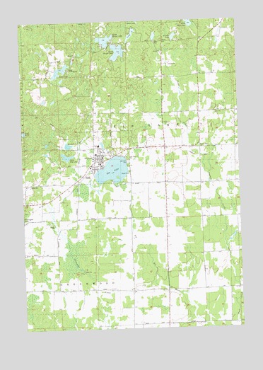
Rib Lake, WI USGS Topographic Map
Click on map above to begin viewing in our Map Viewer.

This topographic map contains these locations and features:
Feature Name Type Latitude Longitude GNIS ID View Map
1 ReservoirReservoirN45.3716°W90.2368°1793243View Map
Camp Forest SpringsLocaleN45.3552°W90.2221°1562610View Map
Clearview Elementary SchoolSchoolN45.3172°W90.2060°1833628View Map
Copper CreekStreamN45.3247°W90.1540°1563388View Map
Dr Walther W Meyer Number 3 G4914 DamDamN45.3716°W90.2368°1793242View Map
East LakeLakeN45.3301°W90.2490°1564343View Map
Fawn Valley School (historical)SchoolN45.3086°W90.1474°1833631View Map
James LakeLakeN45.3557°W90.2268°1567094View Map
Kennedy LakeLakeN45.3247°W90.2234°1567409View Map
Lake View ParkParkN45.3194°W90.1890°1567762View Map
Lakeview CemeteryCemeteryN45.3180°W90.1890°1567756View Map
Layman CreekStreamN45.2672°W90.1274°1567899View Map
Little Rib LakeLakeN45.3202°W90.2244°1568377View Map
Long LakeLakeN45.3695°W90.1859°1568553View Map
North Harper LakeLakeN45.3674°W90.2009°1570444View Map
Porky CreekStreamN45.2575°W90.1271°1571792View Map
Rib LakeLakeN45.3145°W90.1979°1572236View Map
Rib LakePopulated PlaceN45.3175°W90.2085°1572237View Map
Rib Lake Elementary SchoolSchoolN45.3280°W90.2058°2713423View Map
Rib Lake High SchoolSchoolN45.3245°W90.2061°1833660View Map
Rib Lake Middle SchoolSchoolN45.3242°W90.2075°2713219View Map
Rib Lake Police DepartmentBuildingN45.3172°W90.2059°2759703View Map
Rib Lake Volunteer Fire DepartmentBuildingN45.3174°W90.2037°2696955View Map
Rib River School (historical)SchoolN45.2636°W90.1674°1833661View Map
Saint Ann ChurchChurchN45.2808°W90.2499°1572831View Map
Saint Clair LakeLakeN45.3684°W90.1615°1572898View Map
Sheep Ranch CreekStreamN45.3061°W90.2071°1574001View Map
Silvernagel CreekStreamN45.2686°W90.1754°1574168View Map
South Harper LakeLakeN45.3626°W90.1938°1574458View Map
Taylor County Ambulance Service - Rib LakeBuildingN45.3182°W90.2073°2698394View Map
Town of Rib LakeCivilN45.3238°W90.1358°1584017View Map
Village of Rib LakeCivilN45.3195°W90.2030°1584016View Map
Village of Rib Lake Wastewater Treatment FacilityLocaleN45.3119°W90.2139°2646879View Map

Note: Coordinates in the location and feature list above are referenced to NAD83 datum.


Copyright (C) 2008-2025 Ryan Niemi / Sunset Dynamics ... All Rights Reserved