TopoQuest Logo
Do you find TopoQuest useful?
Help keep TopoQuest running and adding new maps/features by donating!
Bitcoin:  19c7KJd3qBynnjoSw5npx9KScwjBe4ifkT
Litecoin:  LXs6TkuXGGXo1vDsWCkWVdjQX94eUKd6ui
Home View Maps Find Maps Find Places Resources & Links


Westboro, Wisconsin Topographic Map

USGS Map Title: Westboro, WI
USGS Map MRC: 45090C3
DRG (GeoTIFF) Download: o45090c3.tif


Neighboring USGS Topographic Map Quads:


  Ogema NW, WI  
45090D4
 

  Ogema, WI  
45090D3
 

  Timms Hill, WI  
45090D2
 

  Mondeaux Dam, WI  
45090C4
 

  Westboro, WI  
45090C3
 

  Rib Lake, WI  
45090C2
 

  Medford NW, WI  
45090B4
 

  Medford, WI  
45090B3
 

  Rib River Lookout Tower, WI  
45090B2


Map MRC Location:

N46°
W91°
N46°
W90°
H8 H7 H6 H5 H4 H3 H2 H1
G8 G7 G6 G5 G4 G3 G2 G1
F8 F7 F6 F5 F4 F3 F2 F1
E8 E7 E6 E5 E4 E3 E2 E1
D8 D7 D6 D5 D4 D3 D2 D1
C8 C7 C6 C5 C4 C3 C2 C1
B8 B7 B6 B5 B4 B3 B2 B1
A8 A7 A6 A5 A4 A3 A2 A1
N45°
W91°
N45°
W90°

Westboro, WI USGS 1:24K Topographic Map Preview:
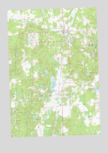
Westboro, WI USGS Topographic Map
Click on map above to begin viewing in our Map Viewer.

This topographic map contains these locations and features:
Feature Name Type Latitude Longitude GNIS ID View Map
1 ReservoirReservoirN45.3266°W90.3118°1792590View Map
Black BrookStreamN45.3602°W90.3240°1578798View Map
Black LakeLakeN45.3101°W90.2643°1578801View Map
Bullhead LakeLakeN45.2889°W90.3279°1578886View Map
ChelseaPopulated PlaceN45.2902°W90.3074°1578983View Map
Chelsea CemeteriesCemeteryN45.2794°W90.3037°1578986View Map
Chelsea Census Designated PlaceCensusN45.2929°W90.3054°2586465View Map
Chelsea LakeLakeN45.2984°W90.3148°1578984View Map
Chelsea LakeReservoirN45.3066°W90.3135°1792263View Map
Chelsea Lake 2WP1491 DamDamN45.3066°W90.3135°1792262View Map
Duchien LakeLakeN45.3306°W90.2580°1579150View Map
Eugene Mathey E 5228 DamDamN45.3266°W90.3118°1792589View Map
Fisher CreekStreamN45.3483°W90.2910°1579244View Map
Gibbs LakeLakeN45.2895°W90.3213°1579326View Map
Half Moon LakeLakeN45.3146°W90.3235°1579373View Map
Highland School (historical)SchoolN45.2811°W90.2510°1840318View Map
Ketcham LakeLakeN45.2664°W90.3687°1579582View Map
Kettle LakeLakeN45.3388°W90.2557°1579583View Map
Little Chelsea LakeLakeN45.2942°W90.3167°1579671View Map
Mount Olive CemeteryCemeteryN45.3508°W90.3240°1579931View Map
Mud LakeLakeN45.2669°W90.3421°1579950View Map
Niene LakeLakeN45.3287°W90.2564°1580008View Map
Northside CemeteryCemeteryN45.3572°W90.2965°1833656View Map
QueenstownPopulated PlaceN45.3519°W90.2882°1580215View Map
Saint Ann CemeteryCemeteryN45.2803°W90.2503°1580312View Map
Shearer LakeLakeN45.2989°W90.3294°1580393View Map
Silver Creek Elementary SchoolSchoolN45.3536°W90.3004°1833668View Map
Skinner LakeLakeN45.3357°W90.2584°1580428View Map
Wellington LakeLakeN45.2949°W90.2537°1580739View Map
WestboroPopulated PlaceN45.3552°W90.2960°1580763View Map
Westboro Census Designated PlaceCensusN45.3608°W90.2934°2586570View Map
Westboro Volunteer Fire DepartmentBuildingN45.3534°W90.2979°2696853View Map
Winding Brook School (historical)SchoolN45.2547°W90.3338°1840338View Map

Note: Coordinates in the location and feature list above are referenced to NAD83 datum.


Copyright (C) 2008-2024 Ryan Niemi / Sunset Dynamics ... All Rights Reserved