TopoQuest Logo
Do you find TopoQuest useful?
Help keep TopoQuest running and adding new maps/features by donating!
Bitcoin:  19c7KJd3qBynnjoSw5npx9KScwjBe4ifkT
Litecoin:  LXs6TkuXGGXo1vDsWCkWVdjQX94eUKd6ui
Home View Maps Find Maps Find Places Resources & Links


Rich Square, North Carolina Topographic Map

USGS Map Title: Rich Square, NC
USGS Map MRC: 36077C3
DRG (GeoTIFF) Download: o36077c3.tif


Neighboring USGS Topographic Map Quads:


  Jackson, NC  
36077D4
 

  Galatia, NC  
36077D3
 

  Conway, NC  
36077D2
 

  Boones Crossroads, NC  
36077C4
 

  Rich Square, NC  
36077C3
 

  Woodland, NC  
36077C2
 

  Scotland Neck, NC  
36077B4
 

  Norfleet, NC  
36077B3
 

  Kelford, NC  
36077B2


Map MRC Location:

N37°
W78°
N37°
W77°
H8 H7 H6 H5 H4 H3 H2 H1
G8 G7 G6 G5 G4 G3 G2 G1
F8 F7 F6 F5 F4 F3 F2 F1
E8 E7 E6 E5 E4 E3 E2 E1
D8 D7 D6 D5 D4 D3 D2 D1
C8 C7 C6 C5 C4 C3 C2 C1
B8 B7 B6 B5 B4 B3 B2 B1
A8 A7 A6 A5 A4 A3 A2 A1
N36°
W78°
N36°
W77°

Rich Square, NC USGS 1:24K Topographic Map Preview:
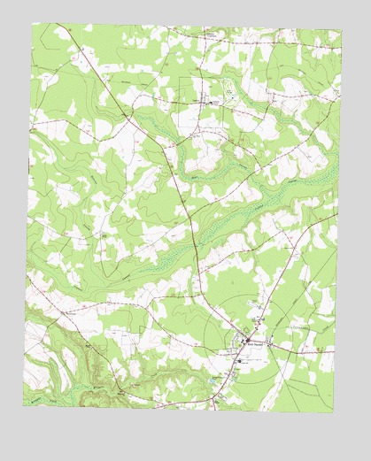
Rich Square, NC USGS Topographic Map
Click on map above to begin viewing in our Map Viewer.

This topographic map contains these locations and features:
Feature Name Type Latitude Longitude GNIS ID View Map
Bear SwampStreamN36.3196°W77.2761°980733View Map
Branch ChapelChurchN36.2693°W77.3472°981823View Map
BryantownPopulated PlaceN36.2807°W77.3589°1006144View Map
Chapel Hill ChurchChurchN36.2552°W77.3339°983019View Map
Cumbo ChapelChurchN36.3068°W77.3444°983847View Map
Hope TempleChurchN36.2535°W77.2980°987041View Map
LaskerPopulated PlaceN36.3502°W77.3055°1021101View Map
Lasker Fire DepartmentBuildingN36.3496°W77.3084°2638394View Map
Lassiter CrossroadsPopulated PlaceN36.3715°W77.3044°1006270View Map
Moratoc MineMineN36.2569°W77.3275°2649229View Map
New Hope ChurchChurchN36.3396°W77.3086°991026View Map
Northeast AcademySchoolN36.3506°W77.3011°991285View Map
Pinners ChurchChurchN36.3038°W77.2675°992408View Map
Quarter SwampStreamN36.2896°W77.3416°992939View Map
Rich SquarePopulated PlaceN36.2740°W77.2844°1022271View Map
Rich Square Fire DepartmentBuildingN36.2760°W77.2873°2638129View Map
Rich Square Police DepartmentBuildingN36.2734°W77.2842°2769681View Map
Rich Square Post OfficePost OfficeN36.2740°W77.2855°2773904View Map
Rich Square-W S Creecy Elementary SchoolSchoolN36.2663°W77.2877°1024818View Map
Town of LaskerCivilN36.3502°W77.3057°2405988View Map
Town of Rich SquareCivilN36.2739°W77.2839°2407205View Map
Township of Rich SquareCivilN36.2676°W77.2753°1027002View Map
Township of RoanokeCivilN36.3369°W77.3454°1027003View Map

Note: Coordinates in the location and feature list above are referenced to NAD83 datum.


Copyright (C) 2008-2025 Ryan Niemi / Sunset Dynamics ... All Rights Reserved