TopoQuest Logo
Do you find TopoQuest useful?
Help keep TopoQuest running and adding new maps/features by donating!
Bitcoin:  19c7KJd3qBynnjoSw5npx9KScwjBe4ifkT
Litecoin:  LXs6TkuXGGXo1vDsWCkWVdjQX94eUKd6ui
Home View Maps Find Maps Find Places Resources & Links


Richland, Kansas Topographic Map

USGS Map Title: Richland, KS
USGS Map MRC: 38095H5
DRG (GeoTIFF) Download: o38095h5.tif


Neighboring USGS Topographic Map Quads:


  Topeka, KS  
39095A6
 

  Grantville, KS  
39095A5
 

  Perry, KS  
39095A4
 

  Wakarusa, KS  
38095H6
 

  Richland, KS  
38095H5
 

  Clinton, KS  
38095H4
 

  Carbondale, KS  
38095G6
 

  Overbrook, KS  
38095G5
 

  Globe, KS  
38095G4


Map MRC Location:

N39°
W96°
N39°
W95°
H8 H7 H6 H5 H4 H3 H2 H1
G8 G7 G6 G5 G4 G3 G2 G1
F8 F7 F6 F5 F4 F3 F2 F1
E8 E7 E6 E5 E4 E3 E2 E1
D8 D7 D6 D5 D4 D3 D2 D1
C8 C7 C6 C5 C4 C3 C2 C1
B8 B7 B6 B5 B4 B3 B2 B1
A8 A7 A6 A5 A4 A3 A2 A1
N38°
W96°
N38°
W95°

Richland, KS USGS 1:24K Topographic Map Preview:
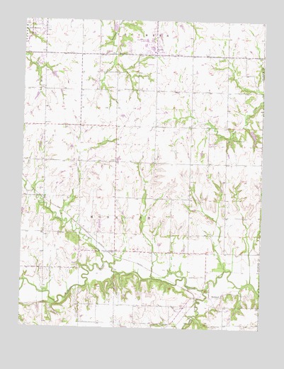
Richland, KS USGS Topographic Map
Click on map above to begin viewing in our Map Viewer.

This topographic map contains these locations and features:
Feature Name Type Latitude Longitude GNIS ID View Map
Bauer CemeteryCemeteryN38.9865°W95.5767°479097View Map
Camp CreekStreamN38.8911°W95.5283°479087View Map
Camp HammondLocaleN38.9519°W95.5153°479092View Map
Dayton (historical)LocaleN38.9778°W95.5961°482540View Map
Emmanuel CemeteryCemeteryN38.9719°W95.5748°479093View Map
Howard School (historical)SchoolN38.8772°W95.5664°479088View Map
Lake Shawnee Golf CourseLocaleN38.9986°W95.6240°2509702View Map
Lindbloom Park (historical)Populated PlaceN38.9850°W95.6222°484944View Map
Lynn CreekStreamN38.9011°W95.5819°479089View Map
Lyons School (historical)SchoolN38.9503°W95.5764°479091View Map
Pleasant Hill CemeteryCemeteryN38.9102°W95.5757°2673369View Map
RichlandPopulated PlaceN38.8836°W95.5397°484928View Map
Richland CemeteryCemeteryN38.8764°W95.5200°479086View Map
Shawnee Heights Fire Protection District Station 25BuildingN38.9064°W95.5934°2111874View Map
Shawnee Heights High SchoolSchoolN38.9901°W95.5625°2506641View Map
Shawnee Heights Middle SchoolSchoolN38.9888°W95.5583°2506619View Map
Shawnee Heights Unified School District 450 Police OfficeBuildingN38.9888°W95.5581°2504149View Map
Shawnee Heights Unified School District Central Administrative OfficeSchoolN38.9872°W95.5573°2506401View Map
Shawnee Heights United Methodist ChurchChurchN38.9879°W95.5557°480923View Map
Starshire Farm AirportAirportN38.9057°W95.5914°481285View Map
Sunset Strip AirparkAirportN38.9854°W95.5942°2651097View Map
Township of MonmouthCivilN38.9279°W95.5665°479090View Map
WatsonPopulated PlaceN38.9881°W95.5564°479095View Map
Williams SchoolSchoolN38.9808°W95.5655°479094View Map
Zion CemeteryCemeteryN38.9865°W95.5470°479096View Map

Note: Coordinates in the location and feature list above are referenced to NAD83 datum.


Copyright (C) 2008-2024 Ryan Niemi / Sunset Dynamics ... All Rights Reserved