TopoQuest Logo
Do you find TopoQuest useful?
Help keep TopoQuest running and adding new maps/features by donating!
Bitcoin:  19c7KJd3qBynnjoSw5npx9KScwjBe4ifkT
Litecoin:  LXs6TkuXGGXo1vDsWCkWVdjQX94eUKd6ui
Home View Maps Find Maps Find Places Resources & Links


Richmond, Minnesota Topographic Map

USGS Map Title: Richmond, MN
USGS Map MRC: 45094D5
DRG (GeoTIFF) Download: o45094d5.tif


Neighboring USGS Topographic Map Quads:


  Saint Martin, MN  
45094E6
 

  Farming, MN  
45094E5
 

  Avon, MN  
45094E4
 

  Paynesville, MN  
45094D6
 

  Richmond, MN  
45094D5
 

  Cold Spring, MN  
45094D4
 

  Lake Koronis, MN  
45094C6
 

  Eden Valley, MN  
45094C5
 

  Watkins, MN  
45094C4


Map MRC Location:

N46°
W95°
N46°
W94°
H8 H7 H6 H5 H4 H3 H2 H1
G8 G7 G6 G5 G4 G3 G2 G1
F8 F7 F6 F5 F4 F3 F2 F1
E8 E7 E6 E5 E4 E3 E2 E1
D8 D7 D6 D5 D4 D3 D2 D1
C8 C7 C6 C5 C4 C3 C2 C1
B8 B7 B6 B5 B4 B3 B2 B1
A8 A7 A6 A5 A4 A3 A2 A1
N45°
W95°
N45°
W94°

Richmond, MN USGS 1:24K Topographic Map Preview:
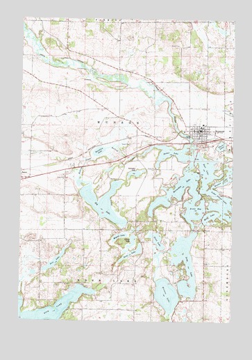
Richmond, MN USGS Topographic Map
Click on map above to begin viewing in our Map Viewer.

This topographic map contains these locations and features:
Feature Name Type Latitude Longitude GNIS ID View Map
Becker LakeLakeN45.4452°W94.5394°639851View Map
Big LakeLakeN45.4239°W94.5766°640094View Map
Browns LakeLakeN45.3860°W94.5380°640543View Map
Cedar Island LakeLakeN45.4229°W94.5015°641004View Map
City of RichmondCivilN45.4556°W94.5155°2396367View Map
Cozy Corner CampgroundLocaleN45.4125°W94.5153°2067969View Map
Deep LakeLakeN45.4033°W94.5584°642701View Map
East LakeLakeN45.4375°W94.5156°643085View Map
Flint LakeLakeN45.4083°W94.5439°643744View Map
Ganzer LakeLakeN45.4081°W94.5589°644022View Map
Horseshoe LakeLakeN45.4289°W94.5322°645214View Map
KNSR-FM (Collegeville)TowerN45.4977°W94.5375°663025View Map
Koetter LakeLakeN45.4353°W94.5014°646223View Map
Kolling CreekStreamN45.4441°W94.5525°646229View Map
Krons BayLakeN45.4208°W94.5227°646263View Map
KSJR-FM (Collegeville)TowerN45.4977°W94.5375°663024View Map
Long LakeLakeN45.3847°W94.5286°647054View Map
Meyers LakeLakeN45.4099°W94.5665°647792View Map
Morning Star Resort CampgroundLocaleN45.3847°W94.5778°2067968View Map
Mud LakeLakeN45.4183°W94.5131°648245View Map
Pirz LakeLakeN45.3993°W94.6044°649531View Map
RichmondLocaleN45.4500°W94.5175°2067978View Map
RichmondPopulated PlaceN45.4541°W94.5183°650067View Map
Richmond City HallBuildingN45.4533°W94.5200°2067976View Map
Richmond Community ParkParkN45.4461°W94.5033°2067983View Map
Richmond Elementary SchoolSchoolN45.4567°W94.5178°2067979View Map
Richmond Fire DepartmentBuildingN45.4535°W94.5202°2067974View Map
Richmond Medical ClinicHospitalN45.4550°W94.5167°2067977View Map
Richmond Police DepartmentBuildingN45.4534°W94.5203°2067975View Map
Richmond Post OfficePost OfficeN45.4542°W94.5192°2068244View Map
River Lakes Civic ArenaBuildingN45.4497°W94.5272°2067973View Map
Roschien LakeLakeN45.4452°W94.5791°650254View Map
Saint Peter and Paul Catholic ChurchChurchN45.4556°W94.5178°2067981View Map
Saint Peter and Paul SchoolSchoolN45.4556°W94.5186°2067980View Map
Saints Peter and Paul CemeteryCemeteryN45.4568°W94.5227°2068105View Map
Schroeder LakeLakeN45.4360°W94.5581°651785View Map
Thein LakeLakeN45.4477°W94.5071°653124View Map
Township of MunsonCivilN45.4560°W94.5732°665065View Map
Your Haven CampgroundLocaleN45.3847°W94.5250°2067985View Map

Note: Coordinates in the location and feature list above are referenced to NAD83 datum.


Copyright (C) 2008-2024 Ryan Niemi / Sunset Dynamics ... All Rights Reserved