TopoQuest Logo
Do you find TopoQuest useful?
Help keep TopoQuest running and adding new maps/features by donating!
Bitcoin:  19c7KJd3qBynnjoSw5npx9KScwjBe4ifkT
Litecoin:  LXs6TkuXGGXo1vDsWCkWVdjQX94eUKd6ui
Home View Maps Find Maps Find Places Resources & Links


Paynesville, Minnesota Topographic Map

USGS Map Title: Paynesville, MN
USGS Map MRC: 45094D6
DRG (GeoTIFF) Download: o45094d6.tif


Neighboring USGS Topographic Map Quads:


  Greenwald, MN  
45094E7
 

  Saint Martin, MN  
45094E6
 

  Farming, MN  
45094E5
 

  Lake Henry, MN  
45094D7
 

  Paynesville, MN  
45094D6
 

  Richmond, MN  
45094D5
 

  Hawick, MN  
45094C7
 

  Lake Koronis, MN  
45094C6
 

  Eden Valley, MN  
45094C5


Map MRC Location:

N46°
W95°
N46°
W94°
H8 H7 H6 H5 H4 H3 H2 H1
G8 G7 G6 G5 G4 G3 G2 G1
F8 F7 F6 F5 F4 F3 F2 F1
E8 E7 E6 E5 E4 E3 E2 E1
D8 D7 D6 D5 D4 D3 D2 D1
C8 C7 C6 C5 C4 C3 C2 C1
B8 B7 B6 B5 B4 B3 B2 B1
A8 A7 A6 A5 A4 A3 A2 A1
N45°
W95°
N45°
W94°

Paynesville, MN USGS 1:24K Topographic Map Preview:
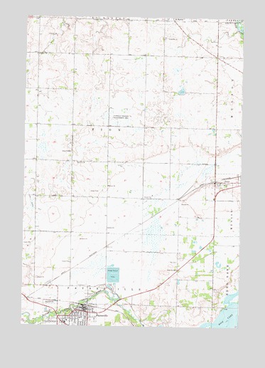
Paynesville, MN USGS Topographic Map
Click on map above to begin viewing in our Map Viewer.

This topographic map contains these locations and features:
Feature Name Type Latitude Longitude GNIS ID View Map
Bonanza ValleyValleyN45.3791°W94.7225°654547View Map
Calvary Baptist ChurchChurchN45.3753°W94.7119°2067991View Map
City of PaynesvilleCivilN45.3785°W94.7216°2396168View Map
City of RoscoeCivilN45.4325°W94.6365°2396426View Map
Good Samaritan Care CenterHospitalN45.3800°W94.7136°2068002View Map
Grace United Methodist ChurchChurchN45.3806°W94.7206°2067992View Map
Nordland Lutheran ChurchChurchN45.3836°W94.6319°2067997View Map
PaynesvillePopulated PlaceN45.3805°W94.7119°649194View Map
PaynesvilleLocaleN45.3833°W94.7128°2067990View Map
Paynesville Elementary SchoolSchoolN45.3783°W94.7158°2068005View Map
Paynesville Fire DepartmentBuildingN45.3783°W94.7139°2067988View Map
Paynesville Lutheran ChurchChurchN45.3753°W94.7219°2067970View Map
Paynesville Police DepartmentBuildingN45.3811°W94.7134°2067989View Map
Paynesville Post OfficePost OfficeN45.3853°W94.7153°2068242View Map
Paynesville Public LibraryBuildingN45.3822°W94.7128°2067987View Map
RoscoePopulated PlaceN45.4339°W94.6397°650255View Map
Roscoe (historical)LocaleN45.4336°W94.6403°2068233View Map
Roscoe Post OfficePost OfficeN45.4339°W94.6394°2068232View Map
Saint Agnes Catholic ChurchChurchN45.4336°W94.6364°2068231View Map
Saint Louis Catholic ChurchChurchN45.3772°W94.7233°2067994View Map
Saint Louis Catholic Church CemeteryCemeteryN45.3769°W94.7113°2068091View Map
Saint Martin Volunteer Fire and Rescue DepartmentBuildingN45.4992°W94.6703°2666637View Map
Saint Stephens Episcopal ChurchChurchN45.3806°W94.7181°2067993View Map
Salem CemeteryCemeteryN45.4418°W94.7154°2068294View Map
Salem ChurchChurchN45.4411°W94.7158°651102View Map
School Number 1948SchoolN45.3980°W94.6611°651444View Map
School Number 1966SchoolN45.4847°W94.7436°651451View Map
School Number 2028SchoolN45.4455°W94.7236°651476View Map
Township of ZionCivilN45.4559°W94.7018°666073View Map
Zion CemeteryCemeteryN45.4011°W94.6612°654449View Map

Note: Coordinates in the location and feature list above are referenced to NAD83 datum.


Copyright (C) 2008-2024 Ryan Niemi / Sunset Dynamics ... All Rights Reserved