TopoQuest Logo
Do you find TopoQuest useful?
Help keep TopoQuest running and adding new maps/features by donating!
Bitcoin:  19c7KJd3qBynnjoSw5npx9KScwjBe4ifkT
Litecoin:  LXs6TkuXGGXo1vDsWCkWVdjQX94eUKd6ui
Home View Maps Find Maps Find Places Resources & Links


Eden Valley, Minnesota Topographic Map

USGS Map Title: Eden Valley, MN
USGS Map MRC: 45094C5
DRG (GeoTIFF) Download: o45094c5.tif


Neighboring USGS Topographic Map Quads:


  Paynesville, MN  
45094D6
 

  Richmond, MN  
45094D5
 

  Cold Spring, MN  
45094D4
 

  Lake Koronis, MN  
45094C6
 

  Eden Valley, MN  
45094C5
 

  Watkins, MN  
45094C4
 

  Grove City, MN  
45094B6
 

  Litchfield North, MN  
45094B5
 

  Forest City, MN  
45094B4


Map MRC Location:

N46°
W95°
N46°
W94°
H8 H7 H6 H5 H4 H3 H2 H1
G8 G7 G6 G5 G4 G3 G2 G1
F8 F7 F6 F5 F4 F3 F2 F1
E8 E7 E6 E5 E4 E3 E2 E1
D8 D7 D6 D5 D4 D3 D2 D1
C8 C7 C6 C5 C4 C3 C2 C1
B8 B7 B6 B5 B4 B3 B2 B1
A8 A7 A6 A5 A4 A3 A2 A1
N45°
W95°
N45°
W94°

Eden Valley, MN USGS 1:24K Topographic Map Preview:
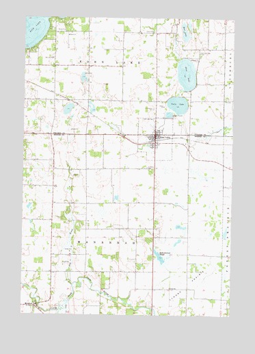
Eden Valley, MN USGS Topographic Map
Click on map above to begin viewing in our Map Viewer.

This topographic map contains these locations and features:
Feature Name Type Latitude Longitude GNIS ID View Map
Assumption CemeteryCemeteryN45.3369°W94.5471°639489View Map
Assumption ParishChurchN45.3264°W94.5458°2068405View Map
Becker DairyLocaleN45.3058°W94.5447°2702988View Map
Church of GodChurchN45.3278°W94.5444°2068406View Map
Church of Our Lady of ManannahChurchN45.2525°W94.6139°2066007View Map
Church of Our Lady of ManannahChurchN45.2525°W94.6139°2066644View Map
City of Eden ValleyCivilN45.3262°W94.5454°2394615View Map
Eden LakeLakeN45.3515°W94.5282°643162View Map
Eden Lake CemeteryCemeteryN45.3327°W94.5469°643163View Map
Eden ValleyLocaleN45.3236°W94.5436°2066013View Map
Eden ValleyLocaleN45.3236°W94.5436°2066650View Map
Eden ValleyPopulated PlaceN45.3261°W94.5461°643168View Map
Eden Valley Baseball ParkParkN45.3242°W94.5478°2066012View Map
Eden Valley Baseball ParkParkN45.3242°W94.5478°2066649View Map
Eden Valley City HallBuildingN45.3256°W94.5475°2066011View Map
Eden Valley City HallBuildingN45.3256°W94.5475°2066648View Map
Eden Valley Elementary SchoolSchoolN45.3250°W94.5561°2066015View Map
Eden Valley Elementary SchoolSchoolN45.3250°W94.5561°2066652View Map
Eden Valley Fire and Rescue DepartmentBuildingN45.3200°W94.5422°2066010View Map
Eden Valley Fire DepartmentBuildingN45.3256°W94.5475°2066647View Map
Eden Valley Medical ClinicHospitalN45.3222°W94.5486°2066008View Map
Eden Valley Medical ClinicHospitalN45.3222°W94.5486°2066645View Map
Eden Valley Police DepartmentBuildingN45.3250°W94.5475°2066009View Map
Eden Valley Police DepartmentBuildingN45.3256°W94.5475°2066646View Map
Eden Valley Post OfficePost OfficeN45.3292°W94.5486°2066016View Map
Eden Valley Post OfficePost OfficeN45.3292°W94.5486°2066653View Map
Eden Valley Watkins High SchoolSchoolN45.3256°W94.5442°2066014View Map
Eden Valley Watkins High SchoolSchoolN45.3256°W94.5442°2066651View Map
Fishers Resort and CampgroundLocaleN45.3694°W94.6000°2067982View Map
Grove CreekStreamN45.2547°W94.5983°644500View Map
Kalkenbrenner LakeLakeN45.2731°W94.5383°646028View Map
Mananah Post Office (historical)Post OfficeN45.2536°W94.6172°2065916View Map
Mananah Post Office (historical)Post OfficeN45.2536°W94.6172°2066553View Map
ManannahPopulated PlaceN45.2536°W94.6175°647430View Map
Meeker County Waterfowl Production AreaParkN45.2829°W94.5166°2765404View Map
Middle Fork Crow RiverStreamN45.2525°W94.6022°647809View Map
Mud LakeLakeN45.3688°W94.5291°648241View Map
Old Eden Lake CemeteryCemeteryN45.3605°W94.5204°648921View Map
Rice LakeLakeN45.3743°W94.6210°650035View Map
Rice Lake SchoolSchoolN45.3577°W94.6078°650048View Map
Saint Paul's Lutheran ChurchChurchN45.3258°W94.5556°2066017View Map
Saint Paul's Lutheran ChurchChurchN45.3258°W94.5556°2066654View Map
Saint Peters CemeteryCemeteryN45.3123°W94.5510°651021View Map
Stag BrookStreamN45.2625°W94.5944°652532View Map
Township of Eden LakeCivilN45.3698°W94.5733°664044View Map
Township of ManannahCivilN45.2821°W94.5732°664884View Map
TTT CampLocaleN45.3702°W94.6092°652973View Map
Tyler Farms AirportAirportN45.2627°W94.5061°2676810View Map
Tyrone PrairieFlatN45.2633°W94.5250°653481View Map
Tyrone SchoolSchoolN45.2614°W94.5369°653482View Map
Vails LakeLakeN45.3386°W94.5333°653584View Map

Note: Coordinates in the location and feature list above are referenced to NAD83 datum.


Copyright (C) 2008-2024 Ryan Niemi / Sunset Dynamics ... All Rights Reserved