TopoQuest Logo
Do you find TopoQuest useful?
Help keep TopoQuest running and adding new maps/features by donating!
Bitcoin:  19c7KJd3qBynnjoSw5npx9KScwjBe4ifkT
Litecoin:  LXs6TkuXGGXo1vDsWCkWVdjQX94eUKd6ui
Home View Maps Find Maps Find Places Resources & Links


Richmond, Utah Topographic Map

USGS Map Title: Richmond, UT
USGS Map MRC: 41111H7
DRG (GeoTIFF) Download: o41111h7.tif


Neighboring USGS Topographic Map Quads:


  Weston, ID  
42111A8
 

  Franklin, ID  
42111A7
 

  Mapleton, ID  
42111A6
 

  Trenton, UT  
41111H8
 

  Richmond, UT  
41111H7
 

  Naomi Peak, UT  
41111H6
 

  Newton, UT  
41111G8
 

  Smithfield, UT  
41111G7
 

  Mount Elmer, UT  
41111G6


Map MRC Location:

N42°
W112°
N42°
W111°
H8 H7 H6 H5 H4 H3 H2 H1
G8 G7 G6 G5 G4 G3 G2 G1
F8 F7 F6 F5 F4 F3 F2 F1
E8 E7 E6 E5 E4 E3 E2 E1
D8 D7 D6 D5 D4 D3 D2 D1
C8 C7 C6 C5 C4 C3 C2 C1
B8 B7 B6 B5 B4 B3 B2 B1
A8 A7 A6 A5 A4 A3 A2 A1
N41°
W112°
N41°
W111°

Richmond, UT USGS 1:24K Topographic Map Preview:
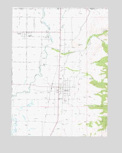
Richmond, UT USGS Topographic Map
Click on map above to begin viewing in our Map Viewer.

This topographic map contains these locations and features:
Feature Name Type Latitude Longitude GNIS ID View Map
Ballantine SpringSpringN41.9047°W111.7765°1438374View Map
Cherry CreekStreamN41.9435°W111.8372°1439652View Map
Cherry Creek DitchCanalN41.9247°W111.7886°1439653View Map
Cherry Creek SpringSpringN41.9311°W111.7746°1439654View Map
City CreekStreamN41.9183°W111.8519°1439754View Map
City of RichmondCivilN41.9233°W111.8075°2410941View Map
CovePopulated PlaceN41.9635°W111.8061°1440063View Map
Cove Census Designated PlaceCensusN41.9683°W111.7792°2407674View Map
East Pump CanalCanalN41.9866°W111.8663°1440843View Map
High CreekStreamN41.9574°W111.8305°1441752View Map
LewistonPopulated PlaceN41.9758°W111.8563°1442573View Map
Lewiston City CemeteryCemeteryN41.9769°W111.8310°1448594View Map
Lewiston City Fire DepartmentBuildingN41.9755°W111.8553°2627378View Map
Lewiston Elementary SchoolSchoolN41.9721°W111.8528°1448595View Map
Lewiston Post OfficePost OfficeN41.9745°W111.8564°1455369View Map
Lower High Creek CanalCanalN41.9352°W111.8074°1443010View Map
Morrison DamDamN41.9999°W111.8041°398672View Map
Nebo CreekStreamN41.8822°W111.8180°1443778View Map
North Cache 8 - 9 Center SchoolSchoolN41.9115°W111.8130°1443855View Map
North Fork City CreekStreamN41.9058°W111.7588°1454840View Map
Oxkiller HollowValleyN41.9447°W111.7791°1444142View Map
Park Elementary SchoolSchoolN41.9212°W111.8121°1448806View Map
Prater HollowValleyN41.9713°W111.7652°1444630View Map
RichmondPopulated PlaceN41.9227°W111.8136°1444892View Map
Richmond City CemeteryCemeteryN41.9308°W111.8027°1448912View Map
Richmond Fire DepartmentBuildingN41.9223°W111.8075°2627293View Map
Richmond KnollSummitN41.9638°W111.7888°1444893View Map
Richmond Post OfficePost OfficeN41.9224°W111.8083°1455478View Map
Robinson SpringSpringN41.9190°W111.8161°1445028View Map
Rocky Ridge ReservoirReservoirN41.9091°W111.8027°1445127View Map
Spring CreekStreamN41.9666°W111.8213°1446006View Map
Spring CreekStreamN41.9699°W111.8236°375208View Map
Stewart SpringSpringN41.9309°W111.8103°1446144View Map
The Church of Jesus Christ of Latter Day SaintsChurchN41.9183°W111.8063°1449597View Map
The Church of Jesus Christ of Latter Day SaintsChurchN41.9222°W111.8122°1449598View Map
The Church of Jesus Christ of Latter Day SaintsChurchN41.9535°W111.8022°1449423View Map
The Church of Jesus Christ of Latter Day SaintsChurchN41.9755°W111.8574°1449507View Map
Upper High Creek CanalCanalN41.9463°W111.7869°1446862View Map
WebsterLocaleN41.9771°W111.8124°1455574View Map
Worm CreekStreamN41.9891°W111.8380°393697View Map
Worm CreekStreamN41.9891°W111.8372°1447532View Map

Note: Coordinates in the location and feature list above are referenced to NAD83 datum.


Copyright (C) 2008-2025 Ryan Niemi / Sunset Dynamics ... All Rights Reserved