TopoQuest Logo
Do you find TopoQuest useful?
Help keep TopoQuest running and adding new maps/features by donating!
Bitcoin:  19c7KJd3qBynnjoSw5npx9KScwjBe4ifkT
Litecoin:  LXs6TkuXGGXo1vDsWCkWVdjQX94eUKd6ui
Home View Maps Find Maps Find Places Resources & Links


Trenton, Utah Topographic Map

USGS Map Title: Trenton, UT
USGS Map MRC: 41111H8
DRG (GeoTIFF) Download: o41111h8.tif


Neighboring USGS Topographic Map Quads:


  Weston Canyon, ID  
42112A1
 

  Weston, ID  
42111A8
 

  Franklin, ID  
42111A7
 

  Clarkston, UT  
41112H1
 

  Trenton, UT  
41111H8
 

  Richmond, UT  
41111H7
 

  Cutler Dam, UT  
41112G1
 

  Newton, UT  
41111G8
 

  Smithfield, UT  
41111G7


Map MRC Location:

N42°
W112°
N42°
W111°
H8 H7 H6 H5 H4 H3 H2 H1
G8 G7 G6 G5 G4 G3 G2 G1
F8 F7 F6 F5 F4 F3 F2 F1
E8 E7 E6 E5 E4 E3 E2 E1
D8 D7 D6 D5 D4 D3 D2 D1
C8 C7 C6 C5 C4 C3 C2 C1
B8 B7 B6 B5 B4 B3 B2 B1
A8 A7 A6 A5 A4 A3 A2 A1
N41°
W112°
N41°
W111°

Trenton, UT USGS 1:24K Topographic Map Preview:
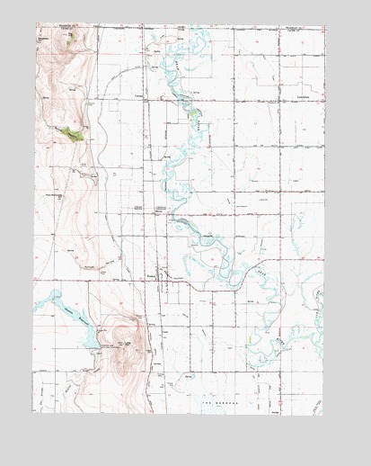
Trenton, UT USGS Topographic Map
Click on map above to begin viewing in our Map Viewer.

This topographic map contains these locations and features:
Feature Name Type Latitude Longitude GNIS ID View Map
Amalga Branch West Cache CanalCanalN41.8949°W111.8822°1438191View Map
Big HillSummitN41.9960°W111.9872°1425495View Map
Butler HollowValleyN41.9627°W111.9775°1426222View Map
City of LewistonCivilN41.9614°W111.8796°2410826View Map
CornishPopulated PlaceN41.9755°W111.9533°1437533View Map
Cornish CemeteryCemeteryN41.9740°W111.9785°1426871View Map
CottleLocaleN41.9019°W111.9447°1426889View Map
Cub RiverStreamN41.8980°W111.8791°380150View Map
Lewiston DivisionCivilN41.9455°W111.9369°1939384View Map
Little MountainSummitN41.8971°W111.9619°1429768View Map
MortonPopulated PlaceN41.9391°W111.9480°1437642View Map
Newton Branch West Cache CanalCanalN41.8766°W111.9483°1430706View Map
Newton CemeeryCemeteryN41.8805°W111.9919°2769278View Map
Newton DamDamN41.8960°W111.9730°1430708View Map
Newton ReservoirReservoirN41.9080°W111.9864°1430709View Map
Pete McCombs HillSummitN41.9435°W111.9886°1431186View Map
Pullum HollowValleyN41.9235°W111.9644°1431497View Map
Ransom HollowValleyN41.9188°W111.9333°1431576View Map
Southwest Lewiston CanalCanalN41.9446°W111.8994°1432777View Map
The Church of Jesus Christ of Latter Day SaintsChurchN41.9755°W111.9544°1436872View Map
The Church of Jesus Christ of Latter Day SaintsChurchN41.9169°W111.9433°1451007View Map
The Church of Jesus Christ of Latter Day SaintsChurchN41.9566°W111.8952°1436988View Map
Town of CornishCivilN41.9716°W111.9565°2413244View Map
Town of TrentonCivilN41.9116°W111.9356°2413399View Map
TrentonPopulated PlaceN41.9177°W111.9424°1433666View Map
Trenton CemeteryCemeteryN41.9063°W111.9524°1433667View Map
Trenton City Fire DepartmentBuildingN41.9179°W111.9425°2627366View Map
Trenton Post OfficePost OfficeN41.9174°W111.9430°84338View Map
UtidaPopulated PlaceN41.9991°W111.9752°395885View Map
West Cache CanalCanalN41.9499°W111.9688°1434053View Map
West Pump CanalCanalN41.9608°W111.8908°1434112View Map
West Pump CanalCanalN41.9802°W111.8974°1434113View Map

Note: Coordinates in the location and feature list above are referenced to NAD83 datum.


Copyright (C) 2008-2025 Ryan Niemi / Sunset Dynamics ... All Rights Reserved