TopoQuest Logo
Do you find TopoQuest useful?
Help keep TopoQuest running and adding new maps/features by donating!
Bitcoin:  19c7KJd3qBynnjoSw5npx9KScwjBe4ifkT
Litecoin:  LXs6TkuXGGXo1vDsWCkWVdjQX94eUKd6ui
Home View Maps Find Maps Find Places Resources & Links


Richmond, Ohio Topographic Map

USGS Map Title: Richmond, OH
USGS Map MRC: 40080D7
DRG (GeoTIFF) Download: o40080d7.tif


Neighboring USGS Topographic Map Quads:


  Bergholz, OH  
40080E8
 

  Salineville, OH  
40080E7
 

  Wellsville, OH  
40080E6
 

  Amsterdam, OH  
40080D8
 

  Richmond, OH  
40080D7
 

  Knoxville, OH  
40080D6
 

  Cadiz, OH  
40080C8
 

  Smithfield, OH  
40080C7
 

  Steubenville West, OH  
40080C6


Map MRC Location:

N41°
W81°
N41°
W80°
H8 H7 H6 H5 H4 H3 H2 H1
G8 G7 G6 G5 G4 G3 G2 G1
F8 F7 F6 F5 F4 F3 F2 F1
E8 E7 E6 E5 E4 E3 E2 E1
D8 D7 D6 D5 D4 D3 D2 D1
C8 C7 C6 C5 C4 C3 C2 C1
B8 B7 B6 B5 B4 B3 B2 B1
A8 A7 A6 A5 A4 A3 A2 A1
N40°
W81°
N40°
W80°

Richmond, OH USGS 1:24K Topographic Map Preview:
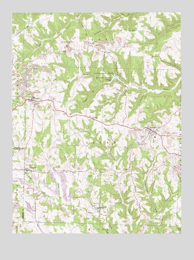
Richmond, OH USGS Topographic Map
Click on map above to begin viewing in our Map Viewer.

This topographic map contains these locations and features:
Feature Name Type Latitude Longitude GNIS ID View Map
AnnapolisPopulated PlaceN40.4112°W80.8631°1064332View Map
Annapolis CemeteryCemeteryN40.4101°W80.8637°1961679View Map
Annapolis Post Office (historical)Post OfficeN40.4112°W80.8637°2014657View Map
Bowers PondReservoirN40.4167°W80.8015°1077813View Map
Bowers Pond DamDamN40.4167°W80.8015°1077812View Map
Carne CemeteryCemeteryN40.4083°W80.7663°1038828View Map
Culp RunStreamN40.4578°W80.7895°1039529View Map
East SpringfieldPopulated PlaceN40.4506°W80.8604°1064589View Map
East Springfield Census Designated PlaceCensusN40.4474°W80.8599°2628890View Map
East Springfield Post OfficePost OfficeN40.4501°W80.8609°2014655View Map
East Springfield Volunteer Fire DepartmentBuildingN40.4494°W80.8579°2549927View Map
FairfieldPopulated PlaceN40.4401°W80.8145°1048719View Map
Grassy RunStreamN40.3834°W80.8109°1061111View Map
Hildebrand RunStreamN40.4981°W80.7942°1067108View Map
Jefferson CountyCivilN40.3850°W80.7610°1074053View Map
Jefferson LakeReservoirN40.4633°W80.7982°1078484View Map
Jefferson Lake DamDamN40.4601°W80.7948°1078483View Map
Jefferson Lake State ParkParkN40.4681°W80.8056°1042065View Map
Lake Lodge Mobile Home VillagePopulated PlaceN40.4192°W80.7544°2518931View Map
Leas BranchStreamN40.3934°W80.8390°1057789View Map
Leas CemeteryCemeteryN40.4105°W80.8382°1042452View Map
Lebanon CemeteryCemeteryN40.4809°W80.8126°1042463View Map
Mader PondReservoirN40.3809°W80.8744°1079176View Map
Mader Pond DamDamN40.3801°W80.8748°1079175View Map
Middle RidgeRidgeN40.4837°W80.8220°1043280View Map
Montgomery CemeteryCemeteryN40.4775°W80.8346°1043455View Map
Mount Hope CemeteryCemeteryN40.4065°W80.8208°1043569View Map
Mount Zion Methodist CemeteryCemeteryN40.4898°W80.7867°1961701View Map
Mount Zion Methodist ChurchChurchN40.4895°W80.7865°1961702View Map
Old Annapolis CemeteryCemeteryN40.4130°W80.8608°1044092View Map
Old Union CemeteryCemeteryN40.4675°W80.7676°1961708View Map
Quaker CemeteryCemeteryN40.4110°W80.7882°1044812View Map
Quaker RidgeRidgeN40.3870°W80.7804°1044817View Map
RichmondPopulated PlaceN40.4334°W80.7717°1049120View Map
Richmond CemeteryCemeteryN40.4289°W80.7762°1044983View Map
Richmond Elementary SchoolSchoolN40.4295°W80.7695°1051048View Map
Richmond Methodist CemeteryCemeteryN40.4317°W80.7709°1961709View Map
Richmond Post OfficePost OfficeN40.4334°W80.7720°2015517View Map
Richmond United Presbyterian CemeteryCemeteryN40.4309°W80.7684°1961710View Map
Richmond Volunteer Fire and Rescue CompanyBuildingN40.4263°W80.7818°2550148View Map
Rippy RunStreamN40.4581°W80.7892°1045032View Map
Saint John Fisher ChurchChurchN40.4253°W80.7792°1045503View Map
Saint John Vianney SeminarySchoolN40.3895°W80.8106°1045505View Map
Saint John Vianney Seminary DamDamN40.3867°W80.8115°1079516View Map
Saint John Vianney Seminary LakeReservoirN40.3867°W80.8115°1079517View Map
ShanePopulated PlaceN40.4776°W80.8042°1063010View Map
Shane Post Office (historical)Post OfficeN40.4778°W80.8040°2015520View Map
Spring Hills Golf ClubLocaleN40.4509°W80.8401°1051047View Map
Springfield CemeteryCemeteryN40.4487°W80.8590°1046591View Map
Sproat CemeteryCemeteryN40.4039°W80.8718°1046602View Map
Timothy RidgeRidgeN40.4895°W80.8668°1047068View Map
Town ForkStreamN40.4595°W80.8076°1047104View Map
Township of SalemCivilN40.4246°W80.8084°1086382View Map
Village of RichmondCivilN40.4328°W80.7719°2399066View Map
Wallace Private CemeteryCemeteryN40.4391°W80.8164°1961712View Map

Note: Coordinates in the location and feature list above are referenced to NAD83 datum.


Copyright (C) 2008-2025 Ryan Niemi / Sunset Dynamics ... All Rights Reserved