TopoQuest Logo
Do you find TopoQuest useful?
Help keep TopoQuest running and adding new maps/features by donating!
Bitcoin:  19c7KJd3qBynnjoSw5npx9KScwjBe4ifkT
Litecoin:  LXs6TkuXGGXo1vDsWCkWVdjQX94eUKd6ui
Home View Maps Find Maps Find Places Resources & Links


Bergholz, Ohio Topographic Map

USGS Map Title: Bergholz, OH
USGS Map MRC: 40080E8
DRG (GeoTIFF) Download: o40080e8.tif


Neighboring USGS Topographic Map Quads:


  Minerva, OH  
40081F1
 

  Kensington, OH  
40080F8
 

  Gavers, OH  
40080F7
 

  Carrollton, OH  
40081E1
 

  Bergholz, OH  
40080E8
 

  Salineville, OH  
40080E7
 

  Scio, OH  
40081D1
 

  Amsterdam, OH  
40080D8
 

  Richmond, OH  
40080D7


Map MRC Location:

N41°
W81°
N41°
W80°
H8 H7 H6 H5 H4 H3 H2 H1
G8 G7 G6 G5 G4 G3 G2 G1
F8 F7 F6 F5 F4 F3 F2 F1
E8 E7 E6 E5 E4 E3 E2 E1
D8 D7 D6 D5 D4 D3 D2 D1
C8 C7 C6 C5 C4 C3 C2 C1
B8 B7 B6 B5 B4 B3 B2 B1
A8 A7 A6 A5 A4 A3 A2 A1
N40°
W81°
N40°
W80°

Bergholz, OH USGS 1:24K Topographic Map Preview:
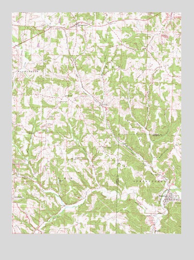
Bergholz, OH USGS Topographic Map
Click on map above to begin viewing in our Map Viewer.

This topographic map contains these locations and features:
Feature Name Type Latitude Longitude GNIS ID View Map
BergholzPopulated PlaceN40.5195°W80.8840°1064416View Map
Bergholz CemeteryCemeteryN40.5156°W80.8954°1037869View Map
Bergholz SquadBuildingN40.5204°W80.8856°2550756View Map
Bergholz Volunteer Fire CompanyBuildingN40.5245°W80.8834°2549938View Map
Blazer HollowValleyN40.5426°W80.8945°1038108View Map
Burgett RunStreamN40.5515°W80.8970°1038529View Map
Carroll RunStreamN40.5603°W80.9026°1065950View Map
Center ForkStreamN40.5153°W80.9595°1038938View Map
Chestnut Ridge CemeteryCemeteryN40.5492°W80.9335°1052472View Map
Chestnut Ridge ChurchChurchN40.5492°W80.9329°1039052View Map
Corinth - Mechanicstown CemeteryCemeteryN40.6156°W80.9576°1052473View Map
Elkhorn CreekStreamN40.5103°W80.8934°1040133View Map
Fox Township Volunteer Fire DepartmentBuildingN40.6203°W80.9490°2550175View Map
Frog RunStreamN40.5412°W80.9887°1040704View Map
Hazel RunStreamN40.5734°W80.9340°1041432View Map
Hump RunStreamN40.5373°W80.8973°1041871View Map
Kilgore LakeLakeN40.5297°W80.9655°1042257View Map
McClain Field (historical)AirportN40.6084°W80.9331°1082848View Map
McGauran CemeteryCemeteryN40.5519°W80.9739°1052469View Map
MechanicstownPopulated PlaceN40.6187°W80.9512°1061502View Map
Mechanicstown Post OfficePost OfficeN40.6181°W80.9512°1965239View Map
Palmer CemeteryCemeteryN40.5579°W80.9760°1044286View Map
Rainy RidgeRidgeN40.5145°W80.9165°1044845View Map
ScroggsfieldPopulated PlaceN40.5778°W80.9609°1049162View Map
Scroggsfield CemeteryCemeteryN40.5751°W80.9656°1052470View Map
Scroggsfield ChurchChurchN40.5745°W80.9643°1046073View Map
Scroggsfield Post Office (historical)Post OfficeN40.5778°W80.9609°1083284View Map
Snyder CemeteryCemeteryN40.6169°W80.9768°1046414View Map
Springfield High SchoolSchoolN40.5017°W80.8943°1046594View Map
Strawcamp RunStreamN40.5253°W80.9354°1066226View Map
Township of FoxCivilN40.5999°W80.9193°1085828View Map
Township of LeeCivilN40.5250°W80.9888°1085830View Map
Trail RunStreamN40.5315°W80.9831°1047130View Map
Tunnel HillSummitN40.5345°W80.8793°1049253View Map
Upper North ForkStreamN40.5253°W80.8845°1047371View Map
Village of BergholzCivilN40.5208°W80.8851°2398100View Map
Watson RidgeRidgeN40.5592°W80.9112°1047626View Map
WattsvillePopulated PlaceN40.5734°W80.9329°1061225View Map
Wattsville Post Office (historical)Post OfficeN40.5737°W80.9331°1083286View Map
Wells - Jackman CemeteryCemeteryN40.5178°W80.9521°1052471View Map
Willis Elementary SchoolSchoolN40.6187°W80.9259°1082074View Map

Note: Coordinates in the location and feature list above are referenced to NAD83 datum.


Copyright (C) 2008-2025 Ryan Niemi / Sunset Dynamics ... All Rights Reserved