TopoQuest Logo
Do you find TopoQuest useful?
Help keep TopoQuest running and adding new maps/features by donating!
Bitcoin:  19c7KJd3qBynnjoSw5npx9KScwjBe4ifkT
Litecoin:  LXs6TkuXGGXo1vDsWCkWVdjQX94eUKd6ui
Home View Maps Find Maps Find Places Resources & Links


Salineville, Ohio Topographic Map

USGS Map Title: Salineville, OH
USGS Map MRC: 40080E7
DRG (GeoTIFF) Download: o40080e7.tif


Neighboring USGS Topographic Map Quads:


  Kensington, OH  
40080F8
 

  Gavers, OH  
40080F7
 

  West Point, OH  
40080F6
 

  Bergholz, OH  
40080E8
 

  Salineville, OH  
40080E7
 

  Wellsville, OH  
40080E6
 

  Amsterdam, OH  
40080D8
 

  Richmond, OH  
40080D7
 

  Knoxville, OH  
40080D6


Map MRC Location:

N41°
W81°
N41°
W80°
H8 H7 H6 H5 H4 H3 H2 H1
G8 G7 G6 G5 G4 G3 G2 G1
F8 F7 F6 F5 F4 F3 F2 F1
E8 E7 E6 E5 E4 E3 E2 E1
D8 D7 D6 D5 D4 D3 D2 D1
C8 C7 C6 C5 C4 C3 C2 C1
B8 B7 B6 B5 B4 B3 B2 B1
A8 A7 A6 A5 A4 A3 A2 A1
N40°
W81°
N40°
W80°

Salineville, OH USGS 1:24K Topographic Map Preview:
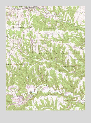
Salineville, OH USGS Topographic Map
Click on map above to begin viewing in our Map Viewer.

This topographic map contains these locations and features:
Feature Name Type Latitude Longitude GNIS ID View Map
Allman RunStreamN40.5645°W80.8340°1037379View Map
Brimstone RunStreamN40.5312°W80.8173°1038319View Map
Brush Creek Wildlife AreaParkN40.5565°W80.7720°1038404View Map
Chestnut Grove CemeteryCemeteryN40.5728°W80.7573°1961682View Map
Chestnut Grove ChurchChurchN40.5731°W80.7567°1039042View Map
Diamond ValleyPopulated PlaceN40.6209°W80.8559°1067670View Map
Dorn CemeteryCemeteryN40.5259°W80.8623°1039752View Map
Dry RunStreamN40.5278°W80.8212°1039822View Map
East Salineville (historical)Populated PlaceN40.6242°W80.8165°1067671View Map
Granny BourStreamN40.5298°W80.8109°1041043View Map
Grants Hill ChurchChurchN40.5909°W80.8070°1041052View Map
Greenbrier - West Union CemeteryCemeteryN40.5698°W80.8726°1052474View Map
Haysville (historical)Populated PlaceN40.6156°W80.8067°1067672View Map
HoltPopulated PlaceN40.5123°W80.7517°1048848View Map
Holt Post Office (historical)Post OfficeN40.5126°W80.7512°2014663View Map
Lake GeorgeLakeN40.5222°W80.8321°1040820View Map
Long RunStreamN40.5126°W80.7570°1042761View Map
Mathews RunStreamN40.5295°W80.8423°1043060View Map
McClelland CemeteryCemeteryN40.5092°W80.7506°1043089View Map
McLain RunStreamN40.5226°W80.7923°1043135View Map
MonroevillePopulated PlaceN40.5978°W80.8376°1057852View Map
Monroeville CemeteryCemeteryN40.5981°W80.8420°1961698View Map
Mooretown Methodist Episcopal CemeteryCemeteryN40.5189°W80.8392°1961699View Map
Nancy RunStreamN40.6237°W80.8231°1043772View Map
Ogle CemeteryCemeteryN40.6067°W80.7779°1044076View Map
Pine Grove CemeteryCemeteryN40.5370°W80.7584°1960358View Map
Pine Grove Methodist ChurchChurchN40.5370°W80.7576°1044462View Map
Pine HillPopulated PlaceN40.5667°W80.8679°1052475View Map
Pinehill Post Office (historical)Post OfficeN40.5667°W80.8679°1083283View Map
PravoPopulated PlaceN40.5192°W80.8326°1062954View Map
Pravo Post Office (historical)Post OfficeN40.5195°W80.8331°2014665View Map
Ralston RunStreamN40.5187°W80.8315°1066368View Map
Reel LakeReservoirN40.5360°W80.8409°1044919View Map
Riley RunStreamN40.6234°W80.8231°1045025View Map
Roach RunStreamN40.5195°W80.7695°1045073View Map
Roach RunStreamN40.5592°W80.7959°1045074View Map
Rod LakeReservoirN40.5390°W80.8404°1077811View Map
Rod Lake DamDamN40.5367°W80.8415°1077810View Map
Rose RunStreamN40.5598°W80.8051°1045192View Map
Russell CemeteryCemeteryN40.5642°W80.7718°1045292View Map
Saint Patricks ChurchChurchN40.6228°W80.8454°1807585View Map
SalinevillePopulated PlaceN40.6226°W80.8379°1065281View Map
Salineville Police DepartmentBuildingN40.6242°W80.8310°2732825View Map
Salineville Post OfficePost OfficeN40.6223°W80.8373°1967553View Map
Salineville United Methodist ChurchChurchN40.6228°W80.8379°1069951View Map
Seever CemeteryCemeteryN40.5234°W80.7984°1046086View Map
Southern Middle SchoolSchoolN40.6231°W80.8387°1052142View Map
Township of Brush CreekCivilN40.5698°W80.8052°1086376View Map
Township of RossCivilN40.5051°W80.8071°1086381View Map
Village of SalinevilleCivilN40.6207°W80.8344°2399176View Map
West Grove CemeteryCemeteryN40.5987°W80.8614°1047761View Map
West Union ChurchChurchN40.5695°W80.8726°1047809View Map
Yellow Creek CemeteryCemeteryN40.5192°W80.8438°1048188View Map

Note: Coordinates in the location and feature list above are referenced to NAD83 datum.


Copyright (C) 2008-2025 Ryan Niemi / Sunset Dynamics ... All Rights Reserved