TopoQuest Logo
Do you find TopoQuest useful?
Help keep TopoQuest running and adding new maps/features by donating!
Bitcoin:  19c7KJd3qBynnjoSw5npx9KScwjBe4ifkT
Litecoin:  LXs6TkuXGGXo1vDsWCkWVdjQX94eUKd6ui
Home View Maps Find Maps Find Places Resources & Links


Arland, Wisconsin Topographic Map

USGS Map Title: Arland, WI
USGS Map MRC: 45092C1
DRG (GeoTIFF) Download: o45092c1.tif


Neighboring USGS Topographic Map Quads:


  Turtle Lake, WI  
45092D2
 

  Almena, WI  
45092D1
 

  Poskin, WI  
45091D8
 

  Clayton, WI  
45092C2
 

  Arland, WI  
45092C1
 

  Dorrity Creek, WI  
45091C8
 

  Graytown, WI  
45092B2
 

  Connorsville, WI  
45092B1
 

  Ridgeland, WI  
45091B8


Map MRC Location:

N46°
W93°
N46°
W92°
H8 H7 H6 H5 H4 H3 H2 H1
G8 G7 G6 G5 G4 G3 G2 G1
F8 F7 F6 F5 F4 F3 F2 F1
E8 E7 E6 E5 E4 E3 E2 E1
D8 D7 D6 D5 D4 D3 D2 D1
C8 C7 C6 C5 C4 C3 C2 C1
B8 B7 B6 B5 B4 B3 B2 B1
A8 A7 A6 A5 A4 A3 A2 A1
N45°
W93°
N45°
W92°

Arland, WI USGS 1:24K Topographic Map Preview:
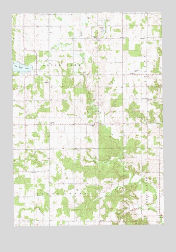
Arland, WI USGS Topographic Map
Click on map above to begin viewing in our Map Viewer.

This topographic map contains these locations and features:
Feature Name Type Latitude Longitude GNIS ID View Map
ArlandPopulated PlaceN45.3383°W92.0230°1560938View Map
Arland Independent CemeteryCemeteryN45.3234°W92.0138°1566895View Map
Bethany CemeteryCemeteryN45.3587°W92.0536°1561614View Map
Bethany ChurchChurchN45.3600°W92.0177°1561622View Map
Big Moon LakeLakeN45.3431°W92.1192°1561750View Map
Big Moon Lake 2WP1478 DamDamN45.3450°W92.1102°1792567View Map
Breen School (historical)SchoolN45.2952°W92.0024°1837886View Map
Clover Leaf School (historical)SchoolN45.3097°W92.0632°1837896View Map
Columbus Elementary SchoolSchoolN45.2839°W92.0494°2097818View Map
Crescent Valley FarmLocaleN45.3222°W92.0556°2664060View Map
Crossroads Covenant ChurchChurchN45.2861°W92.0494°2097819View Map
Degerman DariesLocaleN45.3608°W92.0153°2664058View Map
Grant School (historical)SchoolN45.3386°W92.0543°1837938View Map
Jones CreekStreamN45.2750°W92.0288°1567264View Map
Jones Creek School (historical)SchoolN45.2747°W92.0643°1837956View Map
Liberty School (historical)SchoolN45.3241°W92.0055°1837961View Map
Longfellow School (historical)SchoolN45.3594°W92.0121°1837965View Map
Lutheran ChurchChurchN45.3244°W92.0132°1568820View Map
Manske FarmLocaleN45.3397°W92.0383°2664059View Map
Moon CreekStreamN45.3563°W92.0752°1569689View Map
Moon Lake School (historical)SchoolN45.3377°W92.1043°1837972View Map
Mount Hope CemeteryCemeteryN45.3085°W92.0572°1569812View Map
Musket LakeLakeN45.3637°W92.0486°1577241View Map
Peace CemeteryCemeteryN45.3416°W92.1057°1571112View Map
Peace Church (historical)ChurchN45.3419°W92.1052°1837978View Map
Saint Charles CemeteryCemeteryN45.3101°W92.0942°1572893View Map
Saint Johns CemeteryCemeteryN45.2816°W92.1113°1573070View Map
Silver CreekStreamN45.2886°W92.0382°1574105View Map
Silver Creek ChurchChurchN45.3094°W92.0563°1574123View Map
Thompson ParkParkN45.3391°W92.0218°1575385View Map
Town of Turtle LakeCivilN45.3380°W92.0951°1584303View Map
Town of Vance CreekCivilN45.2522°W92.0949°1584325View Map
Turtle Lake TownhallBuildingN45.3636°W92.0952°1838025View Map
Twin TownPopulated PlaceN45.3600°W92.0324°1577862View Map
White Clover School (historical)SchoolN45.3636°W92.0952°1838032View Map

Note: Coordinates in the location and feature list above are referenced to NAD83 datum.


Copyright (C) 2008-2024 Ryan Niemi / Sunset Dynamics ... All Rights Reserved