TopoQuest Logo
Do you find TopoQuest useful?
Help keep TopoQuest running and adding new maps/features by donating!
Bitcoin:  19c7KJd3qBynnjoSw5npx9KScwjBe4ifkT
Litecoin:  LXs6TkuXGGXo1vDsWCkWVdjQX94eUKd6ui
Home View Maps Find Maps Find Places Resources & Links


Ringgold, Georgia Topographic Map

USGS Map Title: Ringgold, GA
USGS Map MRC: 34085H1
DRG (GeoTIFF) Download: o34085h1.tif


Neighboring USGS Topographic Map Quads:


  East Chattanooga, TN  
35085A2
 

  Ooltewah, TN  
35085A1
 

  McDonald, TN  
35084A8
 

  East Ridge, TN  
34085H2
 

  Ringgold, GA  
34085H1
 

  Cohutta, GA  
34084H8
 

  Nickajack Gap, GA  
34085G2
 

  Tunnel Hill, GA  
34085G1
 

  Dalton North, GA  
34084G8


Map MRC Location:

N35°
W86°
N35°
W85°
H8 H7 H6 H5 H4 H3 H2 H1
G8 G7 G6 G5 G4 G3 G2 G1
F8 F7 F6 F5 F4 F3 F2 F1
E8 E7 E6 E5 E4 E3 E2 E1
D8 D7 D6 D5 D4 D3 D2 D1
C8 C7 C6 C5 C4 C3 C2 C1
B8 B7 B6 B5 B4 B3 B2 B1
A8 A7 A6 A5 A4 A3 A2 A1
N34°
W86°
N34°
W85°

Ringgold, GA USGS 1:24K Topographic Map Preview:
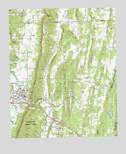
Ringgold, GA USGS Topographic Map
Click on map above to begin viewing in our Map Viewer.

This topographic map contains these locations and features:
Feature Name Type Latitude Longitude GNIS ID View Map
Anderson Memorial GardensCemeteryN34.9109°W85.1222°353209View Map
Baker RidgeRidgeN34.9958°W85.0446°1276189View Map
Broom BranchStreamN34.9315°W85.0549°327229View Map
Camp CanaanLocaleN34.9520°W85.1183°353229View Map
Cat CreekStreamN34.9462°W85.0013°327381View Map
Catoosa County Fire Department Station 1BuildingN34.9155°W85.1066°2603783View Map
Catoosa County Fire Department Station 4BuildingN34.9334°W85.0325°2604235View Map
Catoosa County Sheriff's OfficeBuildingN34.9149°W85.1149°2733623View Map
Catoosa SchoolSchoolN34.9326°W85.0327°355038View Map
Catoosa SpringsSpringN34.9145°W85.0544°327383View Map
Catoosa SpringsPopulated PlaceN34.9140°W85.0555°353231View Map
Catoosa Springs AirportAirportN34.9185°W85.0525°351884View Map
Catoosa Springs BranchStreamN34.9104°W85.0647°327384View Map
Catoosa Springs DivisionCivilN34.9073°W85.0616°1936165View Map
Catoosa Springs Post Office (historical)Post OfficeN34.9140°W85.0555°2026997View Map
Catoosa Target RangeLocaleN34.9142°W85.0638°327385View Map
Cave SpringSpringN34.9848°W85.0538°327388View Map
Cedar BluffRidgeN34.9812°W85.0611°351623View Map
Cherokee BranchStreamN34.9062°W85.0802°330902View Map
Cherokee SpringsSpringN34.9162°W85.0852°330896View Map
Cherokee ValleyBasinN34.9565°W85.0716°327428View Map
Cherokee Valley ChurchChurchN34.9323°W85.0858°355137View Map
City of RinggoldCivilN34.9140°W85.1221°2404619View Map
Cohutta RidgeRidgeN34.8840°W85.0016°327485View Map
Community ChurchChurchN34.9998°W85.0186°1322776View Map
Conley BluffRidgeN34.9334°W85.0716°335838View Map
Conley BluffRidgeN34.9492°W85.0741°326136View Map
East Chickamauga CreekStreamN34.9054°W85.0819°327731View Map
Ebenezer CemeteryCemeteryN34.8942°W85.0724°353250View Map
Ebenezer ChurchChurchN34.8940°W85.0724°355634View Map
First Baptist Church of RinggoldChurchN34.9170°W85.1116°353254View Map
Friendship ChurchChurchN34.9579°W85.0613°327890View Map
Friendship ChurchChurchN34.8776°W85.0713°355958View Map
Friendship ChurchChurchN34.9737°W85.0997°355963View Map
Gordy CemeteryCemeteryN34.9495°W85.1108°327974View Map
Gordy Memorial GardensCemeteryN34.8781°W85.0513°327975View Map
GreenwoodPopulated PlaceN34.8937°W85.0749°353267View Map
House of Prayer ChurchChurchN34.9181°W85.0741°353272View Map
Hutcheson Medical Center Emergency Medical Services RinggoldBuildingN34.9183°W85.1142°2625453View Map
Interchange 139CrossingN34.8926°W85.0747°330898View Map
Johnson BranchStreamN34.9865°W85.0638°335842View Map
Joseph Standing MonumentParkN34.9212°W85.0008°353443View Map
KeithPopulated PlaceN34.9181°W85.0419°332133View Map
Keith Baptist ChurchChurchN34.9195°W85.0419°353278View Map
Keith ValleyValleyN34.8992°W85.0330°353281View Map
Kesler HillsPopulated PlaceN34.9945°W85.1088°1312718View Map
Kettle BranchStreamN34.9504°W85.1166°328392View Map
Lake KathyReservoirN34.8967°W85.0078°328371View Map
Lake Kathy DamDamN34.8987°W85.0072°337018View Map
Lee ChapelChurchN34.9009°W85.0283°328482View Map
Little Chickamauga CreekStreamN34.9134°W85.1183°328529View Map
Little CreekStreamN34.9306°W85.0086°328534View Map
Little Tiger CreekStreamN34.9212°W85.0255°328585View Map
Mount VernonPopulated PlaceN34.9801°W85.0061°353294View Map
Mount Vernon CemeteryCemeteryN34.9795°W85.0074°353295View Map
Mount Vernon ChurchChurchN34.9790°W85.0066°328908View Map
Mount Vernon ValleyValleyN34.9309°W85.0082°353296View Map
Nellie Head Memorial ChurchChurchN34.8990°W85.0402°328981View Map
New Bethel ChurchChurchN34.9295°W85.0722°353297View Map
New Heights Baptist ChurchChurchN34.9842°W85.0969°353298View Map
Old Ringgold CemeteryCemeteryN34.9153°W85.1133°353305View Map
Parker GapGapN34.9931°W85.0766°1296823View Map
Parker Gap ChurchChurchN34.9976°W85.0891°1296826View Map
Peters BranchStreamN34.9690°W85.1127°329181View Map
Pleasant Valley ChurchChurchN34.9579°W85.1027°329269View Map
Pleasant Valley SchoolSchoolN34.9576°W85.1033°329270View Map
Rabbit ValleyValleyN34.9313°W85.1096°329347View Map
Rhinehart ValleyValleyN34.9879°W85.0605°1299279View Map
RinggoldPopulated PlaceN34.9159°W85.1091°329441View Map
Ringgold City HallBuildingN34.9179°W85.1116°353323View Map
Ringgold High SchoolSchoolN34.9227°W85.1130°353325View Map
Ringgold Middle SchoolSchoolN34.9214°W85.1099°353326View Map
Ringgold Police DepartmentBuildingN34.9172°W85.1084°2733895View Map
Ringgold Post OfficePost OfficeN34.9148°W85.1114°353328View Map
SalemPopulated PlaceN34.9570°W85.0424°332960View Map
Salem Baptist ChurchChurchN34.9567°W85.0430°353333View Map
Salem CemeteryCemeteryN34.9556°W85.0422°353334View Map
Salem Community CenterBuildingN34.9581°W85.0444°353335View Map
Salem School (historical)SchoolN34.9581°W85.0444°353336View Map
Salem ValleyBasinN34.9481°W85.0674°329573View Map
Sand MountainSummitN34.9415°W85.0613°332968View Map
ShookvillePopulated PlaceN34.9117°W85.0863°333041View Map
Smith ChapelChurchN34.9245°W85.0133°329734View Map
Smiths Chapel CemeteryCemeteryN34.9248°W85.0141°353332View Map
Stone CemeteryCemeteryN34.9078°W85.0769°353337View Map
Stone ChurchPopulated PlaceN34.9059°W85.0774°353338View Map
Stone ChurchChurchN34.9065°W85.0769°329849View Map
Sugar CreekStreamN34.9292°W85.0380°329881View Map
SugartownPopulated PlaceN34.8862°W85.0716°333156View Map
Tiger CreekStreamN34.9051°W85.0816°329986View Map
Tiger Creek Elementary SchoolSchoolN34.9041°W85.0717°353341View Map
Toney RidgeRidgeN34.9740°W85.0497°330897View Map
Town and Country Shopping CenterLocaleN34.9179°W85.1241°353342View Map
Union Academy (historical)SchoolN34.8773°W85.0716°353343View Map
Volunteer Training Site CatoosaMilitaryN34.9344°W85.0577°2512380View Map
Ward BranchStreamN34.9020°W85.0202°330157View Map
White Oak MountainSummitN34.9526°W85.0883°333418View Map
White Oak MountainSummitN34.9112°W85.1000°330609View Map
WSGC-FM (Ringgold)TowerN34.9698°W85.0861°352757View Map

Note: Coordinates in the location and feature list above are referenced to NAD83 datum.


Copyright (C) 2008-2024 Ryan Niemi / Sunset Dynamics ... All Rights Reserved