TopoQuest Logo
Do you find TopoQuest useful?
Help keep TopoQuest running and adding new maps/features by donating!
Bitcoin:  19c7KJd3qBynnjoSw5npx9KScwjBe4ifkT
Litecoin:  LXs6TkuXGGXo1vDsWCkWVdjQX94eUKd6ui
Home View Maps Find Maps Find Places Resources & Links


Ripley, Mississippi Topographic Map

USGS Map Title: Ripley, MS
USGS Map MRC: 34088F8
DRG (GeoTIFF) Download: o34088f8.tif


Neighboring USGS Topographic Map Quads:


  Whitten Town, MS  
34089G1
 

  Falkner, MS  
34088G8
 

  Peoples, MS  
34088G7
 

  Blue Mountain, MS  
34089F1
 

  Ripley, MS  
34088F8
 

  Dumas, MS  
34088F7
 

  Myrtle, MS  
34089E1
 

  Keownville, MS  
34088E8
 

  Pleasant Ridge, MS  
34088E7


Map MRC Location:

N35°
W89°
N35°
W88°
H8 H7 H6 H5 H4 H3 H2 H1
G8 G7 G6 G5 G4 G3 G2 G1
F8 F7 F6 F5 F4 F3 F2 F1
E8 E7 E6 E5 E4 E3 E2 E1
D8 D7 D6 D5 D4 D3 D2 D1
C8 C7 C6 C5 C4 C3 C2 C1
B8 B7 B6 B5 B4 B3 B2 B1
A8 A7 A6 A5 A4 A3 A2 A1
N34°
W89°
N34°
W88°

Ripley, MS USGS 1:24K Topographic Map Preview:
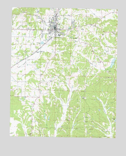
Ripley, MS USGS Topographic Map
Click on map above to begin viewing in our Map Viewer.

This topographic map contains these locations and features:
Feature Name Type Latitude Longitude GNIS ID View Map
Academy CemeteryCemeteryN34.6273°W88.9745°683490View Map
Academy ChurchChurchN34.6268°W88.9762°666138View Map
Adkins BottomValleyN34.6874°W88.9954°666160View Map
Adkins ChapelChurchN34.6851°W88.9656°666161View Map
Antioch ChurchChurchN34.6454°W88.9742°683491View Map
Antioch SchoolSchoolN34.6445°W88.9740°666340View Map
Buena VistaPopulated PlaceN34.6668°W88.9151°691736View Map
Buena Vista School (historical)SchoolN34.6640°W88.9140°706027View Map
City of RipleyCivilN34.7321°W88.9445°2404621View Map
ClarysvillePopulated PlaceN34.6440°W88.9117°691769View Map
Dixon Pond DitchCanalN34.7140°W88.9653°678350View Map
Eugene Bennett Pond DamDamN34.7484°W88.8984°682795View Map
Fellowship CemeteryCemeteryN34.6406°W88.9128°683506View Map
Fellowship ChurchChurchN34.6404°W88.9137°669943View Map
First United Pentecostal ChurchChurchN34.7362°W88.9531°683507View Map
Green BottomValleyN34.7087°W88.9612°670647View Map
Green CemeteryCemeteryN34.7184°W88.9267°670656View Map
Harden BranchStreamN34.6259°W88.8814°670898View Map
Hickory Grove ChurchChurchN34.7179°W88.9756°671170View Map
Holliday CreekStreamN34.7059°W88.8795°671296View Map
J A Booker Senior Pond DamDamN34.7284°W88.9317°682791View Map
Jacobs ChapelChurchN34.6698°W88.9128°683512View Map
Jacobs Chapel CemeteryCemeteryN34.6704°W88.9117°683513View Map
Line Street High School (historical)SchoolN34.7287°W88.9570°706046View Map
Moses ChapelChurchN34.7348°W88.9112°673866View Map
New HopePopulated PlaceN34.6793°W88.9528°683519View Map
New Hope CemeteryCemeteryN34.6762°W88.9567°683520View Map
New Hope ChurchChurchN34.6768°W88.9581°674744View Map
New York CemeteryCemeteryN34.6834°W88.8887°674861View Map
North Ripley Baptist ChurchChurchN34.7445°W88.9467°683522View Map
Orizaba (historical)LocaleN34.6529°W88.9737°706054View Map
Palmer CemeteryCemeteryN34.7076°W88.9834°683524View Map
Palmer ChurchChurchN34.7059°W88.9834°675410View Map
Palmer SchoolSchoolN34.7012°W88.9923°675411View Map
Parks CemeteryCemeteryN34.7248°W88.8973°675471View Map
Parks Chapel Presbyterian Church (historical)ChurchN34.7259°W88.8917°706055View Map
Parks Chapel School (historical)SchoolN34.7265°W88.8917°706056View Map
Phyfer CreekStreamN34.7143°W88.9659°675696View Map
Pine Hill Golf CourseLocaleN34.7293°W88.9167°683531View Map
Pleasant Hill CemeteryCemeteryN34.6418°W88.9317°676056View Map
RipleyPopulated PlaceN34.7298°W88.9506°691645View Map
Ripley CemeteryCemeteryN34.7381°W88.9464°683535View Map
Ripley Church of ChristChurchN34.7451°W88.9495°706060View Map
Ripley City Police DepartmentBuildingN34.7268°W88.9495°2754160View Map
Ripley Cumberland Presbyterian Church (historical)ChurchN34.7295°W88.9487°706061View Map
Ripley Elementary SchoolSchoolN34.7284°W88.9562°706062View Map
Ripley First Baptist ChurchChurchN34.7332°W88.9484°706063View Map
Ripley First United Methodist ChurchChurchN34.7290°W88.9492°706064View Map
Ripley High SchoolSchoolN34.7240°W88.9451°706065View Map
Ripley Male and Female Academy (historical)SchoolN34.7234°W88.9445°706066View Map
Ripley Middle SchoolSchoolN34.7237°W88.9431°706067View Map
Ripley Post OfficePost OfficeN34.7188°W88.9546°2768592View Map
Ripley Presbyterian ChurchChurchN34.7323°W88.9515°683536View Map
Ripley Primitive Baptist ChurchChurchN34.7373°W88.9626°683537View Map
Ripley Public LibraryBuildingN34.7429°W88.9478°706068View Map
Ripley Second Baptist ChurchChurchN34.7357°W88.9509°706069View Map
Ripley Sewage Lagoon DamDamN34.7201°W88.9617°682786View Map
Ripley Volunteer Fire DepartmentBuildingN34.7292°W88.9458°2665719View Map
Saint John ChurchChurchN34.7084°W88.9053°677068View Map
Smith BranchStreamN34.6554°W88.8926°677895View Map
Springdale ChurchChurchN34.7304°W88.9298°683545View Map
Tippah County CourthouseBuildingN34.7307°W88.9490°683547View Map
Tippah County HospitalHospitalN34.7392°W88.9506°706074View Map
Tippah County Lake DamDamN34.6401°W88.8751°682752View Map
Tippah County Sheriff's OfficeBuildingN34.7308°W88.9501°2754118View Map
Tippah County Vocational Technical CenterSchoolN34.7368°W88.9559°706075View Map
Tippah Memorial GardensCemeteryN34.7215°W88.9217°683548View Map
Tippah Village (historical)LocaleN34.7348°W88.9917°683549View Map
Town CreekStreamN34.7107°W88.9665°678836View Map
Trinity ChurchChurchN34.7432°W88.9323°683550View Map
WCSA-AM (Ripley)TowerN34.7209°W88.9445°680168View Map
West Hatchie Watershed 36 DamDamN34.7051°W88.8751°682781View Map
West Ripley Baptist ChurchChurchN34.7390°W88.9653°706082View Map
West Ripley ChurchChurchN34.7290°W88.9798°683553View Map
Wier ChapelChurchN34.6993°W88.8978°679667View Map
Wiers Chapel CemeteryCemeteryN34.6987°W88.8951°683556View Map
Wiers Chapel School (historical)SchoolN34.6984°W88.8939°706084View Map

Note: Coordinates in the location and feature list above are referenced to NAD83 datum.


Copyright (C) 2008-2025 Ryan Niemi / Sunset Dynamics ... All Rights Reserved