TopoQuest Logo
Do you find TopoQuest useful?
Help keep TopoQuest running and adding new maps/features by donating!
Bitcoin:  19c7KJd3qBynnjoSw5npx9KScwjBe4ifkT
Litecoin:  LXs6TkuXGGXo1vDsWCkWVdjQX94eUKd6ui
Home View Maps Find Maps Find Places Resources & Links


Ripley, New York Topographic Map

USGS Map Title: Ripley, NY
USGS Map MRC: 42079C6
DRG (GeoTIFF) Download: o42079c6.tif


Neighboring USGS Topographic Map Quads:


  Ripley, NY  
42079C6
 

  Westfield, NY  
42079C5
 

  North East, PA  
42079B7
 

  South Ripley, NY  
42079B6
 

  Sherman, NY  
42079B5


Map MRC Location:

N43°
W80°
N43°
W79°
H8 H7 H6 H5 H4 H3 H2 H1
G8 G7 G6 G5 G4 G3 G2 G1
F8 F7 F6 F5 F4 F3 F2 F1
E8 E7 E6 E5 E4 E3 E2 E1
D8 D7 D6 D5 D4 D3 D2 D1
C8 C7 C6 C5 C4 C3 C2 C1
B8 B7 B6 B5 B4 B3 B2 B1
A8 A7 A6 A5 A4 A3 A2 A1
N42°
W80°
N42°
W79°

Ripley, NY USGS 1:24K Topographic Map Preview:
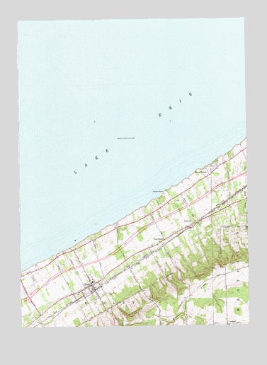
Ripley, NY USGS Topographic Map
Click on map above to begin viewing in our Map Viewer.

This topographic map contains these locations and features:
Feature Name Type Latitude Longitude GNIS ID View Map
East RipleyPopulated PlaceN42.2839°W79.6725°949227View Map
East Ripley CemeteryCemeteryN42.2841°W79.6715°2554260View Map
Endpoint Toll PlazaLocaleN42.2655°W79.7386°2615143View Map
First Baptist ChurchChurchN42.2564°W79.7017°2437637View Map
First Presbyterian ChurchChurchN42.2664°W79.7108°2437638View Map
ForsythPopulated PlaceN42.2923°W79.6537°950458View Map
Foursquare Gospel ChurchChurchN42.2725°W79.6995°2616037View Map
Lakeside CampgroundLocaleN42.3190°W79.6363°2615217View Map
LombardPopulated PlaceN42.2503°W79.6367°955815View Map
McIntosh FarmsLocaleN42.2903°W79.6936°2542397View Map
Quincy Rural CemeteryCemeteryN42.2634°W79.7025°962103View Map
RipleyPopulated PlaceN42.2670°W79.7106°962542View Map
Ripley Airport (historical)AirportN42.2695°W79.7425°973420View Map
Ripley BeachBeachN42.3042°W79.6706°962543View Map
Ripley Census Designated PlaceCensusN42.2657°W79.7123°2389753View Map
Ripley Central SchoolSchoolN42.2681°W79.7103°2437677View Map
Ripley Fire Department Station 1BuildingN42.2659°W79.7101°2700949View Map
Ripley Foursquare ChurchChurchN42.2686°W79.7053°2437639View Map
Ripley Free LibraryBuildingN42.2658°W79.7125°2617393View Map
Ripley Post OfficePost OfficeN42.2669°W79.7111°2618089View Map
Saint Thomas More Roman Catholic ChurchChurchN42.2689°W79.7044°2437640View Map
Shore HavenPopulated PlaceN42.3139°W79.6417°965156View Map
United Methodist Church of RipleyChurchN42.2658°W79.7125°2617132View Map

Note: Coordinates in the location and feature list above are referenced to NAD83 datum.


Copyright (C) 2008-2025 Ryan Niemi / Sunset Dynamics ... All Rights Reserved