TopoQuest Logo
Do you find TopoQuest useful?
Help keep TopoQuest running and adding new maps/features by donating!
Bitcoin:  19c7KJd3qBynnjoSw5npx9KScwjBe4ifkT
Litecoin:  LXs6TkuXGGXo1vDsWCkWVdjQX94eUKd6ui
Home View Maps Find Maps Find Places Resources & Links


South Ripley, New York Topographic Map

USGS Map Title: South Ripley, NY
USGS Map MRC: 42079B6
DRG (GeoTIFF) Download: o42079b6.tif


Neighboring USGS Topographic Map Quads:


  Ripley, NY  
42079C6
 

  Westfield, NY  
42079C5
 

  North East, PA  
42079B7
 

  South Ripley, NY  
42079B6
 

  Sherman, NY  
42079B5
 

  Wattsburg, PA  
42079A7
 

  Clymer, NY  
42079A6
 

  North Clymer, NY  
42079A5


Map MRC Location:

N43°
W80°
N43°
W79°
H8 H7 H6 H5 H4 H3 H2 H1
G8 G7 G6 G5 G4 G3 G2 G1
F8 F7 F6 F5 F4 F3 F2 F1
E8 E7 E6 E5 E4 E3 E2 E1
D8 D7 D6 D5 D4 D3 D2 D1
C8 C7 C6 C5 C4 C3 C2 C1
B8 B7 B6 B5 B4 B3 B2 B1
A8 A7 A6 A5 A4 A3 A2 A1
N42°
W80°
N42°
W79°

South Ripley, NY USGS 1:24K Topographic Map Preview:
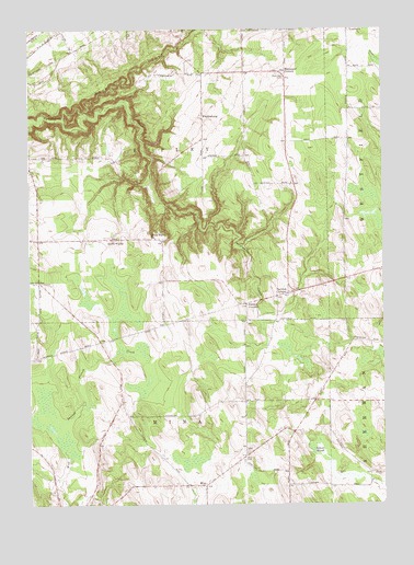
South Ripley, NY USGS Topographic Map
Click on map above to begin viewing in our Map Viewer.

This topographic map contains these locations and features:
Feature Name Type Latitude Longitude GNIS ID View Map
Beaver MarshSwampN42.1389°W79.6481°943397View Map
Belson CreekStreamN42.2284°W79.7312°943643View Map
Blueberry Sky Farm WineryBuildingN42.1933°W79.7239°2542387View Map
Christian Missionary Alliance ChurchChurchN42.1306°W79.6882°2615739View Map
MinaPopulated PlaceN42.1301°W79.6881°957372View Map
Mina CemeteryCemeteryN42.1367°W79.6743°957373View Map
Minnegar CornersLocaleN42.2389°W79.6592°957419View Map
Pratt's Eastern Divide AirportAirportN42.1493°W79.6861°978297View Map
Raters CornersLocaleN42.1781°W79.6731°962204View Map
Ripley Fire District Station 2BuildingN42.1951°W79.7269°2734706View Map
Sheldon CornersLocaleN42.1798°W79.6625°965014View Map
South RipleyPopulated PlaceN42.1951°W79.7206°965858View Map
South Ripley CemeteryCemeteryN42.1977°W79.7098°2554266View Map
South Ripley ChurchChurchN42.1956°W79.7056°965859View Map
Town of MinaCivilN42.1299°W79.7030°979222View Map
Town of RipleyCivilN42.2329°W79.6992°979424View Map
WattlesburgPopulated PlaceN42.2270°W79.6887°968933View Map

Note: Coordinates in the location and feature list above are referenced to NAD83 datum.


Copyright (C) 2008-2025 Ryan Niemi / Sunset Dynamics ... All Rights Reserved