TopoQuest Logo
Do you find TopoQuest useful?
Help keep TopoQuest running and adding new maps/features by donating!
Bitcoin:  19c7KJd3qBynnjoSw5npx9KScwjBe4ifkT
Litecoin:  LXs6TkuXGGXo1vDsWCkWVdjQX94eUKd6ui
Home View Maps Find Maps Find Places Resources & Links


North East, Pennsylvania Topographic Map

USGS Map Title: North East, PA
USGS Map MRC: 42079B7
DRG (GeoTIFF) Download: o42079b7.tif


Neighboring USGS Topographic Map Quads:


  Ripley, NY  
42079C6
 

  Harborcreek, PA  
42079B8
 

  North East, PA  
42079B7
 

  South Ripley, NY  
42079B6
 

  Hammett, PA  
42079A8
 

  Wattsburg, PA  
42079A7
 

  Clymer, NY  
42079A6


Map MRC Location:

N43°
W80°
N43°
W79°
H8 H7 H6 H5 H4 H3 H2 H1
G8 G7 G6 G5 G4 G3 G2 G1
F8 F7 F6 F5 F4 F3 F2 F1
E8 E7 E6 E5 E4 E3 E2 E1
D8 D7 D6 D5 D4 D3 D2 D1
C8 C7 C6 C5 C4 C3 C2 C1
B8 B7 B6 B5 B4 B3 B2 B1
A8 A7 A6 A5 A4 A3 A2 A1
N42°
W80°
N42°
W79°

North East, PA USGS 1:24K Topographic Map Preview:
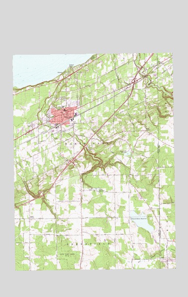
North East, PA USGS Topographic Map
Click on map above to begin viewing in our Map Viewer.

This topographic map contains these locations and features:
Feature Name Type Latitude Longitude GNIS ID View Map
Borough of North EastCivilN42.2134°W79.8334°1215216View Map
Camp Cayuga DamDamN42.1722°W79.8139°1195885View Map
Carris Fruit FarmLocaleN42.2333°W79.7564°2542388View Map
Crescent Hose Company Station 21BuildingN42.2169°W79.8327°2644858View Map
Delhill CornersPopulated PlaceN42.1551°W79.8631°1173132View Map
Earl C Davis Elementary SchoolSchoolN42.2201°W79.8320°1211462View Map
Eaton DamDamN42.1467°W79.7664°1195884View Map
FreeportPopulated PlaceN42.2398°W79.8328°1175216View Map
Freeport Yacht ClubLocaleN42.2412°W79.8337°1213432View Map
Fuller Hose Company North East Fire Department Erie County Station 20BuildingN42.2117°W79.8370°2645302View Map
Gage GulfValleyN42.2298°W79.7582°950835View Map
Gibson ParkParkN42.2162°W79.8350°1175592View Map
Grahamville ReservoirReservoirN42.1921°W79.7861°1175926View Map
Grahamville Reservoir DamDamN42.1834°W79.7881°1195886View Map
Greenfield ChurchChurchN42.1326°W79.8637°1176153View Map
Heard Memorial SchoolSchoolN42.2178°W79.8328°1176726View Map
Howard Eaton ReservoirReservoirN42.1528°W79.7761°1209195View Map
Immanuel United Methodist ChurchChurchN42.2189°W79.8320°1796302View Map
Interchange 11CrossingN42.1876°W79.8300°1209148View Map
Interchange 12CrossingN42.2339°W79.7798°1209151View Map
Kerrs CornersPopulated PlaceN42.2053°W79.7714°1178410View Map
Lake View Country ClubLocaleN42.1806°W79.8220°1213257View Map
Merryhurst CollegeSchoolN42.2195°W79.8353°1186423View Map
North EastPopulated PlaceN42.2156°W79.8342°1182570View Map
North East CemeteryCemeteryN42.2095°W79.8564°1182776View Map
North East Christian AcademySchoolN42.1920°W79.8370°1796295View Map
North East High SchoolSchoolN42.2245°W79.8295°1211438View Map
North East High School (historical)SchoolN42.2178°W79.8348°1197574View Map
North East Middle SchoolSchoolN42.2238°W79.8269°1796301View Map
North East Police DepartmentBuildingN42.2173°W79.8315°2777004View Map
North East Post OfficePost OfficeN42.2148°W79.8346°2772886View Map
Northville CemeteryCemeteryN42.2425°W79.7648°1182680View Map
Orchard BeachPopulated PlaceN42.2414°W79.8287°1183019View Map
Papermill Hollow Airport (historical)AirportN42.2167°W79.8164°1194334View Map
Phillips CemeteryCemeteryN42.2325°W79.7837°1183670View Map
Praise Cathedral Church of GodChurchN42.1920°W79.8370°1796296View Map
Saint Gregorys SchoolSchoolN42.2131°W79.8442°1185985View Map
Saint Peters ChurchChurchN42.2259°W79.8339°1796298View Map
Sixteenmile CreekStreamN42.2428°W79.8320°1187741View Map
Smith ReservoirReservoirN42.1718°W79.8108°1187884View Map
State Game Lands Number 163ParkN42.1334°W79.8331°1208003View Map
State LinePopulated PlaceN42.2445°W79.7587°966272View Map
Township of North EastCivilN42.2000°W79.8250°1216421View Map
WHYP-AM (North East)TowerN42.2014°W79.8617°1200521View Map
WRKT-FM 101TowerN42.2017°W79.8623°1796299View Map
WRTS-FM 104TowerN42.2017°W79.8620°1796300View Map

Note: Coordinates in the location and feature list above are referenced to NAD83 datum.


Copyright (C) 2008-2025 Ryan Niemi / Sunset Dynamics ... All Rights Reserved