TopoQuest Logo
Do you find TopoQuest useful?
Help keep TopoQuest running and adding new maps/features by donating!
Bitcoin:  19c7KJd3qBynnjoSw5npx9KScwjBe4ifkT
Litecoin:  LXs6TkuXGGXo1vDsWCkWVdjQX94eUKd6ui
Home View Maps Find Maps Find Places Resources & Links


Riverton, Louisiana Topographic Map

USGS Map Title: Riverton, LA
USGS Map MRC: 32092B1
DRG (GeoTIFF) Download: o32092b1.tif


Neighboring USGS Topographic Map Quads:


  Luna, LA  
32092C2
 

  Bosco, LA  
32092C1
 

  Gilleyville, LA  
32091C8
 

  Blankston, LA  
32092B2
 

  Riverton, LA  
32092B1
 

  Hebert, LA  
32091B8
 

  Clark, LA  
32092A2
 

  Columbia, LA  
32092A1
 

  Mason, LA  
32091A8


Map MRC Location:

N33°
W93°
N33°
W92°
H8 H7 H6 H5 H4 H3 H2 H1
G8 G7 G6 G5 G4 G3 G2 G1
F8 F7 F6 F5 F4 F3 F2 F1
E8 E7 E6 E5 E4 E3 E2 E1
D8 D7 D6 D5 D4 D3 D2 D1
C8 C7 C6 C5 C4 C3 C2 C1
B8 B7 B6 B5 B4 B3 B2 B1
A8 A7 A6 A5 A4 A3 A2 A1
N32°
W93°
N32°
W92°

Riverton, LA USGS 1:24K Topographic Map Preview:
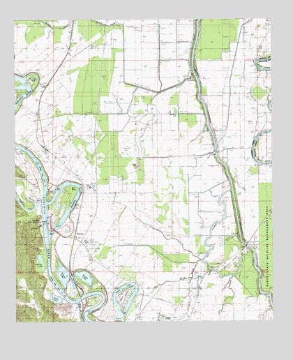
Riverton, LA USGS Topographic Map
Click on map above to begin viewing in our Map Viewer.

This topographic map contains these locations and features:
Feature Name Type Latitude Longitude GNIS ID View Map
Ballard BayouStreamN32.2474°W92.0718°556550View Map
Barr PointCapeN32.1813°W92.1010°540725View Map
Barr Point LandingLocaleN32.1815°W92.0985°546284View Map
Bayou deCheneStreamN32.1324°W92.0951°532408View Map
Bell BayouGutN32.1413°W92.0529°532904View Map
Bellevue Baptist ChurchChurchN32.1385°W92.0362°553592View Map
Bethany Baptist ChurchChurchN32.2324°W92.0079°553612View Map
Bethany CemeteryCemeteryN32.2329°W92.0090°542380View Map
Brushy LakeLakeN32.1436°W92.0920°553813View Map
Brushy Lake DamDamN32.1429°W92.0910°556834View Map
Caldwell Parish AirportAirportN32.1263°W92.0544°556556View Map
Call LandingLocaleN32.1802°W92.1049°546290View Map
Cane HillSummitN32.1896°W92.0649°543052View Map
Cane Hill Gas FieldOilfieldN32.1835°W92.0624°542384View Map
Columbia Closure DamDamN32.1685°W92.1101°556883View Map
Columbia Lock and DamDamN32.1668°W92.1112°540718View Map
CoreyPopulated PlaceN32.2227°W92.1101°541076View Map
Davis LakeLakeN32.1347°W92.0689°554192View Map
Duchene CemeteryCemeteryN32.2140°W92.0029°554282View Map
Eagle Lake (historical)LakeN32.1629°W92.1118°554309View Map
Ferrand LakeLakeN32.2265°W92.1141°554394View Map
Good Hope School (historical)SchoolN32.2107°W92.1140°540732View Map
Hearn IslandIslandN32.1349°W92.0724°535589View Map
Hebert School (historical)SchoolN32.1960°W92.0107°540733View Map
Hebert Volunteer Fire DepartmentBuildingN32.2002°W92.0088°2672908View Map
Horseshoe LakeLakeN32.1762°W92.1239°554780View Map
Indian SloughGutN32.1399°W92.0401°540734View Map
Joe Powell LandingLocaleN32.1960°W92.1182°546315View Map
Kenneys Airstrip (historical)AirportN32.1435°W92.0362°1632670View Map
KLTM-TV (Monroe)TowerN32.1960°W92.0696°1632501View Map
KNOE-FM (Monroe)TowerN32.1960°W92.0696°1632469View Map
KNOE-TV (Monroe)TowerN32.1960°W92.0696°1632502View Map
Lock and Dam Number Three (historical)DamN32.1788°W92.1054°555113View Map
Marsh LandingLocaleN32.1965°W92.1246°546325View Map
McEnery LakeLakeN32.1498°W92.1127°556533View Map
Old Channel Bayou LafourcheGutN32.1615°W92.0304°537825View Map
Parish Governing Authority District 1CivilN32.1840°W92.0179°1929728View Map
Perrins IslandIslandN32.1490°W92.0199°538076View Map
RivertonPopulated PlaceN32.1607°W92.0962°543625View Map
Riverton LakeLakeN32.1607°W92.1082°555807View Map
Saint Alban LandingLocaleN32.1804°W92.1112°546341View Map
Sinope LandingLocaleN32.2182°W92.1229°546343View Map
Smithland LandingLocaleN32.1438°W92.1087°546344View Map
Swim LakeLakeN32.1353°W92.1056°556192View Map
Volman LakeLakeN32.1448°W92.1023°556338View Map
Wheeler BayouGutN32.1752°W92.1182°540349View Map
Wild Boar LakeLakeN32.2115°W92.0468°556417View Map

Note: Coordinates in the location and feature list above are referenced to NAD83 datum.


Copyright (C) 2008-2025 Ryan Niemi / Sunset Dynamics ... All Rights Reserved