TopoQuest Logo
Do you find TopoQuest useful?
Help keep TopoQuest running and adding new maps/features by donating!
Bitcoin:  19c7KJd3qBynnjoSw5npx9KScwjBe4ifkT
Litecoin:  LXs6TkuXGGXo1vDsWCkWVdjQX94eUKd6ui
Home View Maps Find Maps Find Places Resources & Links


Roaring Spring, Kentucky Topographic Map

USGS Map Title: Roaring Spring, KY
USGS Map MRC: 36087F6
DRG (GeoTIFF) Download: o36087f6.tif


Neighboring USGS Topographic Map Quads:


  Cadiz, KY  
36087G7
 

  Caledonia, KY  
36087G6
 

  Church Hill, KY  
36087G5
 

  Johnson Hollow, KY  
36087F7
 

  Roaring Spring, KY  
36087F6
 

  Herndon, KY  
36087F5
 

  Bumpus Mills, TN  
36087E7
 

  Indian Mound, TN  
36087E6
 

  Woodlawn, TN  
36087E5


Map MRC Location:

N37°
W88°
N37°
W87°
H8 H7 H6 H5 H4 H3 H2 H1
G8 G7 G6 G5 G4 G3 G2 G1
F8 F7 F6 F5 F4 F3 F2 F1
E8 E7 E6 E5 E4 E3 E2 E1
D8 D7 D6 D5 D4 D3 D2 D1
C8 C7 C6 C5 C4 C3 C2 C1
B8 B7 B6 B5 B4 B3 B2 B1
A8 A7 A6 A5 A4 A3 A2 A1
N36°
W88°
N36°
W87°

Roaring Spring, KY USGS 1:24K Topographic Map Preview:
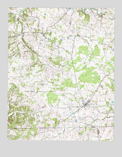
Roaring Spring, KY USGS Topographic Map
Click on map above to begin viewing in our Map Viewer.

This topographic map contains these locations and features:
Feature Name Type Latitude Longitude GNIS ID View Map
Antioch ChurchChurchN36.6642°W87.6625°485970View Map
Carter CemeteryCemeteryN36.7400°W87.6272°489000View Map
City of LaFayetteCivilN36.6599°W87.6584°2404851View Map
Corinth Missionary Baptist ChurchChurchN36.7383°W87.7391°2632184View Map
Dawson CemeteryCemeteryN36.7437°W87.6828°490686View Map
Elliott CemeteryCemeteryN36.6584°W87.6275°491707View Map
Flat Lick (historical)Populated PlaceN36.7150°W87.6733°2742888View Map
Fort Campbell DivisionCivilN36.6784°W87.7446°2583513View Map
Hester CemeteryCemeteryN36.6503°W87.6725°494098View Map
La FayettePopulated PlaceN36.6584°W87.6583°495883View Map
Lafayette Volunteer Fire DepartmentBuildingN36.6609°W87.6604°2636938View Map
Little River Baptist ChurchChurchN36.7443°W87.6406°496839View Map
Powell CemeteryCemeteryN36.6523°W87.6683°501236View Map
Roaring SpringPopulated PlaceN36.7256°W87.7070°502041View Map
Roaring Springs Fire DepartmentBuildingN36.7232°W87.7069°2636955View Map
Simmons CemeteryCemeteryN36.7245°W87.6681°503521View Map
Skinner CreekStreamN36.7438°W87.7414°503615View Map
Weavers BranchStreamN36.6273°W87.7056°1309014View Map
Weavers CreekStreamN36.6392°W87.6583°506321View Map
Weavers CreekStreamN36.6370°W87.6647°1274001View Map
Weavers Store (historical)LocaleN36.6325°W87.7084°1309015View Map

Note: Coordinates in the location and feature list above are referenced to NAD83 datum.


Copyright (C) 2008-2024 Ryan Niemi / Sunset Dynamics ... All Rights Reserved