TopoQuest Logo
Do you find TopoQuest useful?
Help keep TopoQuest running and adding new maps/features by donating!
Bitcoin:  19c7KJd3qBynnjoSw5npx9KScwjBe4ifkT
Litecoin:  LXs6TkuXGGXo1vDsWCkWVdjQX94eUKd6ui
Home View Maps Find Maps Find Places Resources & Links


Roberts, Alabama Topographic Map

USGS Map Title: Roberts, AL
USGS Map MRC: 31086A8
DRG (GeoTIFF) Download: o31086a8.tif


Neighboring USGS Topographic Map Quads:


  Brewton North, AL  
31087B1
 

  Shipps Creek, AL  
31086B8
 

  Damascus, AL  
31086B7
 

  Brewton South, AL  
31087A1
 

  Roberts, AL  
31086A8
 

  Parker Springs, AL  
31086A7
 

  Fidelis, FL  
30087H1
 

  McLellan, FL  
30086H8
 

  Hurricane Lake, FL  
30086H7


Map MRC Location:

N32°
W87°
N32°
W86°
H8 H7 H6 H5 H4 H3 H2 H1
G8 G7 G6 G5 G4 G3 G2 G1
F8 F7 F6 F5 F4 F3 F2 F1
E8 E7 E6 E5 E4 E3 E2 E1
D8 D7 D6 D5 D4 D3 D2 D1
C8 C7 C6 C5 C4 C3 C2 C1
B8 B7 B6 B5 B4 B3 B2 B1
A8 A7 A6 A5 A4 A3 A2 A1
N31°
W87°
N31°
W86°

Roberts, AL USGS 1:24K Topographic Map Preview:
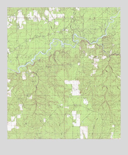
Roberts, AL USGS Topographic Map
Click on map above to begin viewing in our Map Viewer.

This topographic map contains these locations and features:
Feature Name Type Latitude Longitude GNIS ID View Map
Bethea Mill CreekStreamN31.0991°W86.9250°114004View Map
Bethel CemeteryCemeteryN31.0410°W86.9308°133751View Map
Bethel ChurchChurchN31.0407°W86.9311°133752View Map
Bethel ChurchChurchN31.0302°W86.9372°133753View Map
Crossway CreekStreamN31.1016°W86.9200°133767View Map
Dexter Hill School (historical)SchoolN31.0402°W86.9791°133778View Map
East Escambia DivisionCivilN31.1152°W86.8905°161612View Map
East Prong Silas CreekStreamN31.0793°W86.8872°161663View Map
First Open Bible ChurchChurchN31.0827°W86.9961°133792View Map
Fuqua CemeteryCemeteryN31.0330°W86.9433°133803View Map
Harold Mill (historical)LocaleN31.0743°W86.9964°133806View Map
Hickory Head BranchStreamN31.0702°W86.8880°163141View Map
May Creek CemeteryCemeteryN31.1121°W86.9543°133829View Map
May Creek United Methodist ChurchChurchN31.1124°W86.9539°155973View Map
Maye CreekStreamN31.0957°W86.9491°133955View Map
Mayo Mill CreekStreamN31.0685°W86.9855°133830View Map
Mayos Toll Bridge (historical)BridgeN31.0699°W86.9861°133831View Map
Parker BridgeBridgeN31.0905°W86.9236°133850View Map
Ridge Road Volunteer Fire DepartmentBuildingN31.1169°W86.9966°2691077View Map
RobertsPopulated PlaceN31.0818°W86.8889°125692View Map
Rock HillPopulated PlaceN31.1166°W86.9991°156979View Map
Rock Hill Assembly of God ChurchChurchN31.1157°W86.9902°155792View Map
School House CreekStreamN31.0810°W86.8755°163038View Map
Second Shady Grove Baptist ChurchChurchN31.1230°W86.9475°155950View Map
Shady Grove ChurchChurchN31.1163°W86.9369°133877View Map
Silas CreekStreamN31.0916°W86.9019°154080View Map
West Prong Silas CreekStreamN31.0793°W86.8872°163145View Map

Note: Coordinates in the location and feature list above are referenced to NAD83 datum.


Copyright (C) 2008-2025 Ryan Niemi / Sunset Dynamics ... All Rights Reserved