TopoQuest Logo
Do you find TopoQuest useful?
Help keep TopoQuest running and adding new maps/features by donating!
Bitcoin:  19c7KJd3qBynnjoSw5npx9KScwjBe4ifkT
Litecoin:  LXs6TkuXGGXo1vDsWCkWVdjQX94eUKd6ui
Home View Maps Find Maps Find Places Resources & Links


Parker Springs, Alabama Topographic Map

USGS Map Title: Parker Springs, AL
USGS Map MRC: 31086A7
DRG (GeoTIFF) Download: o31086a7.tif


Neighboring USGS Topographic Map Quads:


  Shipps Creek, AL  
31086B8
 

  Damascus, AL  
31086B7
 

  Dixie, AL  
31086B6
 

  Roberts, AL  
31086A8
 

  Parker Springs, AL  
31086A7
 

  Bradley, AL  
31086A6
 

  McLellan, FL  
30086H8
 

  Hurricane Lake, FL  
30086H7
 

  Blackman, FL  
30086H6


Map MRC Location:

N32°
W87°
N32°
W86°
H8 H7 H6 H5 H4 H3 H2 H1
G8 G7 G6 G5 G4 G3 G2 G1
F8 F7 F6 F5 F4 F3 F2 F1
E8 E7 E6 E5 E4 E3 E2 E1
D8 D7 D6 D5 D4 D3 D2 D1
C8 C7 C6 C5 C4 C3 C2 C1
B8 B7 B6 B5 B4 B3 B2 B1
A8 A7 A6 A5 A4 A3 A2 A1
N31°
W87°
N31°
W86°

Parker Springs, AL USGS 1:24K Topographic Map Preview:
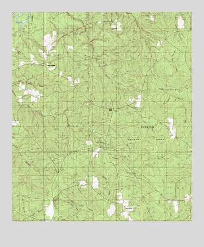
Parker Springs, AL USGS Topographic Map
Click on map above to begin viewing in our Map Viewer.

This topographic map contains these locations and features:
Feature Name Type Latitude Longitude GNIS ID View Map
AlafloraLocaleN31.0141°W86.8463°161646View Map
Bay BranchStreamN31.0718°W86.7513°161648View Map
Beader BranchStreamN31.0802°W86.7555°161649View Map
Big BrookStreamN31.0066°W86.8205°163132View Map
Brackens DitchStreamN31.0816°W86.8497°163102View Map
Camp AlexLocaleN31.1155°W86.8052°163099View Map
Camp WilliamsLocaleN31.0924°W86.8508°161653View Map
East Prong Rock CreekStreamN31.0210°W86.7694°161662View Map
Elim CemeteryCemeteryN31.0929°W86.8694°161664View Map
First Marietta Missionary Baptist ChurchChurchN31.0926°W86.8700°161665View Map
Floyd CreekStreamN31.1249°W86.8464°161667View Map
Henley RobertsLocaleN31.0674°W86.8044°161671View Map
Hog Pen BranchStreamN31.0946°W86.7638°161673View Map
Horse BranchStreamN31.0743°W86.7527°161676View Map
Leon Brooks Hines LakeReservoirN31.0307°W86.8317°163037View Map
Little CreekStreamN31.0096°W86.8230°161678View Map
Mancill CemeteryCemeteryN31.1004°W86.7708°161682View Map
Mile BranchStreamN31.1249°W86.7586°161686View Map
New Bethel Methodist Episcopal ChurchChurchN31.0424°W86.8666°137049View Map
Parker SpringsPopulated PlaceN31.0549°W86.8097°160343View Map
Parker Springs LookoutLocaleN31.0443°W86.8091°164512View Map
Rock CreekPopulated PlaceN31.0088°W86.7972°161688View Map
Rock Creek Assembly of God ChurchChurchN31.0038°W86.7933°161689View Map
Rock Creek ChurchChurchN31.0085°W86.7966°161690View Map
Rock Creek Church CemeteryCemeteryN31.0085°W86.7963°161691View Map
Rock Creek Church CemeteryCemeteryN31.0041°W86.7936°161692View Map
Sam McGowin CemeteryCemeteryN31.1174°W86.8189°162269View Map
Sandy Hill BranchStreamN31.0296°W86.7886°161694View Map
Wagon Body BranchStreamN31.0363°W86.7927°161699View Map
West Prong Rock CreekStreamN31.0210°W86.7694°161700View Map
Wiggins BranchStreamN31.0018°W86.8658°163146View Map

Note: Coordinates in the location and feature list above are referenced to NAD83 datum.


Copyright (C) 2008-2025 Ryan Niemi / Sunset Dynamics ... All Rights Reserved