TopoQuest Logo
Do you find TopoQuest useful?
Help keep TopoQuest running and adding new maps/features by donating!
Bitcoin:  19c7KJd3qBynnjoSw5npx9KScwjBe4ifkT
Litecoin:  LXs6TkuXGGXo1vDsWCkWVdjQX94eUKd6ui
Home View Maps Find Maps Find Places Resources & Links


Roberts Corner, Michigan Topographic Map

USGS Map Title: Roberts Corner, MI
USGS Map MRC: 46085C4
DRG (GeoTIFF) Download: o46085c4.tif


Neighboring USGS Topographic Map Quads:


  Auger Lake, MI  
46085D5
 

  Roy Lake, MI  
46085D4
 

  Gimlet Creek, MI  
46085D3
 

  Newberry, MI  
46085C5
 

  Roberts Corner, MI  
46085C4
 

  Soo Junction, MI  
46085C3
 

  Millecoquins, MI  
46085B5
 

  Gilchrist, MI  
46085B4
 

  Garnet, MI  
46085B3


Map MRC Location:

N47°
W86°
N47°
W85°
H8 H7 H6 H5 H4 H3 H2 H1
G8 G7 G6 G5 G4 G3 G2 G1
F8 F7 F6 F5 F4 F3 F2 F1
E8 E7 E6 E5 E4 E3 E2 E1
D8 D7 D6 D5 D4 D3 D2 D1
C8 C7 C6 C5 C4 C3 C2 C1
B8 B7 B6 B5 B4 B3 B2 B1
A8 A7 A6 A5 A4 A3 A2 A1
N46°
W86°
N46°
W85°

Roberts Corner, MI USGS 1:24K Topographic Map Preview:
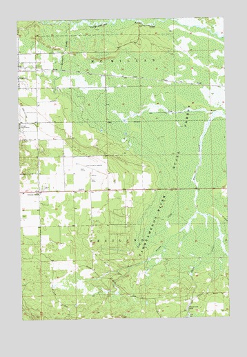
Roberts Corner, MI USGS Topographic Map
Click on map above to begin viewing in our Map Viewer.

This topographic map contains these locations and features:
Feature Name Type Latitude Longitude GNIS ID View Map
Big DitchCanalN46.3358°W85.4157°621314View Map
First CreekStreamN46.3083°W85.3943°626004View Map
Great Northern Trailer CourtPopulated PlaceN46.3050°W85.4856°2360378View Map
LencelPopulated PlaceN46.3503°W85.4296°1617680View Map
Lencel StationLocaleN46.3503°W85.4294°2360451View Map
Living Water Assembly of God ChurchChurchN46.3328°W85.4881°2360433View Map
Luce County AirportAirportN46.3111°W85.4564°1624068View Map
McPhees LandingPopulated PlaceN46.3722°W85.4201°1617714View Map
Roberts CornerPopulated PlaceN46.3033°W85.4887°636038View Map
Sault Tribe Community Health CenterHospitalN46.3039°W85.4361°2360350View Map
Third CreekStreamN46.2939°W85.3937°1614729View Map
Third Creek PondLakeN46.2544°W85.3998°1614730View Map
Thirtynine CreekStreamN46.3725°W85.4640°1614745View Map
Township of PentlandCivilN46.2887°W85.4266°1626892View Map
West Branch Sage RiverStreamN46.3356°W85.3807°1616065View Map

Note: Coordinates in the location and feature list above are referenced to NAD83 datum.


Copyright (C) 2008-2024 Ryan Niemi / Sunset Dynamics ... All Rights Reserved