TopoQuest Logo
Do you find TopoQuest useful?
Help keep TopoQuest running and adding new maps/features by donating!
Bitcoin:  19c7KJd3qBynnjoSw5npx9KScwjBe4ifkT
Litecoin:  LXs6TkuXGGXo1vDsWCkWVdjQX94eUKd6ui
Home View Maps Find Maps Find Places Resources & Links


Millecoquins, Michigan Topographic Map

USGS Map Title: Millecoquins, MI
USGS Map MRC: 46085B5
DRG (GeoTIFF) Download: o46085b5.tif


Neighboring USGS Topographic Map Quads:


  McMillan, MI  
46085C6
 

  Newberry, MI  
46085C5
 

  Roberts Corner, MI  
46085C4
 

  Curtis East, MI  
46085B6
 

  Millecoquins, MI  
46085B5
 

  Gilchrist, MI  
46085B4
 

  Gould City, MI  
46085A6
 

  Engadine, MI  
46085A5
 

  Naubinway, MI  
46085A4


Map MRC Location:

N47°
W86°
N47°
W85°
H8 H7 H6 H5 H4 H3 H2 H1
G8 G7 G6 G5 G4 G3 G2 G1
F8 F7 F6 F5 F4 F3 F2 F1
E8 E7 E6 E5 E4 E3 E2 E1
D8 D7 D6 D5 D4 D3 D2 D1
C8 C7 C6 C5 C4 C3 C2 C1
B8 B7 B6 B5 B4 B3 B2 B1
A8 A7 A6 A5 A4 A3 A2 A1
N46°
W86°
N46°
W85°

Millecoquins, MI USGS 1:24K Topographic Map Preview:
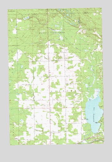
Millecoquins, MI USGS Topographic Map
Click on map above to begin viewing in our Map Viewer.

This topographic map contains these locations and features:
Feature Name Type Latitude Longitude GNIS ID View Map
Bethlehem ChurchChurchN46.1872°W85.5721°621237View Map
Bethlehem Lutheran CemeteryCemeteryN46.1839°W85.5722°2359959View Map
Chases PointCapeN46.1450°W85.5068°623130View Map
Cold CreekStreamN46.1567°W85.5037°623563View Map
Doe CreekStreamN46.1364°W85.5509°624737View Map
Furlong CreekStreamN46.1397°W85.5168°626575View Map
Hagler CreekStreamN46.1631°W85.5220°627600View Map
Harris CreekStreamN46.1675°W85.5198°627836View Map
Jocko CreekStreamN46.1958°W85.5148°629288View Map
Maloney CreekStreamN46.2008°W85.5162°631366View Map
McAlpine CreekStreamN46.2167°W85.5409°631795View Map
McAlpine PondLakeN46.2419°W85.5987°631796View Map
Milk CreekStreamN46.2086°W85.5159°632311View Map
MillecoquinsPopulated PlaceN46.1353°W85.5076°632353View Map
Millecoquins LakeLakeN46.1524°W85.5131°632354View Map
Millecoquins PondLakeN46.2376°W85.5309°632356View Map
Skunk CreekStreamN46.2144°W85.5382°638075View Map
Upper Millecoquins RiverStreamN46.1656°W85.5187°632358View Map

Note: Coordinates in the location and feature list above are referenced to NAD83 datum.


Copyright (C) 2008-2025 Ryan Niemi / Sunset Dynamics ... All Rights Reserved