TopoQuest Logo
Do you find TopoQuest useful?
Help keep TopoQuest running and adding new maps/features by donating!
Bitcoin:  19c7KJd3qBynnjoSw5npx9KScwjBe4ifkT
Litecoin:  LXs6TkuXGGXo1vDsWCkWVdjQX94eUKd6ui
Home View Maps Find Maps Find Places Resources & Links


Gilchrist, Michigan Topographic Map

USGS Map Title: Gilchrist, MI
USGS Map MRC: 46085B4
DRG (GeoTIFF) Download: o46085b4.tif


Neighboring USGS Topographic Map Quads:


  Newberry, MI  
46085C5
 

  Roberts Corner, MI  
46085C4
 

  Soo Junction, MI  
46085C3
 

  Millecoquins, MI  
46085B5
 

  Gilchrist, MI  
46085B4
 

  Garnet, MI  
46085B3
 

  Engadine, MI  
46085A5
 

  Naubinway, MI  
46085A4
 

  Hog Island Point, MI  
46085A3


Map MRC Location:

N47°
W86°
N47°
W85°
H8 H7 H6 H5 H4 H3 H2 H1
G8 G7 G6 G5 G4 G3 G2 G1
F8 F7 F6 F5 F4 F3 F2 F1
E8 E7 E6 E5 E4 E3 E2 E1
D8 D7 D6 D5 D4 D3 D2 D1
C8 C7 C6 C5 C4 C3 C2 C1
B8 B7 B6 B5 B4 B3 B2 B1
A8 A7 A6 A5 A4 A3 A2 A1
N46°
W86°
N46°
W85°

Gilchrist, MI USGS 1:24K Topographic Map Preview:
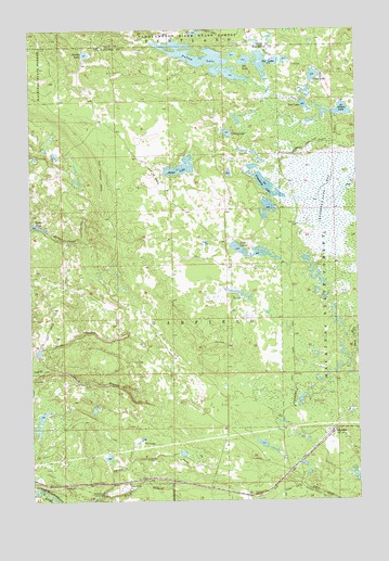
Gilchrist, MI USGS Topographic Map
Click on map above to begin viewing in our Map Viewer.

This topographic map contains these locations and features:
Feature Name Type Latitude Longitude GNIS ID View Map
Cranberry LakeLakeN46.2086°W85.4096°623988View Map
Cranberry Lake BogSwampN46.2056°W85.3890°623994View Map
Devine LakeLakeN46.2435°W85.4786°624612View Map
Dollar LakeLakeN46.2132°W85.4423°624765View Map
Ear LakeLakeN46.2417°W85.4171°625103View Map
GilchristPopulated PlaceN46.1428°W85.3848°626811View Map
Gilchrist Post Office (historical)Post OfficeN46.1428°W85.3847°2358154View Map
Gilchrist StationLocaleN46.1431°W85.3853°2358169View Map
Goat LakeLakeN46.2297°W85.3945°626909View Map
Grass LakeLakeN46.2376°W85.3912°627206View Map
Jocko PondLakeN46.1977°W85.4969°629289View Map
Lake LouiseLakeN46.1916°W85.4203°631137View Map
Lucky LakeLakeN46.2225°W85.4243°631200View Map
Nelson LakeLakeN46.2283°W85.3803°633288View Map
North Branch Gold CreekStreamN46.1597°W85.4959°633511View Map
Pullup LakeLakeN46.2419°W85.4331°635514View Map
South Branch Gold CreekStreamN46.1597°W85.4959°638286View Map
South Branch Three Mile CreekStreamN46.1261°W85.4737°638317View Map
Tee LakeLakeN46.2412°W85.4099°1614657View Map
Township of GarfieldCivilN46.1610°W85.4953°1626339View Map

Note: Coordinates in the location and feature list above are referenced to NAD83 datum.


Copyright (C) 2008-2024 Ryan Niemi / Sunset Dynamics ... All Rights Reserved