TopoQuest Logo
Do you find TopoQuest useful?
Help keep TopoQuest running and adding new maps/features by donating!
Bitcoin:  19c7KJd3qBynnjoSw5npx9KScwjBe4ifkT
Litecoin:  LXs6TkuXGGXo1vDsWCkWVdjQX94eUKd6ui
Home View Maps Find Maps Find Places Resources & Links


Center Point, West Virginia Topographic Map

USGS Map Title: Center Point, WV
USGS Map MRC: 39080D6
DRG (GeoTIFF) Download: o39080d6.tif


Neighboring USGS Topographic Map Quads:


  Porters Falls, WV  
39080E7
 

  Pine Grove, WV  
39080E6
 

  Big Run, WV  
39080E5
 

  Shirley, WV  
39080D7
 

  Center Point, WV  
39080D6
 

  Folsom, WV  
39080D5
 

  West Union, WV  
39080C7
 

  Smithburg, WV  
39080C6
 

  Salem, WV  
39080C5


Map MRC Location:

N40°
W81°
N40°
W80°
H8 H7 H6 H5 H4 H3 H2 H1
G8 G7 G6 G5 G4 G3 G2 G1
F8 F7 F6 F5 F4 F3 F2 F1
E8 E7 E6 E5 E4 E3 E2 E1
D8 D7 D6 D5 D4 D3 D2 D1
C8 C7 C6 C5 C4 C3 C2 C1
B8 B7 B6 B5 B4 B3 B2 B1
A8 A7 A6 A5 A4 A3 A2 A1
N39°
W81°
N39°
W80°

Center Point, WV USGS 1:24K Topographic Map Preview:
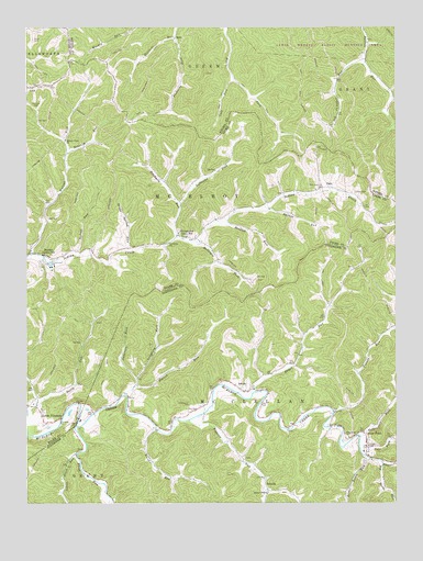
Center Point, WV USGS Topographic Map
Click on map above to begin viewing in our Map Viewer.

This topographic map contains these locations and features:
Feature Name Type Latitude Longitude GNIS ID View Map
Allen School (historical)SchoolN39.3951°W80.7051°1689434View Map
Alvy Post OfficePost OfficeN39.4454°W80.6982°1721389View Map
Anderson ForkStreamN39.4079°W80.7129°1534943View Map
AshleyPopulated PlaceN39.4045°W80.6759°1553759View Map
Beartree RunStreamN39.4976°W80.6993°1535424View Map
Bethel ChapelChurchN39.3776°W80.6687°1535689View Map
Big Battle RunStreamN39.3854°W80.6295°1535768View Map
Bonelick RunStreamN39.4673°W80.7362°1536213View Map
BradenPopulated PlaceN39.4404°W80.7440°1553958View Map
Broad RunStreamN39.4037°W80.6740°1536367View Map
Broad Run School (historical)SchoolN39.4226°W80.6509°1689451View Map
Buffalo Run School (historical)SchoolN39.4940°W80.6351°1717662View Map
Bunker RunStreamN39.4523°W80.6676°1536722View Map
Cale RunStreamN39.4862°W80.6793°1536859View Map
Campbell RunStreamN39.4915°W80.6351°1536975View Map
Center PointPopulated PlaceN39.3918°W80.6354°1537155View Map
Center Point CemeteryCemeteryN39.3879°W80.6332°1689462View Map
Center Point Christian ChurchChurchN39.3876°W80.6343°1689463View Map
Center Point Covered BridgeBridgeN39.3895°W80.6343°1689464View Map
Center Point Post OfficePost OfficeN39.3912°W80.6351°1689465View Map
DalePopulated PlaceN39.4579°W80.6504°1537961View Map
Davis RunStreamN39.3995°W80.7498°1538051View Map
Elklick RunStreamN39.4037°W80.7162°1538661View Map
Elklick School (historical)SchoolN39.4065°W80.7120°1689484View Map
Flint RunStreamN39.3954°W80.7332°1539093View Map
Franks RunStreamN39.3984°W80.6459°1539235View Map
Golden Don School (historical)SchoolN39.4545°W80.6979°1689628View Map
Grass Spring RunStreamN39.4415°W80.7140°1539615View Map
Indian RunStreamN39.4401°W80.7323°1540699View Map
Laughery ForkStreamN39.4056°W80.7140°1541360View Map
Lefthand Fork Stackpole RunStreamN39.4534°W80.6979°1541766View Map
Lima Post OfficePost OfficeN39.4404°W80.7440°1721383View Map
LinkPopulated PlaceN39.4845°W80.7473°1549786View Map
Little Battle RunStreamN39.3870°W80.6348°1542016View Map
Little Flint RunStreamN39.3879°W80.7332°1542101View Map
Little PittsburgPopulated PlaceN39.3959°W80.7437°1554971View Map
Lower Franks Run School (historical)SchoolN39.4001°W80.6409°1689520View Map
Lower Riggins Run School (historical)SchoolN39.3870°W80.6768°1689521View Map
Lyons CemeteryCemeteryN39.4567°W80.6382°1542659View Map
Lyons School (historical)SchoolN39.4512°W80.6334°1689629View Map
Main CemeteryCemeteryN39.4581°W80.6512°1542701View Map
McClellan Volunteer Fire DepartmentBuildingN39.3896°W80.6344°2577875View Map
McIntyre ForkStreamN39.4440°W80.6923°1543015View Map
Melburn School (historical)SchoolN39.4412°W80.7318°1689630View Map
Mountain State AcademySchoolN39.3921°W80.6353°2631376View Map
Oakland School (historical)SchoolN39.4520°W80.6793°1689631View Map
Parks CemeteryCemeteryN39.4970°W80.7473°1544588View Map
Pike ForkStreamN39.3895°W80.6370°1544848View Map
Pleasant Baptist ChurchChurchN39.3923°W80.6407°1545052View Map
Pleasant Valley Church CemeteryCemeteryN39.3925°W80.6408°2726455View Map
Ralphs RunStreamN39.3951°W80.7062°1545390View Map
Riggins RunStreamN39.3967°W80.6951°1545596View Map
RobertsPopulated PlaceN39.3784°W80.6684°1555494View Map
Robinson ForkStreamN39.3893°W80.6370°1545868View Map
RossPopulated PlaceN39.4970°W80.6993°1555527View Map
Ross School (historical)SchoolN39.4973°W80.6995°1717716View Map
Shadeland School (historical)SchoolN39.3829°W80.7287°1689580View Map
Stackpole RunStreamN39.4451°W80.6990°1547307View Map
StringtownPopulated PlaceN39.4454°W80.6982°1555730View Map
Sunfish RunStreamN39.4495°W80.6820°1547751View Map
Talkington ForkStreamN39.3920°W80.6370°1547877View Map
Tennant CemeteryCemeteryN39.4792°W80.7465°1547972View Map
Underwood CemeteryCemeteryN39.4012°W80.6945°1548459View Map
Walnut ForkStreamN39.4404°W80.7487°1548753View Map
Walnut Fork ChurchChurchN39.4704°W80.7368°1548754View Map
Walnut Fork School (historical)SchoolN39.4709°W80.7365°1689632View Map

Note: Coordinates in the location and feature list above are referenced to NAD83 datum.


Copyright (C) 2008-2024 Ryan Niemi / Sunset Dynamics ... All Rights Reserved