TopoQuest Logo
Do you find TopoQuest useful?
Help keep TopoQuest running and adding new maps/features by donating!
Bitcoin:  19c7KJd3qBynnjoSw5npx9KScwjBe4ifkT
Litecoin:  LXs6TkuXGGXo1vDsWCkWVdjQX94eUKd6ui
Home View Maps Find Maps Find Places Resources & Links


Rocky Pond, Maine Topographic Map

USGS Map Title: Rocky Pond, ME
USGS Map MRC: 44068G2
DRG (GeoTIFF) Download: o44068g2.tif


Neighboring USGS Topographic Map Quads:


  Great Pond, ME  
44068H3
 

  Alligator Lake, ME  
44068H2
 

  Quillpig Mountain, ME  
44068H1
 

  Amherst, ME  
44068G3
 

  Rocky Pond, ME  
44068G2
 

  Lead Mountain, ME  
44068G1
 

  Eastbrook, ME  
44068F3
 

  Molasses Pond, ME  
44068F2
 

  Tunk Mountain, ME  
44068F1


Map MRC Location:

N45°
W69°
N45°
W68°
H8 H7 H6 H5 H4 H3 H2 H1
G8 G7 G6 G5 G4 G3 G2 G1
F8 F7 F6 F5 F4 F3 F2 F1
E8 E7 E6 E5 E4 E3 E2 E1
D8 D7 D6 D5 D4 D3 D2 D1
C8 C7 C6 C5 C4 C3 C2 C1
B8 B7 B6 B5 B4 B3 B2 B1
A8 A7 A6 A5 A4 A3 A2 A1
N44°
W69°
N44°
W68°

Rocky Pond, ME USGS 1:24K Topographic Map Preview:
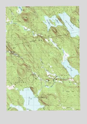
Rocky Pond, ME USGS Topographic Map
Click on map above to begin viewing in our Map Viewer.

This topographic map contains these locations and features:
Feature Name Type Latitude Longitude GNIS ID View Map
Birch HillSummitN44.8282°W68.2140°562292View Map
Dark BrookStreamN44.7842°W68.1667°564772View Map
Dog CornersPopulated PlaceN44.7884°W68.2003°579246View Map
Duck PondLakeN44.7859°W68.1806°565351View Map
Een RidgeRidgeN44.8029°W68.2275°565803View Map
Garden Eden BrookStreamN44.7531°W68.1864°578848View Map
Hardwood HillSummitN44.8259°W68.2395°567615View Map
Hazlam PondLakeN44.8205°W68.2388°567840View Map
Hopper BrookStreamN44.7795°W68.1853°568260View Map
Johns BrookStreamN44.7729°W68.2267°568893View Map
Kingman BrookStreamN44.7767°W68.2192°569209View Map
Leighton River DamDamN44.8181°W68.2380°1774689View Map
Leighton River ReservoirReservoirN44.8176°W68.2371°1774690View Map
Lower Lead Mountain DamDamN44.8447°W68.1774°1774573View Map
Lower Lead Mountain PondReservoirN44.8447°W68.1774°570514View Map
Middle Lead Mountain PondLakeN44.8537°W68.1780°571251View Map
Pine HillSummitN44.8337°W68.1870°573373View Map
Roaring BrookStreamN44.7895°W68.1647°574272View Map
Rocky PondLakeN44.7993°W68.1410°574405View Map
Salmon Island BrookStreamN44.8626°W68.2353°574770View Map
Schoppe RidgeRidgeN44.7723°W68.1320°575035View Map
Sevenmile BrookStreamN44.8551°W68.2389°575243View Map
Sevenmile Brook BluffCliffN44.8626°W68.2100°575244View Map
Spectacle PondLakeN44.7595°W68.2130°576013View Map
Spectacle Pond RidgeRidgeN44.7631°W68.1833°576015View Map
Starvation BranchStreamN44.8098°W68.1489°576274View Map
Steep LandingPopulated PlaceN44.7881°W68.1670°579739View Map
T22 MD BPPCivilN44.8026°W68.1317°2748516View Map
The NarrowsChannelN44.7501°W68.2158°576854View Map
Upper Lead Mountain DamDamN44.8515°W68.1495°1774575View Map
Upper Lead Mountain PondReservoirN44.8518°W68.1408°577623View Map

Note: Coordinates in the location and feature list above are referenced to NAD83 datum.


Copyright (C) 2008-2024 Ryan Niemi / Sunset Dynamics ... All Rights Reserved