TopoQuest Logo
Do you find TopoQuest useful?
Help keep TopoQuest running and adding new maps/features by donating!
Bitcoin:  19c7KJd3qBynnjoSw5npx9KScwjBe4ifkT
Litecoin:  LXs6TkuXGGXo1vDsWCkWVdjQX94eUKd6ui
Home View Maps Find Maps Find Places Resources & Links


Alligator Lake, Maine Topographic Map

USGS Map Title: Alligator Lake, ME
USGS Map MRC: 44068H2
DRG (GeoTIFF) Download: o44068h2.tif


Neighboring USGS Topographic Map Quads:


  Brandy Pond, ME  
45068A3
 

  West Lake, ME  
45068A2
 

  Gassabias Lake, ME  
45068A1
 

  Great Pond, ME  
44068H3
 

  Alligator Lake, ME  
44068H2
 

  Quillpig Mountain, ME  
44068H1
 

  Amherst, ME  
44068G3
 

  Rocky Pond, ME  
44068G2
 

  Lead Mountain, ME  
44068G1


Map MRC Location:

N45°
W69°
N45°
W68°
H8 H7 H6 H5 H4 H3 H2 H1
G8 G7 G6 G5 G4 G3 G2 G1
F8 F7 F6 F5 F4 F3 F2 F1
E8 E7 E6 E5 E4 E3 E2 E1
D8 D7 D6 D5 D4 D3 D2 D1
C8 C7 C6 C5 C4 C3 C2 C1
B8 B7 B6 B5 B4 B3 B2 B1
A8 A7 A6 A5 A4 A3 A2 A1
N44°
W69°
N44°
W68°

Alligator Lake, ME USGS 1:24K Topographic Map Preview:
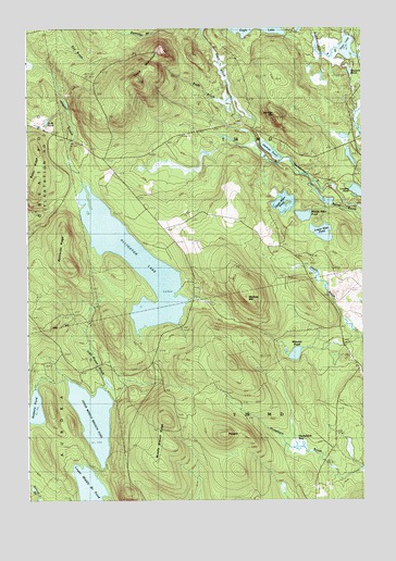
Alligator Lake, ME USGS Topographic Map
Click on map above to begin viewing in our Map Viewer.

This topographic map contains these locations and features:
Feature Name Type Latitude Longitude GNIS ID View Map
Alligator LakeLakeN44.9378°W68.2099°561208View Map
Baker RidgeRidgeN44.9642°W68.2464°561486View Map
Bamfords RidgeRidgeN44.9376°W68.2356°581372View Map
Blackcap MountainSummitN44.9288°W68.1686°562519View Map
Deer LakeLakeN44.9948°W68.1304°564992View Map
Duds PondLakeN44.9753°W68.2424°565387View Map
Eagle MountainSummitN44.9862°W68.2084°565501View Map
Halfmile PondLakeN44.8993°W68.2470°567458View Map
Haycock PondLakeN44.9882°W68.1292°567811View Map
Humpback BogSwampN44.8895°W68.1483°568448View Map
Jimmies MountainSummitN44.9766°W68.1560°568841View Map
Jimmies PondLakeN44.9678°W68.1592°568842View Map
John Brown BrookStreamN44.9059°W68.2225°568884View Map
Lovejoy PondLakeN44.9565°W68.1263°570444View Map
Lower Allen PondLakeN44.9459°W68.1399°570471View Map
Lower Middle Branch PondLakeN44.8775°W68.2267°570518View Map
Middle Allen PondLakeN44.9503°W68.1468°571208View Map
Middle Branch RidgeRidgeN44.8881°W68.2017°571221View Map
PinnacleSummitN44.8926°W68.1761°573435View Map
T28 MD BPPCivilN44.8929°W68.1550°2748818View Map
T34 MD BPPCivilN44.9820°W68.1784°2748812View Map
Unorganized Territory of East HancockCivilN44.9440°W68.1432°582456View Map
Upper Allen PondLakeN44.9536°W68.1542°577571View Map
Upper Middle Branch PondLakeN44.8971°W68.2257°577630View Map
Williams PondLakeN44.9138°W68.1502°578521View Map

Note: Coordinates in the location and feature list above are referenced to NAD83 datum.


Copyright (C) 2008-2025 Ryan Niemi / Sunset Dynamics ... All Rights Reserved