TopoQuest Logo
Do you find TopoQuest useful?
Help keep TopoQuest running and adding new maps/features by donating!
Bitcoin:  19c7KJd3qBynnjoSw5npx9KScwjBe4ifkT
Litecoin:  LXs6TkuXGGXo1vDsWCkWVdjQX94eUKd6ui
Home View Maps Find Maps Find Places Resources & Links


Rodman Rock, Oregon Topographic Map

USGS Map Title: Rodman Rock, OR
USGS Map MRC: 43121A3
DRG (GeoTIFF) Download: o43121a3.tif


Neighboring USGS Topographic Map Quads:


  Location Butte, OR  
43121B4
 

  Antelope Mountain, OR  
43121B3
 

  Oatman Flat, OR  
43121B2
 

  Bear Butte, OR  
43121A4
 

  Rodman Rock, OR  
43121A3
 

  Bridge Creek Draw, OR  
43121A2
 

  Gordon Lake, OR  
42121H4
 

  Yamsay Mountain, OR  
42121H3
 

  Partin Butte, OR  
42121H2


Map MRC Location:

N44°
W122°
N44°
W121°
H8 H7 H6 H5 H4 H3 H2 H1
G8 G7 G6 G5 G4 G3 G2 G1
F8 F7 F6 F5 F4 F3 F2 F1
E8 E7 E6 E5 E4 E3 E2 E1
D8 D7 D6 D5 D4 D3 D2 D1
C8 C7 C6 C5 C4 C3 C2 C1
B8 B7 B6 B5 B4 B3 B2 B1
A8 A7 A6 A5 A4 A3 A2 A1
N43°
W122°
N43°
W121°

Rodman Rock, OR USGS 1:24K Topographic Map Preview:
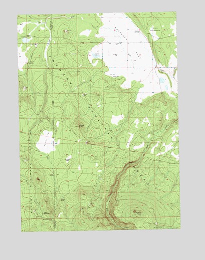
Rodman Rock, OR USGS Topographic Map
Click on map above to begin viewing in our Map Viewer.

This topographic map contains these locations and features:
Feature Name Type Latitude Longitude GNIS ID View Map
Antelope Cow CampLocaleN43.1140°W121.2806°1137233View Map
Antelope FlatFlatN43.1043°W121.2872°1137240View Map
Antelope LakeLakeN43.0998°W121.3146°1137242View Map
Antelope WellWellN43.1075°W121.2992°1137256View Map
Bear Flat StationLocaleN43.0974°W121.3678°1137711View Map
Bear SpringSpringN43.0977°W121.3686°1137745View Map
Boundary SpringSpringN43.0072°W121.3518°1138503View Map
Camp FourteenLocaleN43.1076°W121.3622°1139190View Map
Coffeepot SpringSpringN43.0182°W121.3449°1139896View Map
Dillon ButteSummitN43.0101°W121.3547°1141029View Map
Little Antelope FlatFlatN43.1124°W121.2689°1145068View Map
McCarty ButteSummitN43.0599°W121.3303°1145924View Map
McCarty FieldFlatN43.0415°W121.3383°1145927View Map
McCarty FlatFlatN43.0529°W121.3545°1145928View Map
McKinley RanchLocaleN43.1118°W121.3697°1146005View Map
Peterson CabinLocaleN43.0782°W121.3261°1147610View Map
Road SpringSpringN43.0005°W121.2664°1148509View Map
Rock CreekStreamN43.1201°W121.3536°1148581View Map
Rodman RockSummitN43.0101°W121.2864°1148687View Map
Section One SpringSpringN43.0025°W121.2504°1149219View Map
Shanahan PlaceLocaleN43.0882°W121.3025°1149284View Map
Still SpringSpringN43.0632°W121.3604°1150431View Map
Trapper SpringSpringN43.0323°W121.3492°1151399View Map
Upper Buck Creek Recreation SiteLocaleN43.0521°W121.2650°1952940View Map

Note: Coordinates in the location and feature list above are referenced to NAD83 datum.


Copyright (C) 2008-2025 Ryan Niemi / Sunset Dynamics ... All Rights Reserved