TopoQuest Logo
Do you find TopoQuest useful?
Help keep TopoQuest running and adding new maps/features by donating!
Bitcoin:  19c7KJd3qBynnjoSw5npx9KScwjBe4ifkT
Litecoin:  LXs6TkuXGGXo1vDsWCkWVdjQX94eUKd6ui
Home View Maps Find Maps Find Places Resources & Links


Bridge Creek Draw, Oregon Topographic Map

USGS Map Title: Bridge Creek Draw, OR
USGS Map MRC: 43121A2
DRG (GeoTIFF) Download: o43121a2.tif


Neighboring USGS Topographic Map Quads:


  Antelope Mountain, OR  
43121B3
 

  Oatman Flat, OR  
43121B2
 

  Silver Lake, OR  
43121B1
 

  Rodman Rock, OR  
43121A3
 

  Bridge Creek Draw, OR  
43121A2
 

  Hager Mountain, OR  
43121A1
 

  Yamsay Mountain, OR  
42121H3
 

  Partin Butte, OR  
42121H2
 

  Thompson Reservoir, OR  
42121H1


Map MRC Location:

N44°
W122°
N44°
W121°
H8 H7 H6 H5 H4 H3 H2 H1
G8 G7 G6 G5 G4 G3 G2 G1
F8 F7 F6 F5 F4 F3 F2 F1
E8 E7 E6 E5 E4 E3 E2 E1
D8 D7 D6 D5 D4 D3 D2 D1
C8 C7 C6 C5 C4 C3 C2 C1
B8 B7 B6 B5 B4 B3 B2 B1
A8 A7 A6 A5 A4 A3 A2 A1
N43°
W122°
N43°
W121°

Bridge Creek Draw, OR USGS 1:24K Topographic Map Preview:
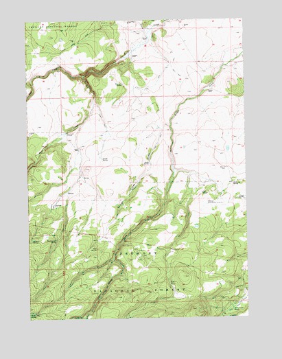
Bridge Creek Draw, OR USGS Topographic Map
Click on map above to begin viewing in our Map Viewer.

This topographic map contains these locations and features:
Feature Name Type Latitude Longitude GNIS ID View Map
Basalt ReservoirReservoirN43.0896°W121.1445°1153888View Map
Bear CreekStreamN43.1021°W121.2186°1137670View Map
Brewer RanchLocaleN43.0951°W121.1467°1138596View Map
Bridge Creek DrawValleyN43.0804°W121.1697°1138619View Map
Bridge Creek WaterholeReservoirN43.0797°W121.1755°1153891View Map
Buck Creek CrossingLocaleN43.0779°W121.2286°1138782View Map
Cashow FlatFlatN43.0474°W121.2389°1139432View Map
Cashow SpringsSpringN43.0328°W121.2494°1139433View Map
Chase SpringSpringN43.0494°W121.1274°1139584View Map
Cliff SpringSpringN43.0522°W121.1513°1139832View Map
D Emery RanchLocaleN43.1060°W121.1369°1155828View Map
Freeman RanchLocaleN43.1101°W121.1908°1142440View Map
Freeman SpringSpringN43.0979°W121.1964°1142441View Map
Howard RanchLocaleN43.1171°W121.1842°1143853View Map
Lower Buck Creek Recreation SiteLocaleN43.0682°W121.2456°1952930View Map
Lundy SpringSpringN43.0668°W121.2081°1145682View Map
McBroom Administrative Study PlotLocaleN43.0490°W121.1478°1163739View Map
McBroom RanchLocaleN43.0629°W121.1378°1145912View Map
McBroom SpringSpringN43.0566°W121.1339°1145913View Map
Mud SpringSpringN43.0293°W121.2122°1146585View Map
Pitcher RanchLocaleN43.0710°W121.2217°1147780View Map
Porterville Post Office (historical)Post OfficeN43.0762°W121.2275°1165809View Map
Silver Creek MarshSwampN43.0034°W121.1362°1149492View Map
Silver Creek Marsh Recreation SiteLocaleN43.0057°W121.1336°1155829View Map
South SpringSpringN43.0649°W121.1819°1150084View Map
South Spring ReservoirReservoirN43.0713°W121.1610°1153889View Map
Staked WaterholeReservoirN43.1088°W121.1710°1153887View Map
Ted ReservoirReservoirN43.0987°W121.1625°1153890View Map
Thirteenmile SpringSpringN43.0334°W121.2347°1151069View Map
Timothy CreekStreamN43.1207°W121.1797°1151251View Map
Willow SpringSpringN43.0147°W121.1707°1152431View Map

Note: Coordinates in the location and feature list above are referenced to NAD83 datum.


Copyright (C) 2008-2024 Ryan Niemi / Sunset Dynamics ... All Rights Reserved